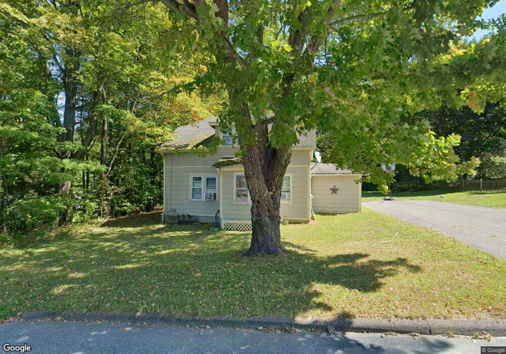
24 E St North Adams, MA 01247
Estimated Value: $223,505 - $243,000
2
Beds
1
Bath
1,138
Sq Ft
$204/Sq Ft
Est. Value
About This Home
This home is located at 24 E St, North Adams, MA 01247 and is currently estimated at $231,876, approximately $203 per square foot. 24 E St is a home located in Berkshire County with nearby schools including Brayton Elementary School, Drury High School, and Berkshire Arts & Technology Charter Public School.
Ownership History
Date
Name
Owned For
Owner Type
Purchase Details
Closed on
Nov 29, 2023
Sold by
Archambeau David J and Archambeau Dawn K
Bought by
Archambeau Dawn L
Current Estimated Value
Purchase Details
Closed on
May 31, 1990
Sold by
Fisher Marie
Bought by
Archambeau David J
Create a Home Valuation Report for This Property
The Home Valuation Report is an in-depth analysis detailing your home's value as well as a comparison with similar homes in the area
Home Values in the Area
Average Home Value in this Area
Purchase History
| Date | Buyer | Sale Price | Title Company |
|---|---|---|---|
| Archambeau Dawn L | -- | None Available | |
| Archambeau Dawn L | -- | None Available | |
| Archambeau David J | $72,000 | -- | |
| Archambeau David J | $72,000 | -- |
Source: Public Records
Mortgage History
| Date | Status | Borrower | Loan Amount |
|---|---|---|---|
| Previous Owner | Archambeau David J | $122,720 | |
| Previous Owner | Archambeau David J | $105,000 | |
| Previous Owner | Archambeau David J | $66,890 |
Source: Public Records
Tax History
| Year | Tax Paid | Tax Assessment Tax Assessment Total Assessment is a certain percentage of the fair market value that is determined by local assessors to be the total taxable value of land and additions on the property. | Land | Improvement |
|---|---|---|---|---|
| 2025 | $2,862 | $171,300 | $38,000 | $133,300 |
| 2024 | $2,686 | $156,700 | $34,700 | $122,000 |
| 2023 | $2,522 | $142,700 | $34,700 | $108,000 |
| 2022 | $2,313 | $124,800 | $34,700 | $90,100 |
| 2021 | $2,149 | $115,500 | $32,200 | $83,300 |
| 2020 | $1,996 | $107,200 | $32,000 | $75,200 |
| 2019 | $1,926 | $100,800 | $32,000 | $68,800 |
| 2018 | $1,862 | $101,300 | $33,700 | $67,600 |
| 2017 | $1,771 | $100,200 | $33,300 | $66,900 |
| 2016 | $1,720 | $98,900 | $33,300 | $65,600 |
| 2015 | $1,694 | $101,500 | $34,500 | $67,000 |
Source: Public Records
Map
Nearby Homes
- 17 A St
- 585 A & B State Rd
- 1268 Curran Hwy
- 4 Seminole Dr
- 12 Aztec Dr
- 6 Overlook Terrace
- 350 Mohawk Trail
- 100 Autumn Dr
- 0 Oak Hill Unit 237953
- 33 Gattuso Dr
- 30 Dover St
- 336 Walnut St
- 74 Washington Ave
- 66 Lyman St
- 301 Walnut St
- 286 Walnut St
- 32-38 Spring St
- 24 Spring St
- 0 Mohawk Trail
- 516-518 Union St
Your Personal Tour Guide
Ask me questions while you tour the home.