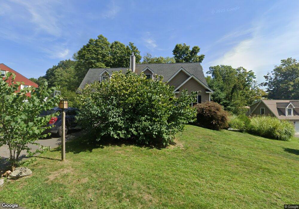
24 Gleeson Rd Middletown, CT 06457
Estimated Value: $497,000 - $576,000
3
Beds
3
Baths
2,074
Sq Ft
$258/Sq Ft
Est. Value
About This Home
This home is located at 24 Gleeson Rd, Middletown, CT 06457 and is currently estimated at $534,945, approximately $257 per square foot. 24 Gleeson Rd is a home located in Middlesex County with nearby schools including Wesley School, Middletown High School, and The Independent Day School.
Ownership History
Date
Name
Owned For
Owner Type
Purchase Details
Closed on
Oct 12, 2004
Sold by
Mounts Chester D and Mounts Jacqueline M
Bought by
Mounts Robert D and Mounts Kimberly M
Current Estimated Value
Home Financials for this Owner
Home Financials are based on the most recent Mortgage that was taken out on this home.
Original Mortgage
$210,000
Outstanding Balance
$103,761
Interest Rate
5.84%
Estimated Equity
$431,184
Create a Home Valuation Report for This Property
The Home Valuation Report is an in-depth analysis detailing your home's value as well as a comparison with similar homes in the area
Home Values in the Area
Average Home Value in this Area
Purchase History
| Date | Buyer | Sale Price | Title Company |
|---|---|---|---|
| Mounts Robert D | $100,000 | -- |
Source: Public Records
Mortgage History
| Date | Status | Borrower | Loan Amount |
|---|---|---|---|
| Open | Mounts Robert D | $210,000 |
Source: Public Records
Tax History
| Year | Tax Paid | Tax Assessment Tax Assessment Total Assessment is a certain percentage of the fair market value that is determined by local assessors to be the total taxable value of land and additions on the property. | Land | Improvement |
|---|---|---|---|---|
| 2025 | $12,692 | $326,260 | $76,310 | $249,950 |
| 2024 | $12,006 | $326,260 | $76,310 | $249,950 |
| 2023 | $11,452 | $326,260 | $76,310 | $249,950 |
| 2022 | $10,518 | $239,040 | $50,880 | $188,160 |
| 2021 | $10,518 | $239,040 | $50,880 | $188,160 |
| 2020 | $10,566 | $239,040 | $50,880 | $188,160 |
| 2019 | $10,613 | $239,040 | $50,880 | $188,160 |
| 2018 | $10,446 | $239,040 | $50,880 | $188,160 |
| 2017 | $8,858 | $208,910 | $54,430 | $154,480 |
| 2016 | $8,607 | $208,910 | $54,430 | $154,480 |
| 2015 | $8,273 | $208,910 | $54,430 | $154,480 |
| 2014 | $8,356 | $208,910 | $54,430 | $154,480 |
Source: Public Records
Map
Nearby Homes
- 109 Red Clover Cir
- 2 Yellow Orange Cir
- 70 Jack English Dr
- 122 Baldwin Dr
- 797 Long Hill Rd Unit B
- Lot 3 Coleman Rd
- 7 Blue Bell Ln
- 672 Laurel Grove Rd
- 17 Mckenna Dr
- 45 Mckenna Dr
- 183 Aston Ln
- 9 Sunset Dr
- 330 Coleman Rd
- (Map 12, Lot 80A) Hubbard St
- Lot 2 Coleman Rd
- 160 Boston Rd
- 104 Boston Rd
- 50 Cedar St
- 58 Durant Terrace
- 50 Garfield Ave
- 1642 Randolph Rd
- 34 Gleeson Rd
- 1678 Randolph Rd
- 33 Gleeson Rd
- 44 Gleeson Rd
- 45 Gleeson Rd
- 1630 Randolph Rd
- 54 Gleeson Rd
- 55 Gleeson Rd
- 1681 Randolph Rd
- 1687 Randolph Rd
- 69 Gleeson Rd
- 1703 Randolph Rd
- 70 Gleeson Rd
- 75 Gleeson Rd
- 1725 Randolph Rd
- 439 Long Hill Rd
- 78 Gleeson Rd
- 89 Gleeson Rd
- 91 Gleeson Rd
Your Personal Tour Guide
Ask me questions while you tour the home.