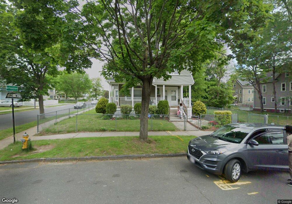
24 Gunn Square Springfield, MA 01109
Upper Hill NeighborhoodEstimated Value: $278,000 - $348,000
8
Beds
3
Baths
3,173
Sq Ft
$100/Sq Ft
Est. Value
About This Home
This home is located at 24 Gunn Square, Springfield, MA 01109 and is currently estimated at $316,880, approximately $99 per square foot. 24 Gunn Square is a home located in Hampden County with nearby schools including Glickman Elementary, M Marcus Kiley Middle, and Springfield High School of Science and Technology.
Ownership History
Date
Name
Owned For
Owner Type
Purchase Details
Closed on
Feb 9, 1996
Sold by
Springfield Nbrhd Hsng
Bought by
Grant Dennis R
Current Estimated Value
Home Financials for this Owner
Home Financials are based on the most recent Mortgage that was taken out on this home.
Original Mortgage
$76,000
Outstanding Balance
$2,509
Interest Rate
7.1%
Mortgage Type
Purchase Money Mortgage
Estimated Equity
$314,371
Purchase Details
Closed on
Sep 28, 1995
Sold by
Stewart Milton and Stewart Betty A
Bought by
Neighbrhd Springfield
Home Financials for this Owner
Home Financials are based on the most recent Mortgage that was taken out on this home.
Original Mortgage
$65,000
Interest Rate
7.89%
Mortgage Type
Purchase Money Mortgage
Purchase Details
Closed on
Feb 3, 1995
Sold by
Stewart Milton and Stewart Betty A
Bought by
Springfield Nbrhd Hsng
Create a Home Valuation Report for This Property
The Home Valuation Report is an in-depth analysis detailing your home's value as well as a comparison with similar homes in the area
Home Values in the Area
Average Home Value in this Area
Purchase History
| Date | Buyer | Sale Price | Title Company |
|---|---|---|---|
| Grant Dennis R | $80,000 | -- | |
| Grant Dennis R | $80,000 | -- | |
| Neighbrhd Springfield | $20,000 | -- | |
| Springfield Neighbrhd | $20,000 | -- | |
| Springfield Nbrhd Hsng | $20,000 | -- | |
| Springfield Nbrhd Hsng | $20,000 | -- |
Source: Public Records
Mortgage History
| Date | Status | Borrower | Loan Amount |
|---|---|---|---|
| Open | Springfield Nbrhd Hsng | $76,000 | |
| Closed | Springfield Nbrhd Hsng | $76,000 | |
| Previous Owner | Springfield Nbrhd Hsng | $65,000 |
Source: Public Records
Tax History
| Year | Tax Paid | Tax Assessment Tax Assessment Total Assessment is a certain percentage of the fair market value that is determined by local assessors to be the total taxable value of land and additions on the property. | Land | Improvement |
|---|---|---|---|---|
| 2025 | $3,064 | $195,400 | $30,800 | $164,600 |
| 2024 | $2,239 | $139,400 | $30,800 | $108,600 |
| 2023 | $2,222 | $130,300 | $28,000 | $102,300 |
| 2022 | $2,529 | $134,400 | $26,100 | $108,300 |
| 2021 | $2,217 | $117,300 | $18,500 | $98,800 |
| 2020 | $2,224 | $113,900 | $18,500 | $95,400 |
| 2019 | $1,990 | $101,100 | $15,800 | $85,300 |
| 2018 | $1,777 | $96,900 | $15,800 | $81,100 |
| 2017 | $1,777 | $90,400 | $14,900 | $75,500 |
| 2016 | $1,508 | $76,700 | $14,900 | $61,800 |
| 2015 | $1,475 | $75,000 | $14,900 | $60,100 |
Source: Public Records
Map
Nearby Homes
- 21 Westford Cir
- 189 Northampton Ave
- 290 Quincy St
- 19 Westford Ave
- 124-126 Westford Cir
- 41 Olive St
- 283 Wilbraham Rd
- 52-56 Andrew St
- 46 Mapledell St
- 135-137 Suffolk St
- 65 Montrose St
- 0 NS (24) Alden St
- 31-33 Suffolk St
- 62-64 Bristol St
- 48-50 Dresden St
- 89 Bristol St
- 86 Alden St
- 25 Dresden St
- 22-24 Westminster St
- 118 Quincy St
- 14 Gunn Square
- 121 Northampton Ave
- 121 Northampton Ave
- 121 Northampton Ave Unit 1
- 121 Northampton Ave Unit 3
- 134 Northampton Ave
- 124 Northampton Ave
- 115 Northampton Ave
- 115-117 Northampton Ave
- 117 Northampton Ave
- 0 Northampton Ave
- 120 Northampton Ave
- 20 Gunn Square
- 124 Westford Ave Unit 126
- 146 Northampton Ave
- 111 Northampton Ave
- 116 Westford Ave Unit 118
- 9 Beverly St
- 129 Wilbraham Ave Unit 131
- 129-131 Wilbraham Ave Unit 2
Your Personal Tour Guide
Ask me questions while you tour the home.