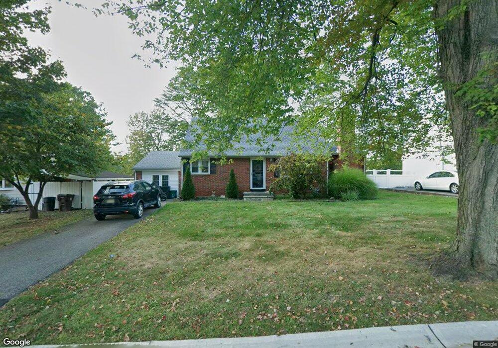
24 Halstead Rd New Brunswick, NJ 08901
Estimated Value: $510,000 - $585,000
3
Beds
2
Baths
1,412
Sq Ft
$386/Sq Ft
Est. Value
About This Home
This home is located at 24 Halstead Rd, New Brunswick, NJ 08901 and is currently estimated at $545,562, approximately $386 per square foot. 24 Halstead Rd is a home located in Middlesex County with nearby schools including New Brunswick High School.
Ownership History
Date
Name
Owned For
Owner Type
Purchase Details
Closed on
Mar 20, 2019
Sold by
Kapp Jennifer and Smith Keith V
Bought by
Sing Manjinder Pal and Newton Carolyn
Current Estimated Value
Home Financials for this Owner
Home Financials are based on the most recent Mortgage that was taken out on this home.
Original Mortgage
$320,100
Interest Rate
4%
Mortgage Type
New Conventional
Purchase Details
Closed on
Jul 15, 1993
Bought by
Smith Keith and Kapp Jennifer
Create a Home Valuation Report for This Property
The Home Valuation Report is an in-depth analysis detailing your home's value as well as a comparison with similar homes in the area
Home Values in the Area
Average Home Value in this Area
Purchase History
| Date | Buyer | Sale Price | Title Company |
|---|---|---|---|
| Sing Manjinder Pal | $334,000 | Fidelity National Title Ins | |
| Smith Keith | $131,000 | -- |
Source: Public Records
Mortgage History
| Date | Status | Borrower | Loan Amount |
|---|---|---|---|
| Previous Owner | Sing Manjinder Pal | $320,100 |
Source: Public Records
Tax History Compared to Growth
Tax History
| Year | Tax Paid | Tax Assessment Tax Assessment Total Assessment is a certain percentage of the fair market value that is determined by local assessors to be the total taxable value of land and additions on the property. | Land | Improvement |
|---|---|---|---|---|
| 2025 | $6,990 | $266,900 | $142,600 | $124,300 |
| 2024 | $6,787 | $266,900 | $142,600 | $124,300 |
| 2023 | $6,787 | $266,900 | $142,600 | $124,300 |
| 2022 | $6,643 | $266,900 | $142,600 | $124,300 |
| 2021 | $4,928 | $266,900 | $142,600 | $124,300 |
| 2020 | $6,592 | $266,900 | $142,600 | $124,300 |
| 2019 | $6,467 | $266,900 | $142,600 | $124,300 |
| 2018 | $6,320 | $266,900 | $142,600 | $124,300 |
| 2017 | $6,069 | $266,900 | $142,600 | $124,300 |
| 2016 | $8,048 | $137,200 | $50,000 | $87,200 |
| 2015 | $7,856 | $137,200 | $50,000 | $87,200 |
| 2014 | $7,716 | $137,200 | $50,000 | $87,200 |
Source: Public Records
Map
Nearby Homes
- 63 Pennington Rd
- 104 S Pennington Rd
- 106 S Pennington Rd
- 88 Fox Rd Unit 4B
- 66 Fox Rd Unit 9B
- 53 Patton Dr
- 60 Fox Rd
- 37 York Dr Unit 6A
- 15 York Dr Unit 1B
- 31 York Dr Unit 3A
- 11 Cotter Dr
- 523 Sadie Cir
- 521 Sadie Cir
- 602 Sadie Cir
- 628 Sadie Cir
- 513 Sadie Cir
- 509 Sadie Cir
- 49 Player Ave
- 220 Jessie Place
- 228 Jessie Place