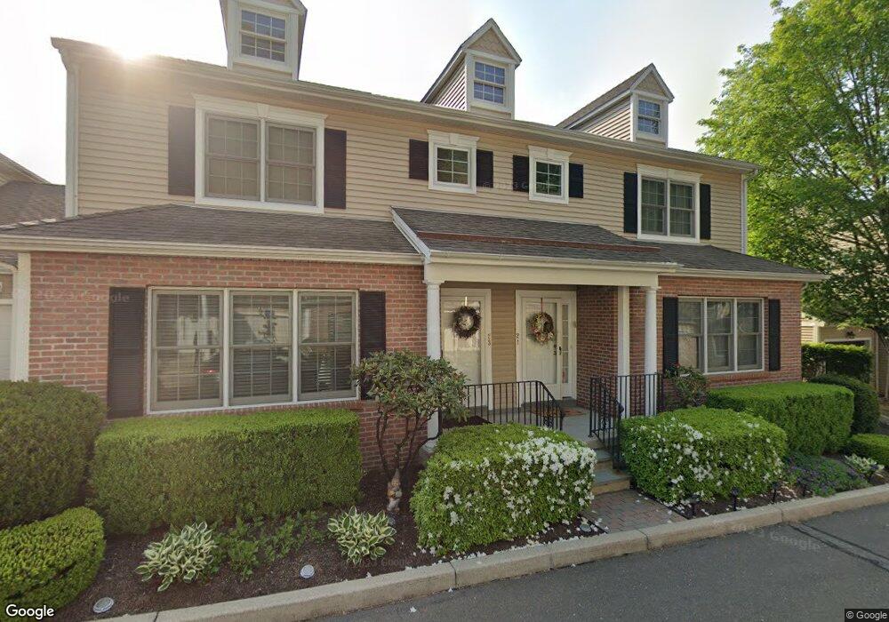
24 Hawthorne Ridge Cir Trumbull, CT 06611
Trumbull Center NeighborhoodEstimated Value: $548,000 - $641,000
3
Beds
2
Baths
2,028
Sq Ft
$294/Sq Ft
Est. Value
About This Home
This home is located at 24 Hawthorne Ridge Cir, Trumbull, CT 06611 and is currently estimated at $596,816, approximately $294 per square foot. 24 Hawthorne Ridge Cir is a home located in Fairfield County with nearby schools including Frenchtown Elementary School, Hillcrest Middle School, and Trumbull High School.
Ownership History
Date
Name
Owned For
Owner Type
Purchase Details
Closed on
Nov 27, 2002
Sold by
Hawthorne Rdg Assoc Ll
Bought by
Nichols Lawrence T and Nichols Mary K
Current Estimated Value
Create a Home Valuation Report for This Property
The Home Valuation Report is an in-depth analysis detailing your home's value as well as a comparison with similar homes in the area
Home Values in the Area
Average Home Value in this Area
Purchase History
| Date | Buyer | Sale Price | Title Company |
|---|---|---|---|
| Nichols Lawrence T | $374,635 | -- |
Source: Public Records
Mortgage History
| Date | Status | Borrower | Loan Amount |
|---|---|---|---|
| Open | Nichols Lawrence T | $245,760 | |
| Closed | Nichols Lawrence T | $126,000 | |
| Closed | Nichols Lawrence T | $66,011 | |
| Closed | Nichols Lawrence T | $302,800 |
Source: Public Records
Tax History Compared to Growth
Tax History
| Year | Tax Paid | Tax Assessment Tax Assessment Total Assessment is a certain percentage of the fair market value that is determined by local assessors to be the total taxable value of land and additions on the property. | Land | Improvement |
|---|---|---|---|---|
| 2025 | $9,053 | $245,210 | $0 | $245,210 |
| 2024 | $8,805 | $245,210 | $0 | $245,210 |
| 2023 | $8,663 | $245,210 | $0 | $245,210 |
| 2022 | $8,525 | $245,210 | $0 | $245,210 |
| 2021 | $7,732 | $215,670 | $0 | $215,670 |
| 2020 | $7,732 | $215,670 | $0 | $215,670 |
| 2018 | $7,541 | $215,670 | $0 | $215,670 |
| 2017 | $7,389 | $215,670 | $0 | $215,670 |
| 2016 | $7,240 | $215,670 | $0 | $215,670 |
| 2015 | $7,910 | $232,900 | $0 | $232,900 |
| 2014 | $7,739 | $232,900 | $0 | $232,900 |
Source: Public Records
Map
Nearby Homes
- 122 Paugusett Cir
- 121 Paugusett Cir
- 8 Moorland Rd
- 7 Manor Dr
- 58 Daniels Farm Rd
- 1 Village Dr
- 1675 Old Town Rd
- 11 Laurel St
- 33 Enclave Dr Unit 33
- 1800 Chopsey Hill Rd
- 60 Lillian Dr
- 11 Linda Dr
- Lot 31 Valley View Rd
- 401 Unity Rd
- 715 Frenchtown Rd Unit 31
- 182 Trumbull Ave
- 539 Old Town Rd
- 26 Grove St
- 32 Marshall Ave
- 90 Sequoia Rd
- 56 Redspire Ct
- 55 Redspire Ct
- 54 Redspire Ct
- 53 Redspire Ct
- 52 Redspire Ct
- 51 Redspire Ct
- 43 Hawthorne Ridge Cir
- 41 Hawthorne Ridge Cir
- 37 Hawthorne Ridge Cir
- 35 Hawthorne Ridge Cir
- 30 Hawthorne Ridge Cir
- 29 Hawthorne Ridge Cir
- 28 Hawthorne Ridge Cir
- 27 Hawthorne Ridge Cir
- 26 Hawthorne Ridge Cir
- 25 Hawthorne Ridge Cir
- 23 Hawthorne Ridge Cir
- 22 Hawthorne Ridge Cir
- 21 Hawthorne Ridge Cir
- 20 Hawthorne Ridge Cir