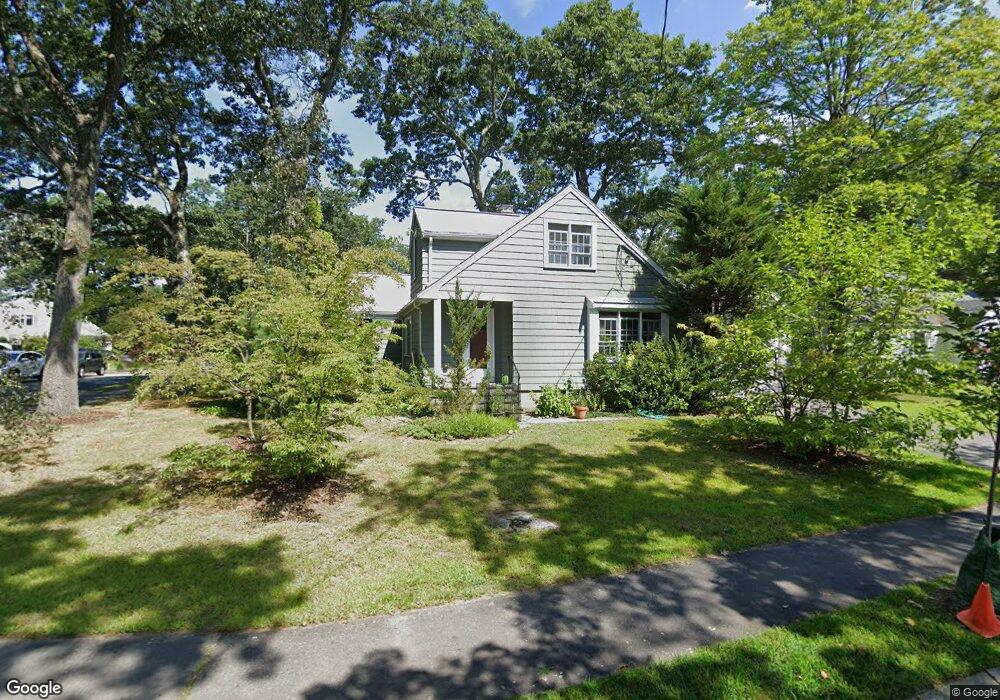
24 Hemlock Rd Newton Upper Falls, MA 02464
Newton Upper Falls NeighborhoodEstimated Value: $1,031,000 - $1,448,000
3
Beds
3
Baths
2,039
Sq Ft
$635/Sq Ft
Est. Value
About This Home
This home is located at 24 Hemlock Rd, Newton Upper Falls, MA 02464 and is currently estimated at $1,294,090, approximately $634 per square foot. 24 Hemlock Rd is a home located in Middlesex County with nearby schools including Zervas Elementary School, Angier Elementary School, and Charles E Brown Middle School.
Ownership History
Date
Name
Owned For
Owner Type
Purchase Details
Closed on
Jul 13, 2022
Sold by
Thomas Margaret A
Bought by
M A Thomas Ret 2003
Current Estimated Value
Purchase Details
Closed on
Jul 24, 1991
Sold by
Power Thomas O
Bought by
Haskin Dayton W and Thomas Margaret A
Home Financials for this Owner
Home Financials are based on the most recent Mortgage that was taken out on this home.
Original Mortgage
$140,000
Interest Rate
9.58%
Mortgage Type
Purchase Money Mortgage
Create a Home Valuation Report for This Property
The Home Valuation Report is an in-depth analysis detailing your home's value as well as a comparison with similar homes in the area
Home Values in the Area
Average Home Value in this Area
Purchase History
| Date | Buyer | Sale Price | Title Company |
|---|---|---|---|
| M A Thomas Ret 2003 | -- | None Available | |
| D W Haskin Ret 2003 | -- | None Available | |
| Haskin Dayton W | -- | None Available | |
| Haskin Dayton W | -- | None Available | |
| Haskin Dayton W | $175,000 | -- |
Source: Public Records
Mortgage History
| Date | Status | Borrower | Loan Amount |
|---|---|---|---|
| Previous Owner | Haskin Dayton W | $35,000 | |
| Previous Owner | Haskin Dayton W | $130,400 | |
| Previous Owner | Haskin Dayton W | $140,000 |
Source: Public Records
Tax History Compared to Growth
Tax History
| Year | Tax Paid | Tax Assessment Tax Assessment Total Assessment is a certain percentage of the fair market value that is determined by local assessors to be the total taxable value of land and additions on the property. | Land | Improvement |
|---|---|---|---|---|
| 2025 | $11,035 | $1,126,000 | $928,900 | $197,100 |
| 2024 | $10,670 | $1,093,200 | $901,800 | $191,400 |
| 2023 | $10,062 | $988,400 | $683,400 | $305,000 |
| 2022 | $9,628 | $915,200 | $632,800 | $282,400 |
| 2021 | $9,290 | $863,400 | $597,000 | $266,400 |
| 2020 | $9,014 | $863,400 | $597,000 | $266,400 |
| 2019 | $8,760 | $838,300 | $579,600 | $258,700 |
| 2018 | $8,384 | $774,900 | $522,100 | $252,800 |
| 2017 | $8,129 | $731,000 | $492,500 | $238,500 |
| 2016 | $7,775 | $683,200 | $460,300 | $222,900 |
| 2015 | $7,413 | $638,500 | $430,200 | $208,300 |
Source: Public Records
Map
Nearby Homes
- 103 Thurston Rd
- 17 Circuit Ave Unit 2
- 102 Thurston Rd Unit 100
- 66 Rockland Place
- 1077 Boylston St
- 51 Pettee St Unit 11
- 200 Lincoln St
- 992 Chestnut St
- 120 Stanley Rd
- 1003 Chestnut St
- 989 Chestnut St Unit 8
- 131 Oliver Rd
- 12 Shawmut Park
- 66 Linden St
- 20 Pennsylvania Ave
- 20 Pennsylvania Ave Unit 20
- 3 Glenmore Terrace Unit 2
- 18-20 Pennsylvania Ave Unit 18
- 873 Chestnut St
- 27 Indiana Terrace Unit 29
- 18 Hemlock Rd
- 103 Roundwood Rd
- 110 Roundwood Rd
- 23 Hemlock Rd
- 17 Hemlock Rd
- 17 Hemlock Rd Unit 17
- 17 Hemlock Rd Unit 1
- 12 Hemlock Rd
- 12 Hemlock Rd Unit 1
- 116 Roundwood Rd
- 104 Roundwood Rd
- 95 Roundwood Rd
- 11 Hemlock Rd
- 122 Roundwood Rd
- 46 Hickory Cliff Rd
- 96 Roundwood Rd
- 40 Hickory Cliff Rd
- 6 Hemlock Rd
- 89 Roundwood Rd
- 49 Thurston Rd