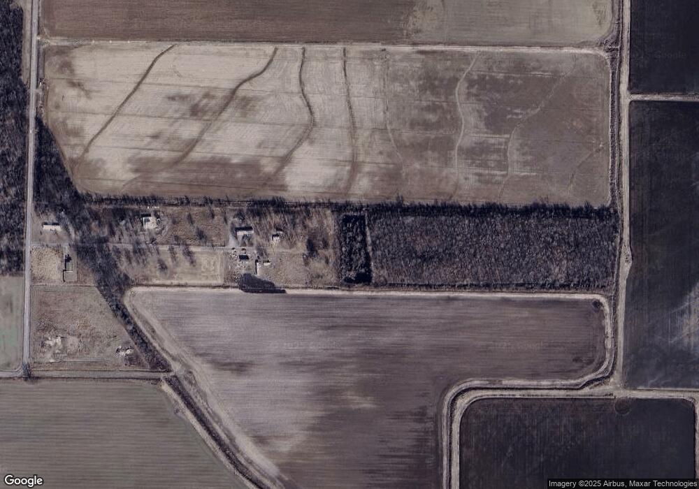
Estimated Value: $85,000 - $162,000
--
Bed
--
Bath
1,064
Sq Ft
$116/Sq Ft
Est. Value
About This Home
This home is located at 24 Henson Ln, Scott, AR 72142 and is currently estimated at $123,500, approximately $116 per square foot. 24 Henson Ln is a home with nearby schools including England Elementary School and England High School.
Ownership History
Date
Name
Owned For
Owner Type
Purchase Details
Closed on
Sep 14, 2016
Sold by
Holladay L D
Bought by
Sanders Darren and Sanders Heather
Current Estimated Value
Purchase Details
Closed on
Jun 25, 2013
Sold by
Holladay And Henson Inc
Bought by
Turpin Zach
Purchase Details
Closed on
Jan 31, 2007
Sold by
Holladay And Henson Inc
Bought by
Gunter Leon and Gunter Jean
Purchase Details
Closed on
Jul 9, 2004
Bought by
Petray and Wf *1
Purchase Details
Closed on
Jul 7, 2004
Bought by
Petray and Wf *1
Purchase Details
Closed on
Oct 6, 2000
Bought by
Lockwood
Purchase Details
Closed on
Apr 1, 1998
Bought by
Holladay & Henson Inc
Purchase Details
Closed on
Jun 22, 1994
Bought by
Redemption For 88-92 Taxes
Purchase Details
Closed on
Jul 2, 1993
Bought by
Thompson
Create a Home Valuation Report for This Property
The Home Valuation Report is an in-depth analysis detailing your home's value as well as a comparison with similar homes in the area
Home Values in the Area
Average Home Value in this Area
Purchase History
| Date | Buyer | Sale Price | Title Company |
|---|---|---|---|
| Sanders Darren | $19,000 | None Available | |
| Turpin Zach | -- | -- | |
| Gunter Leon | -- | -- | |
| Petray | $25,000 | -- | |
| Petray | $25,000 | -- | |
| Lockwood | $16,000 | -- | |
| Holladay & Henson Inc | $15,000 | -- | |
| Redemption For 88-92 Taxes | -- | -- | |
| Thompson | -- | -- |
Source: Public Records
Tax History Compared to Growth
Tax History
| Year | Tax Paid | Tax Assessment Tax Assessment Total Assessment is a certain percentage of the fair market value that is determined by local assessors to be the total taxable value of land and additions on the property. | Land | Improvement |
|---|---|---|---|---|
| 2025 | $117 | $2,200 | $2,200 | -- |
| 2024 | $117 | $2,200 | $2,200 | $0 |
| 2023 | $117 | $5,830 | $2,240 | $3,590 |
| 2022 | $335 | $5,830 | $2,240 | $3,590 |
| 2021 | $294 | $5,830 | $2,240 | $3,590 |
| 2020 | $269 | $4,650 | $2,300 | $2,350 |
| 2019 | $269 | $4,650 | $2,300 | $2,350 |
| 2018 | $246 | $4,650 | $2,300 | $2,350 |
| 2017 | $222 | $4,680 | $2,300 | $2,380 |
| 2016 | $247 | $4,830 | $2,450 | $2,380 |
| 2015 | $315 | $6,020 | $3,570 | $2,450 |
| 2014 | $309 | $6,020 | $3,570 | $2,450 |
Source: Public Records
Map
Nearby Homes
- 3078 Johnson Rd
- 000 Cole Dealing Rd
- 1070 Mound View Dr
- 995 Mound View Dr
- Lot 328 Mound View Dr
- Lot 73 Mound View Dr
- Lot 332 Mound View Dr
- Lot 322 Mound View Dr
- Lot 303 Mound View Dr
- Lot 317 Mound View Dr
- Lot 306 Mound View Dr
- Lot 320 Mound View Dr
- Lot 307 Mound View Dr
- Lot 309 Mound View Dr
- Lot 329 Mound View Dr
- Lot 326 Mound View Dr
- Lot 334 Mound View Dr
- Lot 74 Mound View Dr
- Lot 331 Mound View Dr
- Lot 323 Mound View Dr
- 95 Henson Ln
- 35 Henson Ln
- 0 Henson Ln Unit 16020965
- 1660 Johnson Rd
- 1586 Johnson Rd
- 647 Stewart Rd
- 595 Stewart Rd
- 1534 Johnson Rd
- 432 Stewart Rd
- 558 Stewart Rd
- 1638 Johnson Rd
- 1442 Johnson Rd
- 402 Stewart Rd
- 374 Stewart Rd
- 331 Stewart Rd
- 1280 Johnson Rd
- 302 Stewart Rd
- 466 Stewart Rd
- 244 Stewart Rd
- 1208 Johnson Rd
