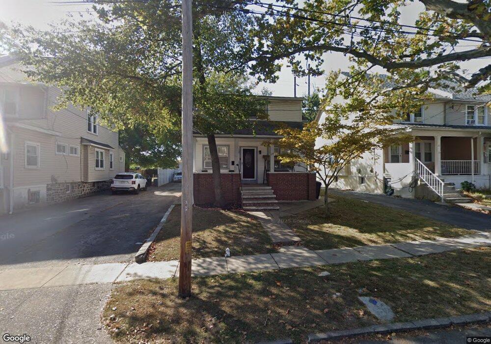
24 Hirst Ave Lansdowne, PA 19050
Estimated Value: $237,000 - $271,000
3
Beds
1
Bath
1,318
Sq Ft
$194/Sq Ft
Est. Value
About This Home
This home is located at 24 Hirst Ave, Lansdowne, PA 19050 and is currently estimated at $255,504, approximately $193 per square foot. 24 Hirst Ave is a home located in Delaware County with nearby schools including East Lansdowne Elementary School, Penn Wood Middle School, and Penn Wood High School - Cypress Street Campus.
Ownership History
Date
Name
Owned For
Owner Type
Purchase Details
Closed on
Jul 9, 2008
Sold by
Roswell Holdings Tax Liens 2004-1 Llc
Bought by
Samuels Albert and Snead Shakiya
Current Estimated Value
Home Financials for this Owner
Home Financials are based on the most recent Mortgage that was taken out on this home.
Original Mortgage
$130,965
Outstanding Balance
$85,892
Interest Rate
6.4%
Mortgage Type
FHA
Estimated Equity
$169,612
Purchase Details
Closed on
Aug 11, 2006
Sold by
Fentress Tammy C Holly Rodney and Indymac Bank Fsb
Bought by
Roswell Holdings Tax Liens 2004-1 Llc
Purchase Details
Closed on
Sep 18, 2000
Sold by
Cook Jacqueline R
Bought by
Holly Tammy C and Fentress Rodney
Home Financials for this Owner
Home Financials are based on the most recent Mortgage that was taken out on this home.
Original Mortgage
$51,100
Interest Rate
10.75%
Create a Home Valuation Report for This Property
The Home Valuation Report is an in-depth analysis detailing your home's value as well as a comparison with similar homes in the area
Home Values in the Area
Average Home Value in this Area
Purchase History
| Date | Buyer | Sale Price | Title Company |
|---|---|---|---|
| Samuels Albert | $132,000 | Lawyers Title Insurance Co | |
| Roswell Holdings Tax Liens 2004-1 Llc | $75,800 | None Available | |
| Holly Tammy C | $84,000 | Fidelity National Title Ins |
Source: Public Records
Mortgage History
| Date | Status | Borrower | Loan Amount |
|---|---|---|---|
| Open | Samuels Albert | $130,965 | |
| Previous Owner | Holly Tammy C | $51,100 |
Source: Public Records
Tax History Compared to Growth
Tax History
| Year | Tax Paid | Tax Assessment Tax Assessment Total Assessment is a certain percentage of the fair market value that is determined by local assessors to be the total taxable value of land and additions on the property. | Land | Improvement |
|---|---|---|---|---|
| 2025 | $5,830 | $136,440 | $61,820 | $74,620 |
| 2024 | $5,830 | $136,440 | $61,820 | $74,620 |
| 2023 | $4,359 | $136,440 | $61,820 | $74,620 |
| 2022 | $5,258 | $136,440 | $61,820 | $74,620 |
| 2021 | $7,840 | $136,440 | $61,820 | $74,620 |
| 2020 | $5,110 | $77,590 | $26,740 | $50,850 |
| 2019 | $5,025 | $77,590 | $26,740 | $50,850 |
| 2018 | $4,959 | $77,590 | $0 | $0 |
| 2017 | $4,705 | $77,590 | $0 | $0 |
| 2016 | $426 | $77,590 | $0 | $0 |
| 2015 | $435 | $77,590 | $0 | $0 |
| 2014 | $426 | $77,590 | $0 | $0 |
Source: Public Records
Map
Nearby Homes
- 608 Pembroke Ave
- 230 Wynnewood Ave
- 46 S Maple Ave
- 226 E Greenwood Ave
- 209 E Greenwood Ave
- 75 E Stewart Ave
- 32 N Wycombe Ave
- 603 Penn St
- 319 E Essex Ave
- 317 E Essex Ave
- 315 E Essex Ave
- 37 E Stratford Ave
- 192 Fairview Ave
- 178 N Union Ave
- 408 S Union Ave
- 407 Church Ln
- 435 Bonsall Ave
- 49 Elberon Ave
- 144 Fairview Ave
- 164 Woodland Ave