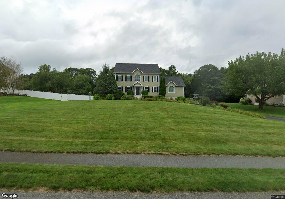
24 Kyle Jacob Rd Westport, MA 02790
North Westport NeighborhoodEstimated Value: $786,007 - $904,000
3
Beds
--
Bath
2,656
Sq Ft
$320/Sq Ft
Est. Value
About This Home
This home is located at 24 Kyle Jacob Rd, Westport, MA 02790 and is currently estimated at $850,002, approximately $320 per square foot. 24 Kyle Jacob Rd is a home located in Bristol County with nearby schools including Alice A. Macomber Primary School, Westport Elementary School, and Westport Middle-High School.
Ownership History
Date
Name
Owned For
Owner Type
Purchase Details
Closed on
Dec 27, 2007
Sold by
Brookside Woods Dev Ll
Bought by
Ferreira David A and Ferreira Kristen M
Current Estimated Value
Home Financials for this Owner
Home Financials are based on the most recent Mortgage that was taken out on this home.
Original Mortgage
$391,950
Interest Rate
6.27%
Mortgage Type
Purchase Money Mortgage
Create a Home Valuation Report for This Property
The Home Valuation Report is an in-depth analysis detailing your home's value as well as a comparison with similar homes in the area
Home Values in the Area
Average Home Value in this Area
Purchase History
| Date | Buyer | Sale Price | Title Company |
|---|---|---|---|
| Ferreira David A | $180,000 | -- |
Source: Public Records
Mortgage History
| Date | Status | Borrower | Loan Amount |
|---|---|---|---|
| Open | Ferreira David A | $378,000 | |
| Closed | Ferreira David A | $392,000 | |
| Closed | Ferreira David A | $391,950 |
Source: Public Records
Tax History Compared to Growth
Tax History
| Year | Tax Paid | Tax Assessment Tax Assessment Total Assessment is a certain percentage of the fair market value that is determined by local assessors to be the total taxable value of land and additions on the property. | Land | Improvement |
|---|---|---|---|---|
| 2025 | $5,243 | $703,800 | $210,400 | $493,400 |
| 2024 | $5,236 | $677,300 | $194,900 | $482,400 |
| 2023 | $5,191 | $636,200 | $185,600 | $450,600 |
| 2022 | $4,957 | $584,500 | $185,600 | $398,900 |
| 2021 | $4,869 | $564,900 | $168,800 | $396,100 |
| 2020 | $4,705 | $558,100 | $162,000 | $396,100 |
| 2019 | $4,186 | $506,200 | $162,000 | $344,200 |
| 2018 | $3,729 | $456,400 | $117,500 | $338,900 |
| 2017 | $3,610 | $453,000 | $113,800 | $339,200 |
| 2016 | $3,269 | $413,300 | $110,000 | $303,300 |
| 2015 | $3,206 | $404,300 | $112,500 | $291,800 |
Source: Public Records
Map
Nearby Homes
- 9 Kyle Jacob Rd
- 15 S Breault St
- 16 S Berryman St
- 116 Gifford Rd
- 0 Van Buren St
- 20 Faulkner St
- 23 Donna St
- 27 Dias Ave
- 565 Highland Ave
- 100 D Dr
- 96 Forge Rd
- 29 Union Ave
- 771 Sanford Rd
- 3 Diane Way
- 56 Lakeside Ave
- 1276 Old Fall River Rd
- 4 Main Rd
- 3 Roller Coaster Way Unit Lot 1
- 55 Lakeside Ave
- 735 Reed Rd
- 28 Kyle Jacob Rd
- 20 Kyle Jacob Rd
- 2 Melissa Beth Way
- 16 Kyle Jacob Rd
- 63 Sylvana St
- 57 Sylvana St
- 6 Melissa Beth Way
- 1 Melissa Beth Way
- 51 Sylvana St
- 5 Rachs Ln
- 9 Rachs Ln
- 12 Kyle Jacob Rd
- 45 Sylvana St
- 30 Kyle Jacob Rd
- 5 Melissa Beth Way
- 62 Sylvana St
- 56 Sylvana St
- 13 Kyle Jacob Rd
- 39 Sylvana St
- 50 Sylvana St