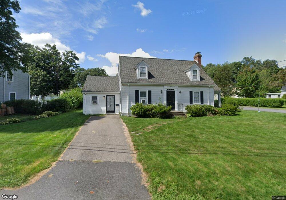
24 Lake St Shrewsbury, MA 01545
Estimated Value: $667,339 - $811,000
4
Beds
3
Baths
2,122
Sq Ft
$358/Sq Ft
Est. Value
About This Home
This home is located at 24 Lake St, Shrewsbury, MA 01545 and is currently estimated at $759,835, approximately $358 per square foot. 24 Lake St is a home located in Worcester County with nearby schools including Walter J. Paton Elementary School, Sherwood Middle School, and Oak Middle School.
Ownership History
Date
Name
Owned For
Owner Type
Purchase Details
Closed on
Jun 19, 2008
Sold by
Nigro Ann
Bought by
Stameris Philip
Current Estimated Value
Purchase Details
Closed on
Dec 6, 2006
Sold by
Nigro Alfred F
Bought by
Nigro Ann
Purchase Details
Closed on
Feb 28, 1992
Sold by
W S B Dev Corp
Bought by
Nigro Alfred and Nigro Ann
Create a Home Valuation Report for This Property
The Home Valuation Report is an in-depth analysis detailing your home's value as well as a comparison with similar homes in the area
Home Values in the Area
Average Home Value in this Area
Purchase History
| Date | Buyer | Sale Price | Title Company |
|---|---|---|---|
| Stameris Philip | $380,500 | -- | |
| Stameris Philip | $380,500 | -- | |
| Stameris Philip | $380,500 | -- | |
| Nigro Ann | -- | -- | |
| Nigro Ann | -- | -- | |
| Nigro Ann | -- | -- | |
| Nigro Alfred | $125,000 | -- | |
| Nigro Alfred | $125,000 | -- |
Source: Public Records
Mortgage History
| Date | Status | Borrower | Loan Amount |
|---|---|---|---|
| Open | Nigro Alfred | $175,000 | |
| Closed | Nigro Alfred | $160,000 |
Source: Public Records
Tax History Compared to Growth
Tax History
| Year | Tax Paid | Tax Assessment Tax Assessment Total Assessment is a certain percentage of the fair market value that is determined by local assessors to be the total taxable value of land and additions on the property. | Land | Improvement |
|---|---|---|---|---|
| 2025 | $75 | $619,200 | $285,500 | $333,700 |
| 2024 | $6,971 | $563,100 | $271,900 | $291,200 |
| 2023 | $6,727 | $512,700 | $271,900 | $240,800 |
| 2022 | $6,509 | $461,300 | $213,600 | $247,700 |
| 2021 | $5,684 | $430,900 | $213,600 | $217,300 |
| 2020 | $5,373 | $430,900 | $213,600 | $217,300 |
| 2019 | $5,141 | $409,000 | $198,700 | $210,300 |
| 2018 | $4,787 | $378,100 | $185,500 | $192,600 |
| 2017 | $4,501 | $350,800 | $168,000 | $182,800 |
| 2016 | $4,438 | $341,400 | $157,000 | $184,400 |
| 2015 | $4,253 | $322,200 | $141,800 | $180,400 |
Source: Public Records
Map
Nearby Homes
- 9 Arnold Rd
- 18 Eastwood Rd
- 60 Harrington Farms Way Unit 60
- 102 Harrington Farms Way
- 114 Grafton St
- 4 Horseneck Rd
- 33 Shady Lane Ave
- 39 Old Brook Rd
- 29 Elma Cir
- 21 Fiske St
- 9 Heritage St
- 25 Harriet Ave
- 28 Cherry St
- 46-50 Wesleyan St
- 15 Conifer Cir Unit 31
- 5 Conifer Cir Unit 28
- 3 Conifer Cir Unit 29
- 43 Harriet Ave
- 7 Wesleyan St
- 129 A-B Maple Ave