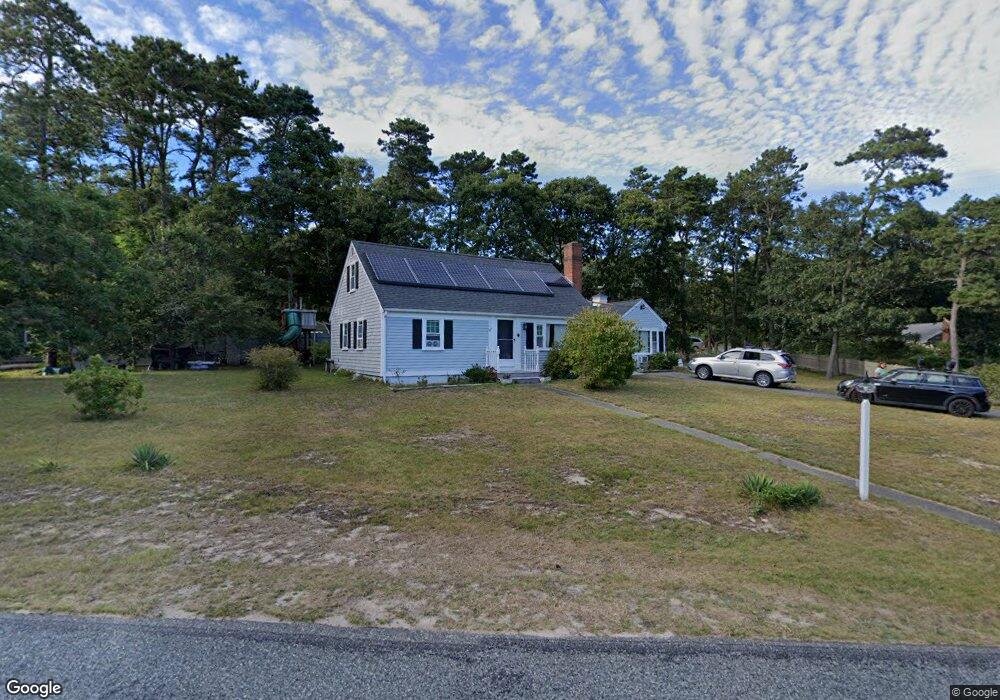
24 Lane Rd Dennis Port, MA 02639
Dennis Port NeighborhoodEstimated Value: $609,000 - $706,000
3
Beds
2
Baths
1,585
Sq Ft
$408/Sq Ft
Est. Value
About This Home
This home is located at 24 Lane Rd, Dennis Port, MA 02639 and is currently estimated at $646,609, approximately $407 per square foot. 24 Lane Rd is a home located in Barnstable County with nearby schools including Dennis-Yarmouth Regional High School and St. Pius X. School.
Ownership History
Date
Name
Owned For
Owner Type
Purchase Details
Closed on
Oct 26, 2007
Sold by
Rothballer Robert P
Bought by
Griesmer Martin E and Griesmer Maryann R
Current Estimated Value
Home Financials for this Owner
Home Financials are based on the most recent Mortgage that was taken out on this home.
Original Mortgage
$200,000
Interest Rate
6.39%
Mortgage Type
Purchase Money Mortgage
Purchase Details
Closed on
Nov 16, 1998
Sold by
Sequin Stephanie J and Sequin Robert J
Bought by
Rothballer Robert P and Rothballer Susan J
Home Financials for this Owner
Home Financials are based on the most recent Mortgage that was taken out on this home.
Original Mortgage
$105,300
Interest Rate
6.65%
Mortgage Type
Purchase Money Mortgage
Create a Home Valuation Report for This Property
The Home Valuation Report is an in-depth analysis detailing your home's value as well as a comparison with similar homes in the area
Home Values in the Area
Average Home Value in this Area
Purchase History
| Date | Buyer | Sale Price | Title Company |
|---|---|---|---|
| Griesmer Martin E | $291,000 | -- | |
| Rothballer Robert P | $117,000 | -- |
Source: Public Records
Mortgage History
| Date | Status | Borrower | Loan Amount |
|---|---|---|---|
| Open | Rothballer Robert P | $198,000 | |
| Closed | Griesmer Martin E | $200,000 | |
| Previous Owner | Rothballer Robert P | $105,300 | |
| Previous Owner | Rothballer Robert P | $93,500 |
Source: Public Records
Tax History Compared to Growth
Tax History
| Year | Tax Paid | Tax Assessment Tax Assessment Total Assessment is a certain percentage of the fair market value that is determined by local assessors to be the total taxable value of land and additions on the property. | Land | Improvement |
|---|---|---|---|---|
| 2025 | $2,476 | $571,900 | $138,600 | $433,300 |
| 2024 | $2,445 | $557,000 | $141,100 | $415,900 |
| 2023 | $2,317 | $496,200 | $128,300 | $367,900 |
| 2022 | $2,247 | $401,200 | $128,400 | $272,800 |
| 2021 | $2,005 | $332,500 | $113,300 | $219,200 |
| 2020 | $1,951 | $319,800 | $113,300 | $206,500 |
| 2019 | $1,836 | $297,500 | $111,100 | $186,400 |
| 2018 | $7,331 | $282,600 | $105,700 | $176,900 |
| 2017 | $15,818 | $282,600 | $105,700 | $176,900 |
| 2016 | $1,718 | $263,100 | $117,500 | $145,600 |
| 2015 | $1,684 | $263,100 | $117,500 | $145,600 |
| 2014 | $1,492 | $234,900 | $94,000 | $140,900 |
Source: Public Records
Map
Nearby Homes
- 11 Lane Rd
- 91 Depot Rd W
- 141 Division St
- 141 Division St
- 47 Telegraph Rd Unit 1
- 9 Country Ln
- 24 Indian Trail
- 78 Upper County Rd Unit A&B
- 78 Upper County Rd
- 9 Bells Neck Rd Unit 10
- 45 Route 28
- 12 Candlewood Ln Unit 2-9
- 12 Candlewood Ln Unit 1-6
- 10 Candlewood Ln Unit 2-1
- 537 Depot St
- 9 Mansion St
- 64 Smith St
- 79 Massachusetts 28
- 73 Division St
- 20 Aunt Debbys Rd