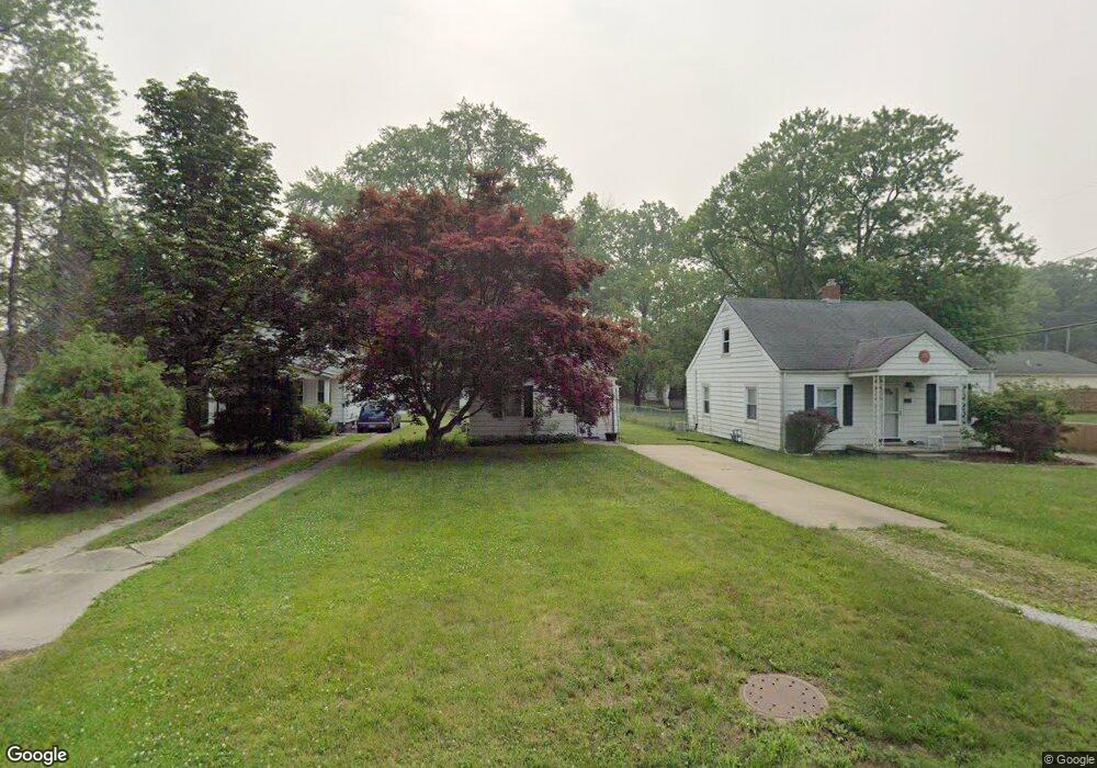
24 Leander Dr Toledo, OH 43615
Reynolds Corners NeighborhoodEstimated Value: $80,702 - $114,000
2
Beds
1
Bath
667
Sq Ft
$154/Sq Ft
Est. Value
About This Home
This home is located at 24 Leander Dr, Toledo, OH 43615 and is currently estimated at $102,426, approximately $153 per square foot. 24 Leander Dr is a home located in Lucas County with nearby schools including McTigue Elementary School, Rogers High School, and Horizon Science Academy-Springfield.
Ownership History
Date
Name
Owned For
Owner Type
Purchase Details
Closed on
Jan 2, 2007
Sold by
Mcguire Jeanette L
Bought by
Twigg Gregory S
Current Estimated Value
Purchase Details
Closed on
Sep 28, 2005
Sold by
Brueshaber Frederick W and Brueshaber Deena
Bought by
Twigg Gregory S and Mcguire Jeanette L
Home Financials for this Owner
Home Financials are based on the most recent Mortgage that was taken out on this home.
Original Mortgage
$59,400
Interest Rate
5.93%
Mortgage Type
Fannie Mae Freddie Mac
Purchase Details
Closed on
Oct 6, 1999
Sold by
Marshall Irene
Bought by
Brueshaber Frederick W and Brueshaber Deena
Create a Home Valuation Report for This Property
The Home Valuation Report is an in-depth analysis detailing your home's value as well as a comparison with similar homes in the area
Home Values in the Area
Average Home Value in this Area
Purchase History
| Date | Buyer | Sale Price | Title Company |
|---|---|---|---|
| Twigg Gregory S | -- | Attorney | |
| Twigg Gregory S | $66,000 | -- | |
| Brueshaber Frederick W | $33,000 | American 1St |
Source: Public Records
Mortgage History
| Date | Status | Borrower | Loan Amount |
|---|---|---|---|
| Previous Owner | Twigg Gregory S | $59,400 |
Source: Public Records
Tax History
| Year | Tax Paid | Tax Assessment Tax Assessment Total Assessment is a certain percentage of the fair market value that is determined by local assessors to be the total taxable value of land and additions on the property. | Land | Improvement |
|---|---|---|---|---|
| 2025 | -- | $20,300 | $4,585 | $15,715 |
| 2024 | $672 | $20,300 | $4,585 | $15,715 |
| 2023 | $1,068 | $15,015 | $3,990 | $11,025 |
| 2022 | $1,051 | $15,015 | $3,990 | $11,025 |
| 2021 | $1,064 | $15,015 | $3,990 | $11,025 |
| 2020 | $1,194 | $14,980 | $4,725 | $10,255 |
| 2019 | $1,160 | $14,980 | $4,725 | $10,255 |
| 2018 | $1,172 | $14,980 | $4,725 | $10,255 |
| 2017 | $1,167 | $14,630 | $4,620 | $10,010 |
| 2016 | $1,173 | $41,800 | $13,200 | $28,600 |
| 2015 | $1,182 | $41,800 | $13,200 | $28,600 |
| 2014 | $920 | $14,630 | $4,620 | $10,010 |
| 2013 | $920 | $14,630 | $4,620 | $10,010 |
Source: Public Records
Map
Nearby Homes
- 216 Deigle Dr
- 6324 Bapst Ave
- 30 N Favony Ave
- 127 N Dorcas Rd
- 419 N Holland Sylvania Rd
- 630 Saturn Dr
- 5845 Cook Dr
- 8161 Hill Ave
- 6032 Willowvale Dr
- 605 Koch Dr
- 411 Danesmoor Rd
- 549 Dorcas Rd
- 607 S Mccord Rd
- 47 Medbury St
- 148 Curwood Rd
- 128 Pebble Beach Dr
- 136 Pebble Beach Dr
- 1137 Bedford Woods Dr
- 715 S Holland Sylvania Rd
- 737 Dorcas Rd
Your Personal Tour Guide
Ask me questions while you tour the home.