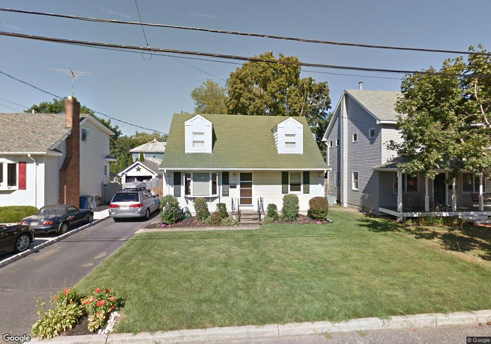
24 Manning St Red Bank, NJ 07701
New Monmouth NeighborhoodEstimated Value: $715,494 - $775,000
3
Beds
2
Baths
1,382
Sq Ft
$539/Sq Ft
Est. Value
About This Home
This home is located at 24 Manning St, Red Bank, NJ 07701 and is currently estimated at $744,374, approximately $538 per square foot. 24 Manning St is a home located in Monmouth County with nearby schools including River Plaza Elementary School, Thompson Middle School, and Middletown - South High School.
Ownership History
Date
Name
Owned For
Owner Type
Purchase Details
Closed on
Oct 16, 2009
Sold by
Miller Aaron and Miller Juliet
Bought by
Miller Aaron and Miller Juliet
Current Estimated Value
Home Financials for this Owner
Home Financials are based on the most recent Mortgage that was taken out on this home.
Original Mortgage
$183,742
Interest Rate
5%
Mortgage Type
New Conventional
Purchase Details
Closed on
Aug 30, 2002
Sold by
Gibbs Robert
Bought by
Miller Aaron and Chin Juliet
Home Financials for this Owner
Home Financials are based on the most recent Mortgage that was taken out on this home.
Original Mortgage
$224,000
Interest Rate
6.27%
Purchase Details
Closed on
Aug 30, 1999
Sold by
Nyack Rudy
Bought by
Gibbs Robert and Robertello Janine
Home Financials for this Owner
Home Financials are based on the most recent Mortgage that was taken out on this home.
Original Mortgage
$160,550
Interest Rate
7.85%
Create a Home Valuation Report for This Property
The Home Valuation Report is an in-depth analysis detailing your home's value as well as a comparison with similar homes in the area
Home Values in the Area
Average Home Value in this Area
Purchase History
| Date | Buyer | Sale Price | Title Company |
|---|---|---|---|
| Miller Aaron | -- | Titleserv Inc | |
| Miller Aaron | $280,000 | -- | |
| Gibbs Robert | $169,000 | -- |
Source: Public Records
Mortgage History
| Date | Status | Borrower | Loan Amount |
|---|---|---|---|
| Closed | Miller Aaron | $183,742 | |
| Closed | Miller Aaron | $224,000 | |
| Previous Owner | Gibbs Robert | $160,550 |
Source: Public Records
Tax History Compared to Growth
Tax History
| Year | Tax Paid | Tax Assessment Tax Assessment Total Assessment is a certain percentage of the fair market value that is determined by local assessors to be the total taxable value of land and additions on the property. | Land | Improvement |
|---|---|---|---|---|
| 2025 | $9,952 | $658,700 | $455,000 | $203,700 |
| 2024 | $9,194 | $605,000 | $405,000 | $200,000 |
| 2023 | $9,194 | $529,000 | $359,200 | $169,800 |
| 2022 | $7,553 | $429,200 | $267,500 | $161,700 |
| 2021 | $7,553 | $376,300 | $232,500 | $143,800 |
| 2020 | $7,000 | $327,400 | $200,000 | $127,400 |
| 2019 | $6,900 | $326,700 | $200,000 | $126,700 |
| 2018 | $7,194 | $332,000 | $200,000 | $132,000 |
| 2017 | $6,967 | $328,000 | $200,000 | $128,000 |
| 2016 | $6,602 | $309,800 | $185,000 | $124,800 |
| 2015 | $6,434 | $301,200 | $185,000 | $116,200 |
| 2014 | $5,827 | $266,200 | $160,000 | $106,200 |
Source: Public Records
Map
Nearby Homes
- 13 Applegate St
- 928 Park Place
- 15 Hillside St
- 11 Buchhop Ln Unit 5
- 11 Buchhop Ln
- 7 Buchhop Ln
- 33 Auburn Ct Unit G
- 6 Buchhop Ln
- 8 Cherry St
- 3 Auburn Ct
- 74 Leighton Ave
- 121 Catherine St
- 79 Lake Shore Dr
- 16 Concord Ct Unit 15D
- 167 River St
- 11 Manchester Ct
- 19 Manchester Ct
- 7 Lexington Ct
- 22 Claremont Ct Unit 33E
- 126 Manchester Ct