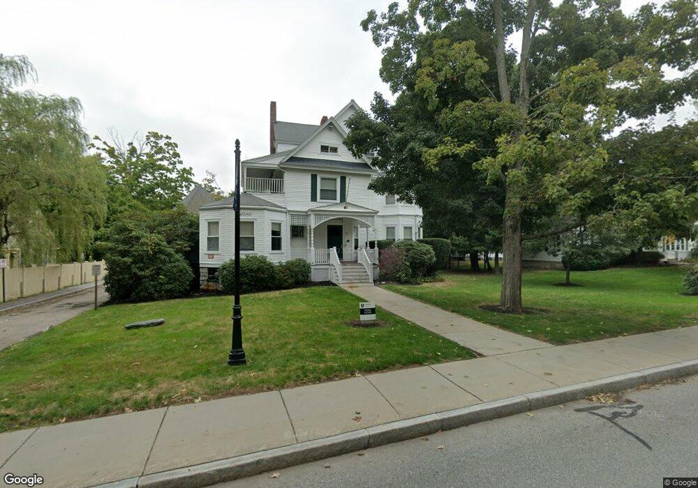
24 Maple Terrace Auburndale, MA 02466
Auburndale NeighborhoodEstimated Value: $1,314,000 - $1,820,000
6
Beds
3
Baths
2,424
Sq Ft
$632/Sq Ft
Est. Value
About This Home
This home is located at 24 Maple Terrace, Auburndale, MA 02466 and is currently estimated at $1,531,942, approximately $631 per square foot. 24 Maple Terrace is a home located in Middlesex County with nearby schools including Williams Elementary School, Charles E Brown Middle School, and Newton South High School.
Ownership History
Date
Name
Owned For
Owner Type
Purchase Details
Closed on
Jun 30, 2005
Sold by
Rutledge Carol A
Bought by
Hatem Danielle M and Hatem Neil M
Current Estimated Value
Home Financials for this Owner
Home Financials are based on the most recent Mortgage that was taken out on this home.
Original Mortgage
$520,000
Outstanding Balance
$272,673
Interest Rate
5.73%
Mortgage Type
Purchase Money Mortgage
Estimated Equity
$1,259,269
Create a Home Valuation Report for This Property
The Home Valuation Report is an in-depth analysis detailing your home's value as well as a comparison with similar homes in the area
Home Values in the Area
Average Home Value in this Area
Purchase History
| Date | Buyer | Sale Price | Title Company |
|---|---|---|---|
| Hatem Danielle M | $850,000 | -- |
Source: Public Records
Mortgage History
| Date | Status | Borrower | Loan Amount |
|---|---|---|---|
| Open | Hatem Danielle M | $520,000 |
Source: Public Records
Tax History Compared to Growth
Tax History
| Year | Tax Paid | Tax Assessment Tax Assessment Total Assessment is a certain percentage of the fair market value that is determined by local assessors to be the total taxable value of land and additions on the property. | Land | Improvement |
|---|---|---|---|---|
| 2025 | $14,863 | $1,516,600 | $756,400 | $760,200 |
| 2024 | $14,371 | $1,472,400 | $734,400 | $738,000 |
| 2023 | $13,854 | $1,360,900 | $585,100 | $775,800 |
| 2022 | $13,256 | $1,260,100 | $541,800 | $718,300 |
| 2021 | $2,538 | $1,156,100 | $497,100 | $659,000 |
| 2020 | $12,070 | $1,156,100 | $497,100 | $659,000 |
| 2019 | $11,291 | $1,080,500 | $464,600 | $615,900 |
| 2018 | $2,294 | $1,043,000 | $439,500 | $603,500 |
| 2017 | $10,641 | $956,900 | $403,200 | $553,700 |
| 2016 | $9,991 | $877,900 | $369,900 | $508,000 |
| 2015 | $9,526 | $820,500 | $345,700 | $474,800 |
Source: Public Records
Map
Nearby Homes
- 17 Lasell St
- 224 Auburn St Unit 224
- 224 Auburn St Unit A
- 226 Auburn St Unit 226
- 283 Melrose St
- 2202 Commonwealth Ave Unit 2
- 2202 Commonwealth Ave Unit 1
- 283 Woodland Rd
- 27 Oakwood Rd
- 13 Weir St
- 62-64 Rowe St Unit B
- 1754 Washington St
- 1639 Washington St
- 51 Bourne St
- 17 Gilbert St
- 17 Crescent St
- 0 Duncan Rd Unit 72925240
- 10 Crescent St Unit 1
- 10 Crescent St Unit 2
- 160 Pine St Unit 12
- 26 Maple Terrace
- 14 Maple Terrace
- 15 Maple Terrace Unit 15A
- 15 Maple Terrace
- 120 Woodland Rd
- 24 Groveland St
- 9 Maple Terrace
- 30 Groveland St Unit 2
- 30 Groveland St Unit 1
- 30 Groveland St Unit 2 30
- 86 Grove St
- 34 Groveland St
- 74 Grove St
- 84 Grove St Unit 86
- 84 Grove St Unit 1
- 84 Grove St Unit 2
- 66 Grove St
- 110 Woodland Rd
- 60 Grove St
- 40 Groveland St