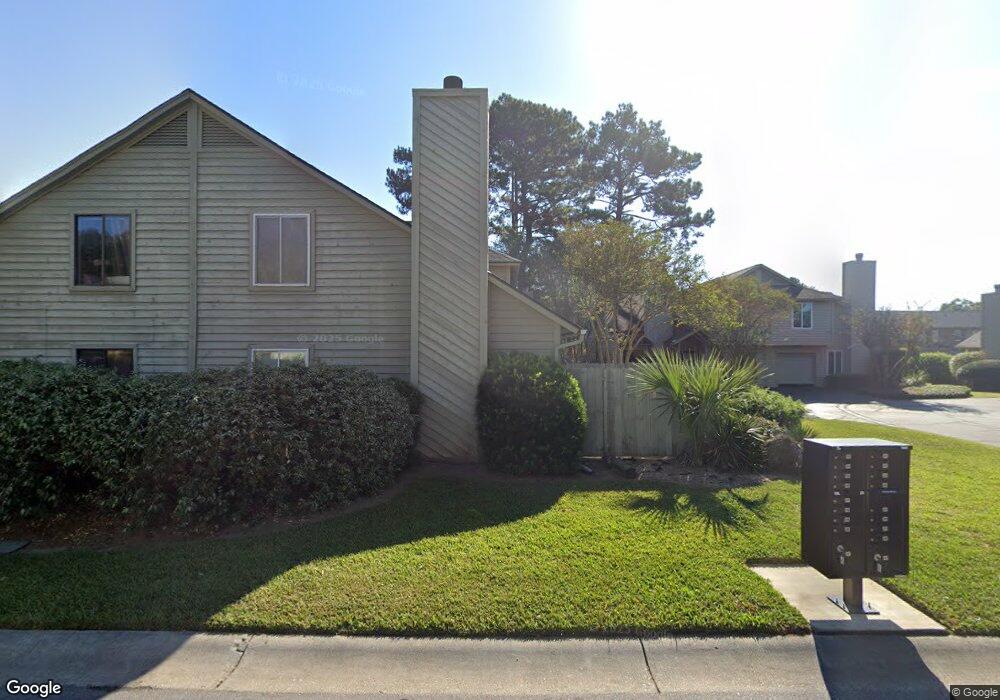
24 Maplecrest Dr Charleston, SC 29412
James Island NeighborhoodEstimated Value: $312,000 - $384,000
2
Beds
2
Baths
1,088
Sq Ft
$316/Sq Ft
Est. Value
About This Home
This home is located at 24 Maplecrest Dr, Charleston, SC 29412 and is currently estimated at $343,869, approximately $316 per square foot. 24 Maplecrest Dr is a home located in Charleston County with nearby schools including Harbor View Elementary School, Camp Road Middle, and James Island Charter High School.
Ownership History
Date
Name
Owned For
Owner Type
Purchase Details
Closed on
Oct 7, 2014
Sold by
Hayes Jason
Bought by
Hayes Jason and Gorman Robert H
Current Estimated Value
Home Financials for this Owner
Home Financials are based on the most recent Mortgage that was taken out on this home.
Original Mortgage
$116,250
Outstanding Balance
$89,286
Interest Rate
4.15%
Mortgage Type
Future Advance Clause Open End Mortgage
Estimated Equity
$254,583
Purchase Details
Closed on
Nov 28, 2005
Sold by
Palyo Alex
Bought by
Hayes Jason
Purchase Details
Closed on
Nov 9, 2004
Sold by
Owens Christopher C and Owens Harriett B
Bought by
Palyo Alex
Purchase Details
Closed on
Oct 1, 2001
Sold by
Bakker Anthony E
Bought by
Owens Christopher C and Owens Harriett B
Create a Home Valuation Report for This Property
The Home Valuation Report is an in-depth analysis detailing your home's value as well as a comparison with similar homes in the area
Home Values in the Area
Average Home Value in this Area
Purchase History
| Date | Buyer | Sale Price | Title Company |
|---|---|---|---|
| Hayes Jason | -- | -- | |
| Hayes Jason | $189,900 | None Available | |
| Palyo Alex | $147,000 | -- | |
| Owens Christopher C | $122,000 | -- |
Source: Public Records
Mortgage History
| Date | Status | Borrower | Loan Amount |
|---|---|---|---|
| Open | Hayes Jason | $116,250 |
Source: Public Records
Tax History
| Year | Tax Paid | Tax Assessment Tax Assessment Total Assessment is a certain percentage of the fair market value that is determined by local assessors to be the total taxable value of land and additions on the property. | Land | Improvement |
|---|---|---|---|---|
| 2024 | $3,195 | $9,360 | $0 | $0 |
| 2023 | $2,804 | $9,360 | $0 | $0 |
| 2022 | $2,571 | $9,360 | $0 | $0 |
| 2021 | $2,540 | $9,360 | $0 | $0 |
| 2020 | $2,522 | $9,360 | $0 | $0 |
| 2019 | $2,310 | $8,140 | $0 | $0 |
| 2017 | $2,209 | $8,140 | $0 | $0 |
| 2016 | $2,140 | $8,140 | $0 | $0 |
| 2015 | $2,045 | $8,140 | $0 | $0 |
| 2014 | $1,980 | $0 | $0 | $0 |
| 2011 | -- | $0 | $0 | $0 |
Source: Public Records
Map
Nearby Homes
- 50 Held Cir Unit 50c
- 37 Rivers Point Row Unit A
- 914 Dill Ave
- 27 Brockman Dr Unit 27B
- 21 Rivers Point Row Unit 11B
- 1402 Camp Rd Unit 3H
- 1402 Camp Rd Unit 5E
- 1402 Camp Rd Unit 3F
- 1402 Camp Rd Unit 3B
- 1402 Camp Rd Unit 7A
- 1402 Camp Rd Unit 16F
- 1402 Camp Rd Unit 10D
- 10 Bass Ln Unit A
- 147 Oyster Point Row
- 830 Jordan St
- 1359 White House Blvd
- 1563 Relyea Ave
- 818 W Madison Ave
- 1517 Brookbank Ave
- 1333 Julian Clark Rd
- 26 Maplecrest Dr
- 20 Maplecrest Dr
- 28 Maplecrest Dr
- 28 Maplecrest Dr Unit 1
- 23 Maplecrest Dr
- 18 Maplecrest Dr
- 25 Maplecrest Dr
- 30 Maplecrest Dr
- 1300 Maplecrest Dr
- 1104 Maplecrest Dr
- 1204 Maplecrest Dr
- 1200 Maplecrest Dr
- 16 Maplecrest Dr
- 32 Maplecrest Dr
- 12 Maplecrest Dr
- 10 Maplecrest Dr
- 21 Maplecrest Dr
- 27 Maplecrest Dr
- 34 Maplecrest Dr
- 35 Maplecrest Dr
Your Personal Tour Guide
Ask me questions while you tour the home.