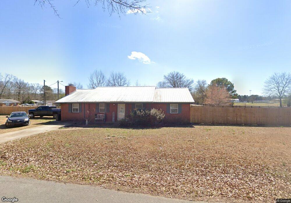
24 Mason Dr E Columbus, MS 39702
Estimated Value: $150,000 - $192,000
Studio
1
Bath
1,422
Sq Ft
$118/Sq Ft
Est. Value
About This Home
This home is located at 24 Mason Dr E, Columbus, MS 39702 and is currently estimated at $167,829, approximately $118 per square foot. 24 Mason Dr E is a home.
Ownership History
Date
Name
Owned For
Owner Type
Purchase Details
Closed on
Jun 22, 2021
Sold by
Baker Kristy N and Baker Scotty
Bought by
Baker Kristy N
Current Estimated Value
Purchase Details
Closed on
Dec 23, 2019
Sold by
Baker Jennifer R
Bought by
Baker Scotty L
Purchase Details
Closed on
Mar 8, 2007
Sold by
Sanders Kimberly Y
Bought by
Baker Scotty L and Baker Jennifer R
Home Financials for this Owner
Home Financials are based on the most recent Mortgage that was taken out on this home.
Original Mortgage
$84,000
Interest Rate
6.22%
Create a Home Valuation Report for This Property
The Home Valuation Report is an in-depth analysis detailing your home's value as well as a comparison with similar homes in the area
Home Values in the Area
Average Home Value in this Area
Purchase History
| Date | Buyer | Sale Price | Title Company |
|---|---|---|---|
| Baker Kristy N | -- | None Available | |
| Baker Scotty | -- | None Available | |
| Baker Scotty L | -- | None Available | |
| Baker Scotty L | -- | -- |
Source: Public Records
Mortgage History
| Date | Status | Borrower | Loan Amount |
|---|---|---|---|
| Previous Owner | Baker Scotty L | $84,000 |
Source: Public Records
Tax History
| Year | Tax Paid | Tax Assessment Tax Assessment Total Assessment is a certain percentage of the fair market value that is determined by local assessors to be the total taxable value of land and additions on the property. | Land | Improvement |
|---|---|---|---|---|
| 2025 | $503 | $8,212 | $0 | $0 |
| 2024 | $501 | $8,260 | $0 | $0 |
| 2023 | $394 | $7,056 | $0 | $0 |
| 2022 | $386 | $6,908 | $0 | $0 |
| 2021 | $361 | $6,908 | $0 | $0 |
| 2020 | $326 | $6,908 | $0 | $0 |
| 2019 | $399 | $7,516 | $0 | $0 |
| 2018 | $399 | $7,701 | $0 | $0 |
| 2017 | $368 | $7,701 | $0 | $0 |
| 2016 | $368 | $7,701 | $0 | $0 |
| 2015 | $381 | $7,854 | $0 | $0 |
| 2014 | $342 | $7,407 | $0 | $0 |
Source: Public Records
Map
Nearby Homes
- 16 Jenny Ln
- 262 Center Rd
- 248 Lakeover Dr W
- 220 Woodridge Place
- 17 Paige Cove
- 178 Rogers Way
- 836 Oswalt Rd
- 164 Sleepy Fawn Park
- Lot 3 Lost Lake Hills Rd
- 0 Lost Lake Hills Rd
- 304 Timber Creek Dr
- 805 Timber Creek Dr
- 76 Richardson Rd
- 346 Williams Place
- 2654 Yorkville Rd E
- 611 Thornton Dr
- 0 Golding Cir
- 305 Mccully Rd
- 479 Bryant Rd
- 0 Fiesta Dr
Your Personal Tour Guide
Ask me questions while you tour the home.