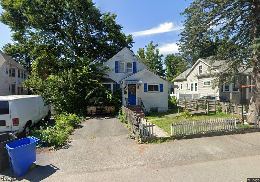
24 McDonald St Quincy, MA 02169
South Quincy NeighborhoodEstimated Value: $633,275 - $685,000
3
Beds
2
Baths
1,462
Sq Ft
$449/Sq Ft
Est. Value
About This Home
This home is located at 24 McDonald St, Quincy, MA 02169 and is currently estimated at $657,069, approximately $449 per square foot. 24 McDonald St is a home located in Norfolk County with nearby schools including South West Middle School, Lincoln-Hancock Community School, and Quincy High School.
Ownership History
Date
Name
Owned For
Owner Type
Purchase Details
Closed on
Feb 2, 2007
Sold by
Julian Albert H and Julian Karen B
Bought by
Julian Albert H and Julian James A
Current Estimated Value
Purchase Details
Closed on
Jun 12, 2006
Sold by
Julian Albert H
Bought by
Julian Albert H and Julian Karen B
Create a Home Valuation Report for This Property
The Home Valuation Report is an in-depth analysis detailing your home's value as well as a comparison with similar homes in the area
Home Values in the Area
Average Home Value in this Area
Purchase History
| Date | Buyer | Sale Price | Title Company |
|---|---|---|---|
| Julian Albert H | -- | -- | |
| Julian Albert H | -- | -- | |
| Julian Albert H | -- | -- | |
| Julian Albert H | -- | -- |
Source: Public Records
Tax History Compared to Growth
Tax History
| Year | Tax Paid | Tax Assessment Tax Assessment Total Assessment is a certain percentage of the fair market value that is determined by local assessors to be the total taxable value of land and additions on the property. | Land | Improvement |
|---|---|---|---|---|
| 2025 | $6,315 | $547,700 | $258,400 | $289,300 |
| 2024 | $5,910 | $524,400 | $246,100 | $278,300 |
| 2023 | $5,423 | $487,200 | $223,700 | $263,500 |
| 2022 | $5,391 | $450,000 | $186,400 | $263,600 |
| 2021 | $5,098 | $419,900 | $186,400 | $233,500 |
| 2020 | $5,049 | $406,200 | $186,400 | $219,800 |
| 2019 | $4,921 | $392,100 | $175,900 | $216,200 |
| 2018 | $4,697 | $352,100 | $162,900 | $189,200 |
| 2017 | $4,679 | $330,200 | $155,100 | $175,100 |
| 2016 | $4,370 | $304,300 | $134,900 | $169,400 |
| 2015 | $4,228 | $289,600 | $134,900 | $154,700 |
| 2014 | $4,094 | $275,500 | $134,900 | $140,600 |
Source: Public Records
Map
Nearby Homes
- 42 West St
- 57 Buckley St
- 46-48 Buckley St
- 14 Arthur Ave
- 21 Arthur St
- 12 Arthur Ave
- 211 Copeland St
- 91 Garfield St
- 211 West St Unit 12B
- 46 Suomi Rd
- 46 Suomi Rd Unit 46
- 510 Willard St
- 64 Garfield St Unit B
- 21 Totman St Unit 202
- 21 Totman St Unit 309
- 21 Totman St Unit Model-1
- 21 Totman St Unit 209
- 21 Totman St Unit 203
- 21 Totman St Unit 2
- 94 Brook Rd Unit 3
- 28 McDonald St
- 10-14 McDonald St
- 22 Station St
- 32 McDonald St
- 12 McDonald St Unit 12
- 26-28 Station St
- 14 McDonald St
- 20 Station St
- 10 McDonald St
- 26 Station St
- 26 Station St Unit 1
- 25 McDonald St
- 28 Station St Unit 2
- 32 Station St
- 29 McDonald St
- 33 McDonald St
- 16 Station St
- 38 McDonald St
- 13 McDonald St
- 19 McDonald St