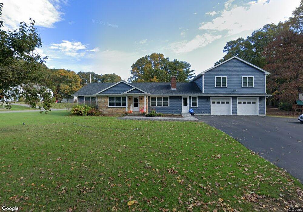
24 Monroe St Douglas, MA 01516
Estimated Value: $445,000 - $668,000
3
Beds
2
Baths
1,516
Sq Ft
$380/Sq Ft
Est. Value
About This Home
This home is located at 24 Monroe St, Douglas, MA 01516 and is currently estimated at $576,045, approximately $379 per square foot. 24 Monroe St is a home located in Worcester County with nearby schools including Douglas Primary School, Douglas Middle School, and Douglas High School.
Ownership History
Date
Name
Owned For
Owner Type
Purchase Details
Closed on
Jan 14, 2020
Sold by
Brennick Meggie R and Doyon Robert J
Bought by
Brennick Meggie R and Brennick Thomas M
Current Estimated Value
Purchase Details
Closed on
Jun 23, 2016
Sold by
Elizabeth Hawes Velma
Bought by
Doyon Robert J and Doyon Bonnye J
Home Financials for this Owner
Home Financials are based on the most recent Mortgage that was taken out on this home.
Original Mortgage
$201,286
Interest Rate
3.57%
Mortgage Type
FHA
Create a Home Valuation Report for This Property
The Home Valuation Report is an in-depth analysis detailing your home's value as well as a comparison with similar homes in the area
Home Values in the Area
Average Home Value in this Area
Purchase History
| Date | Buyer | Sale Price | Title Company |
|---|---|---|---|
| Brennick Meggie R | -- | None Available | |
| Doyon Robert J | $205,000 | -- |
Source: Public Records
Mortgage History
| Date | Status | Borrower | Loan Amount |
|---|---|---|---|
| Previous Owner | Doyon Robert J | $201,286 |
Source: Public Records
Tax History Compared to Growth
Tax History
| Year | Tax Paid | Tax Assessment Tax Assessment Total Assessment is a certain percentage of the fair market value that is determined by local assessors to be the total taxable value of land and additions on the property. | Land | Improvement |
|---|---|---|---|---|
| 2025 | $81 | $614,100 | $88,500 | $525,600 |
| 2024 | $5,365 | $396,800 | $80,500 | $316,300 |
| 2023 | $5,211 | $362,900 | $80,500 | $282,400 |
| 2022 | $5,054 | $309,300 | $74,400 | $234,900 |
| 2021 | $4,931 | $294,900 | $70,800 | $224,100 |
| 2020 | $4,792 | $282,200 | $70,800 | $211,400 |
| 2019 | $4,475 | $255,700 | $70,800 | $184,900 |
| 2018 | $3,977 | $247,500 | $70,800 | $176,700 |
| 2017 | $3,780 | $226,100 | $73,800 | $152,300 |
| 2016 | $3,680 | $218,800 | $73,800 | $145,000 |
| 2015 | $3,601 | $218,800 | $73,800 | $145,000 |
Source: Public Records
Map
Nearby Homes
- 28 Monroe St
- 35 Redding Landing
- 20 Monroe St
- 21 Monroe St
- 25 Monroe St
- 24 Redding Landing
- 79 Redding Landing
- 30 Monroe St
- 19 Monroe St
- 68 Redding Landing
- 29 Monroe St
- 32 Monroe St
- 32 Monroe St
- 11 Redding Landing Unit 13
- 17 Monroe St
- 26 Joseph Rd Unit Lot 15
- 18 Monroe St
- 10 Redding Landing Unit 12
- 34 Monroe St
- 24 Joseph Rd Unit Lot 14