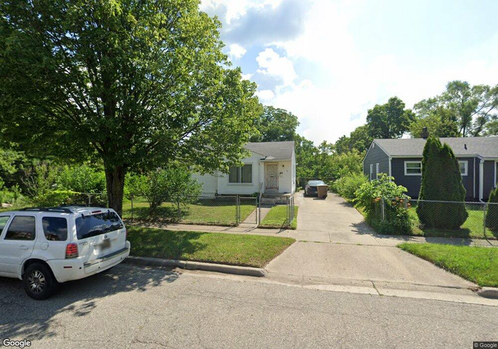
24 N Astor St Pontiac, MI 48342
Estimated Value: $108,995 - $165,000
3
Beds
1
Bath
884
Sq Ft
$145/Sq Ft
Est. Value
About This Home
This home is located at 24 N Astor St, Pontiac, MI 48342 and is currently estimated at $127,999, approximately $144 per square foot. 24 N Astor St is a home located in Oakland County with nearby schools including Herrington Elementary School, Pontiac Middle School, and Pontiac High School.
Ownership History
Date
Name
Owned For
Owner Type
Purchase Details
Closed on
Feb 1, 2008
Sold by
Hall Gilbretta
Bought by
Hall Gilbretta and Hall Gilbert
Current Estimated Value
Purchase Details
Closed on
Jun 29, 2006
Sold by
Ford Corene
Bought by
Hall Gilbretta
Home Financials for this Owner
Home Financials are based on the most recent Mortgage that was taken out on this home.
Original Mortgage
$16,500
Outstanding Balance
$9,833
Interest Rate
6.72%
Mortgage Type
Stand Alone Second
Estimated Equity
$118,166
Purchase Details
Closed on
Jul 1, 2003
Sold by
Steverson Amy E
Bought by
The Provident Bank
Create a Home Valuation Report for This Property
The Home Valuation Report is an in-depth analysis detailing your home's value as well as a comparison with similar homes in the area
Home Values in the Area
Average Home Value in this Area
Purchase History
| Date | Buyer | Sale Price | Title Company |
|---|---|---|---|
| Hall Gilbretta | -- | Clearly Title | |
| Hall Gilbretta | $82,500 | Metropolitan Title Company | |
| The Provident Bank | $43,900 | -- |
Source: Public Records
Mortgage History
| Date | Status | Borrower | Loan Amount |
|---|---|---|---|
| Open | Hall Gilbretta | $16,500 |
Source: Public Records
Tax History Compared to Growth
Tax History
| Year | Tax Paid | Tax Assessment Tax Assessment Total Assessment is a certain percentage of the fair market value that is determined by local assessors to be the total taxable value of land and additions on the property. | Land | Improvement |
|---|---|---|---|---|
| 2024 | $553 | $30,900 | $0 | $0 |
| 2023 | $527 | $26,580 | $0 | $0 |
| 2022 | $575 | $22,970 | $0 | $0 |
| 2021 | $559 | $21,610 | $0 | $0 |
| 2020 | $479 | $19,620 | $0 | $0 |
| 2019 | $535 | $17,430 | $0 | $0 |
| 2018 | $506 | $15,610 | $0 | $0 |
| 2017 | $483 | $15,120 | $0 | $0 |
| 2016 | $511 | $14,780 | $0 | $0 |
| 2015 | -- | $13,670 | $0 | $0 |
| 2014 | -- | $11,940 | $0 | $0 |
| 2011 | -- | $16,670 | $0 | $0 |
Source: Public Records
Map
Nearby Homes
- 717 E Pike St
- 53 N Midland Dr
- 88 N Astor St
- 28 S Marshall St
- 46 N Anderson Ave
- 291 Michigan Ave
- 511 E Pike St
- 505 Auburn Ave
- 33 S Tasmania St
- 176 S Francis Ave
- 18 S Shirley St
- 70 N Roselawn St
- 53 N Roselawn St
- 55 N Roselawn St
- 57 N Roselawn St
- 97 N Roselawn St
- 0 Cesar Chavez Rd Unit 50166552
- 59 Bellevue St
- 54 Bellevue St
- 472 University Dr