Estimated Value: $405,972 - $478,000
3
Beds
3
Baths
1,697
Sq Ft
$259/Sq Ft
Est. Value
About This Home
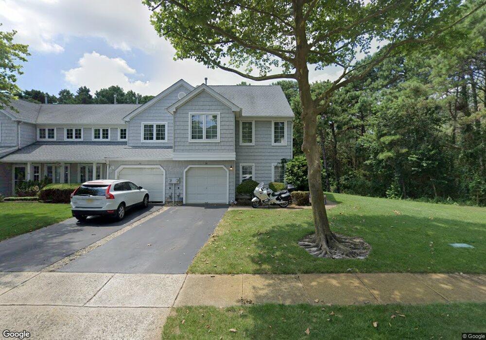
This home is located at 24 N Pier Unit 6, Brick, NJ 08723 and is currently estimated at $438,991, approximately $258 per square foot. 24 N Pier Unit 6 is a home located in Ocean County with nearby schools including Emma Havens Young Elementary School, Lake Riviera Middle School, and Brick Township High School.
Ownership History
Date
Name
Owned For
Owner Type
Purchase Details
Closed on
Jul 12, 2021
Sold by
Testa Mary E
Bought by
Mcentyre Wendy and Mcentyre Timothy
Current Estimated Value
Home Financials for this Owner
Home Financials are based on the most recent Mortgage that was taken out on this home.
Original Mortgage
$166,000
Outstanding Balance
$150,757
Interest Rate
2.96%
Mortgage Type
New Conventional
Estimated Equity
$288,234
Purchase Details
Closed on
Nov 10, 1997
Sold by
Sgs Communities At Grande Quay Llc
Bought by
Testa Mary E and Testa Steven S
Home Financials for this Owner
Home Financials are based on the most recent Mortgage that was taken out on this home.
Original Mortgage
$95,800
Interest Rate
6.5%
Create a Home Valuation Report for This Property
The Home Valuation Report is an in-depth analysis detailing your home's value as well as a comparison with similar homes in the area
Home Values in the Area
Average Home Value in this Area
Purchase History
| Date | Buyer | Sale Price | Title Company |
|---|---|---|---|
| Mcentyre Wendy | $175,000 | None Available | |
| Mcentyre Wendy | $175,000 | None Listed On Document | |
| Testa Mary E | $136,985 | -- |
Source: Public Records
Mortgage History
| Date | Status | Borrower | Loan Amount |
|---|---|---|---|
| Open | Mcentyre Wendy | $166,000 | |
| Closed | Mcentyre Wendy | $166,000 | |
| Previous Owner | Testa Mary E | $95,800 |
Source: Public Records
Tax History Compared to Growth
Tax History
| Year | Tax Paid | Tax Assessment Tax Assessment Total Assessment is a certain percentage of the fair market value that is determined by local assessors to be the total taxable value of land and additions on the property. | Land | Improvement |
|---|---|---|---|---|
| 2025 | $5,817 | $225,200 | $105,000 | $120,200 |
| 2024 | $5,529 | $225,200 | $105,000 | $120,200 |
| 2023 | $5,457 | $225,200 | $105,000 | $120,200 |
| 2022 | $5,457 | $225,200 | $105,000 | $120,200 |
| 2021 | $5,342 | $225,200 | $105,000 | $120,200 |
| 2020 | $5,274 | $225,200 | $105,000 | $120,200 |
| 2019 | $5,186 | $225,200 | $105,000 | $120,200 |
| 2018 | $5,067 | $225,200 | $105,000 | $120,200 |
| 2017 | $4,930 | $225,200 | $105,000 | $120,200 |
| 2016 | $4,905 | $225,200 | $105,000 | $120,200 |
| 2015 | $4,777 | $225,200 | $105,000 | $120,200 |
| 2014 | $4,738 | $225,200 | $105,000 | $120,200 |
Source: Public Records
Map
Nearby Homes
- 29 S Sailors Quay Dr Unit 5
- 3 Victory Ln
- 74 Gloria Ann Smith Dr
- 88 Havens Dr
- 212 Drake Rd
- 165 Port Rd
- 9 Gloria Ann Smith Dr
- 181 Mast Rd
- 404 Carlisa Dr
- 222 Antoinette Ct
- 132 Seaview Ave
- 230 Drum Point Rd
- 45 Manhattan Dr Unit 87
- 0 E St Unit NJOC2037620
- 266 Lake Shore Dr
- 300 Bellanca Rd
- 1 Whitecap Way
- 105 Port Rd
- 99 Seagoin Rd
- 1 Reef Place
- 26 N Pier Unit 5
- 26 N Pier Unit 1802
- 28 N Pier Unit 4
- 28 N Pier Unit 1803
- 28 N Pierstreet_suffix
- 30 N Pier Unit 3
- 32 N Pier Unit 2
- 34 N Pier Unit 1
- 5 N Pier
- 5 N Pier Unit 1703
- 3 N Pier
- 9 N Pier Unit 5
- 7 N Pier Unit 4
- 1 N Pier Unit 1
- 11 N Pier Unit 6
- 13 N Pier Unit 1
- 13 N Pier Unit Pier
- 15 N Pier Unit 2
- 17 N Pier
- 19 N Pier Unit 4