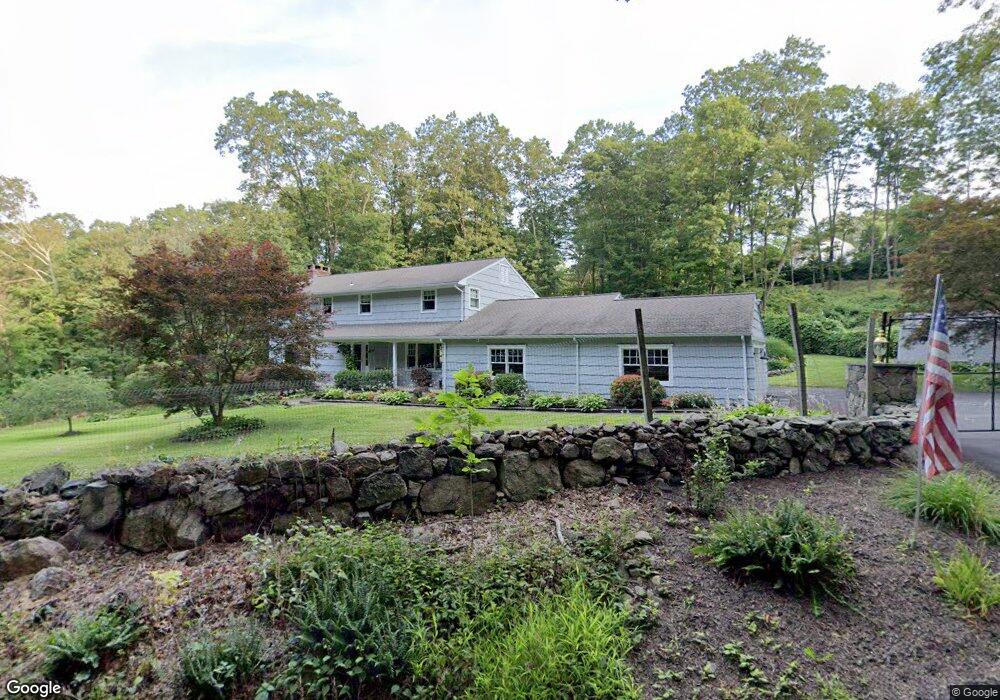
24 Old Barlow Mountain Rd Ridgefield, CT 06877
Estimated Value: $916,000 - $1,038,000
4
Beds
3
Baths
3,154
Sq Ft
$317/Sq Ft
Est. Value
About This Home
This home is located at 24 Old Barlow Mountain Rd, Ridgefield, CT 06877 and is currently estimated at $999,125, approximately $316 per square foot. 24 Old Barlow Mountain Rd is a home located in Fairfield County with nearby schools including Barlow Mountain Elementary School, Scotts Ridge Middle School, and Ridgefield High School.
Ownership History
Date
Name
Owned For
Owner Type
Purchase Details
Closed on
May 23, 2013
Sold by
Trusheim Pamela C
Bought by
Union Savings Bank
Current Estimated Value
Create a Home Valuation Report for This Property
The Home Valuation Report is an in-depth analysis detailing your home's value as well as a comparison with similar homes in the area
Home Values in the Area
Average Home Value in this Area
Purchase History
| Date | Buyer | Sale Price | Title Company |
|---|---|---|---|
| Union Savings Bank | -- | -- |
Source: Public Records
Mortgage History
| Date | Status | Borrower | Loan Amount |
|---|---|---|---|
| Previous Owner | Union Savings Bank | $850,000 | |
| Previous Owner | Union Savings Bank | $336,000 | |
| Previous Owner | Union Savings Bank | $329,600 |
Source: Public Records
Tax History Compared to Growth
Tax History
| Year | Tax Paid | Tax Assessment Tax Assessment Total Assessment is a certain percentage of the fair market value that is determined by local assessors to be the total taxable value of land and additions on the property. | Land | Improvement |
|---|---|---|---|---|
| 2025 | $12,372 | $451,710 | $189,000 | $262,710 |
| 2024 | $11,903 | $451,710 | $189,000 | $262,710 |
| 2023 | $11,659 | $451,710 | $189,000 | $262,710 |
| 2022 | $11,109 | $390,760 | $144,900 | $245,860 |
| 2021 | $11,023 | $390,760 | $144,900 | $245,860 |
| 2020 | $10,988 | $390,760 | $144,900 | $245,860 |
| 2019 | $10,988 | $390,760 | $144,900 | $245,860 |
| 2018 | $10,855 | $390,760 | $144,900 | $245,860 |
| 2017 | $10,684 | $392,650 | $155,230 | $237,420 |
| 2016 | $10,480 | $392,650 | $155,230 | $237,420 |
| 2015 | $10,213 | $392,650 | $155,230 | $237,420 |
| 2014 | $10,213 | $392,650 | $155,230 | $237,420 |
Source: Public Records
Map
Nearby Homes
- 83 Aspen Ledges Rd
- 34 Highview Dr
- 381 Bennetts Farm Rd
- 8 Rustic Rd
- 463 N Salem Rd
- 23 Pond Rd
- 76 Sugarloaf Mountain Rd
- 358 N Salem Rd
- 7 Craigmoor Rd S
- 109 Mountain Rd
- 261 North St
- 213 Mamanasco Rd
- 10 Hillcrest Ct
- 31 Ridgecrest Dr
- 803 N Salem Rd
- 88 Green Ln
- 68 Mopus Bridge Rd
- 0 Ives Ct
- 151 North St
- 415 Barrack Hill Rd
- 34 Pierrepont Dr
- 16 Old Barlow Mountain Rd
- 42 Pierrepont Dr
- 32 Old Barlow Mountain Rd
- 50 Pierrepont Dr
- 41 Pierrepont Dr
- 4 Old Barlow Mountain Rd
- 47 Pierrepont Dr
- 222 Barlow Mountain Rd
- 224 Barlow Mountain Rd
- 18 Pierrepont Dr
- 55 Pierrepont Dr
- 8 Clayton Place
- 210 Barlow Mountain Rd
- 226 Barlow Mountain Rd
- 25 Pierrepont Dr
- 215 Barlow Mountain Rd
- 1 Seth Low Mountain Rd
- 17 Clayton Place
- 21 Pierrepont Dr