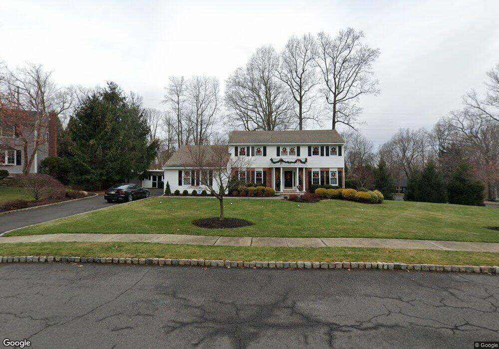
24 Old Cannon Rd Berkeley Heights, NJ 07922
Estimated Value: $1,042,000 - $1,300,000
--
Bed
--
Bath
2,696
Sq Ft
$438/Sq Ft
Est. Value
About This Home
This home is located at 24 Old Cannon Rd, Berkeley Heights, NJ 07922 and is currently estimated at $1,180,094, approximately $437 per square foot. 24 Old Cannon Rd is a home located in Union County with nearby schools including Columbia Middle School, Governor Livingston High School, and The Academy of Our Lady of Peace.
Ownership History
Date
Name
Owned For
Owner Type
Purchase Details
Closed on
Jun 2, 2003
Sold by
Macpherson Donald
Bought by
Mcnamara John and Mcnamara Annette
Current Estimated Value
Home Financials for this Owner
Home Financials are based on the most recent Mortgage that was taken out on this home.
Original Mortgage
$322,700
Outstanding Balance
$140,640
Interest Rate
5.71%
Estimated Equity
$1,039,454
Purchase Details
Closed on
Nov 15, 1993
Sold by
Goldberg Marshall
Bought by
Macpherson Donald P
Home Financials for this Owner
Home Financials are based on the most recent Mortgage that was taken out on this home.
Original Mortgage
$344,000
Interest Rate
6.79%
Create a Home Valuation Report for This Property
The Home Valuation Report is an in-depth analysis detailing your home's value as well as a comparison with similar homes in the area
Home Values in the Area
Average Home Value in this Area
Purchase History
| Date | Buyer | Sale Price | Title Company |
|---|---|---|---|
| Mcnamara John | $769,000 | -- | |
| Macpherson Donald P | $430,000 | -- |
Source: Public Records
Mortgage History
| Date | Status | Borrower | Loan Amount |
|---|---|---|---|
| Open | Mcnamara John | $322,700 | |
| Previous Owner | Macpherson Donald P | $344,000 |
Source: Public Records
Tax History Compared to Growth
Tax History
| Year | Tax Paid | Tax Assessment Tax Assessment Total Assessment is a certain percentage of the fair market value that is determined by local assessors to be the total taxable value of land and additions on the property. | Land | Improvement |
|---|---|---|---|---|
| 2025 | $16,535 | $385,700 | $172,300 | $213,400 |
| 2024 | $16,296 | $385,700 | $172,300 | $213,400 |
| 2023 | $16,296 | $385,700 | $172,300 | $213,400 |
| 2022 | $16,196 | $385,700 | $172,300 | $213,400 |
| 2021 | $16,107 | $385,700 | $172,300 | $213,400 |
| 2020 | $16,192 | $385,700 | $172,300 | $213,400 |
| 2019 | $16,111 | $385,700 | $172,300 | $213,400 |
| 2018 | $15,775 | $385,700 | $172,300 | $213,400 |
| 2017 | $15,582 | $385,700 | $172,300 | $213,400 |
| 2016 | $15,308 | $385,700 | $172,300 | $213,400 |
| 2015 | $15,224 | $385,700 | $172,300 | $213,400 |
| 2014 | $14,826 | $385,700 | $172,300 | $213,400 |
Source: Public Records
Map
Nearby Homes
- 25 Oechsner Ct
- 536 Snyder Ave
- 78 Spring Ridge Dr
- 96 Exeter Dr
- 28 Peacock Ln Unit 28
- 220 Horseshoe Rd
- 189 Lawrence Dr
- 90 Greenbriar Dr
- 675 Plainfield Ave
- 566 Plainfield Ave
- 00 Diamond Hill Rd
- 633 Plainfield Ave
- 27 Angela Way Unit 727
- 24 Berkeley Square
- 581 Phillip Ln
- 235 Plainfield Ave
- 62 Springholm Dr Unit 62
- 5 Castle Dr Unit 5
- 52 Columbia Ave
- 145 Colchester Rd
- 14 Old Cannon Rd
- 16 Coachman Ct
- 15 Old Cannon Rd
- 25 Old Cannon Rd
- 5 Coachman Ct
- 20 Coachman Ct
- 35 Old Cannon Rd
- 15 Coachman Ct
- 337 Mountain Ave
- 6 Old Cannon Rd
- 7 Old Cannon Rd
- 45 Old Cannon Rd
- 305 Mountain Ave
- 343 Mountain Ave
- 60 Old Cannon Rd
- 55 Old Cannon Rd
- 291 Mountain Ave
- 349 Mountain Ave
- 300 Mountain Ave
- 65 Old Cannon Rd