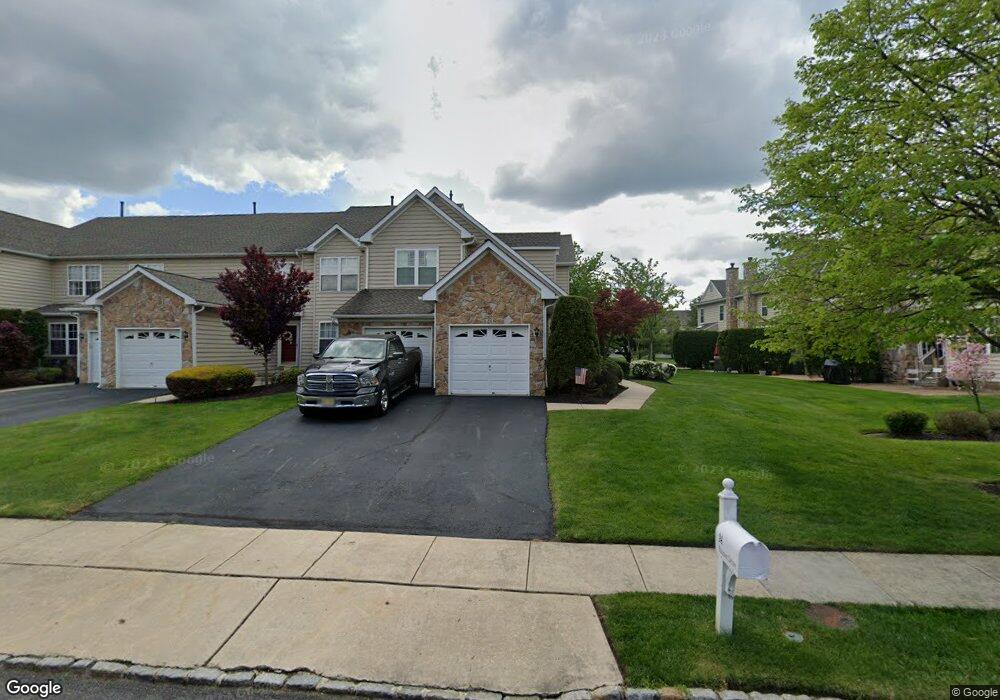
24 Palmer Dr Unit 102 Moorestown, NJ 08057
Estimated Value: $567,439 - $629,000
3
Beds
3
Baths
2,041
Sq Ft
$295/Sq Ft
Est. Value
About This Home
This home is located at 24 Palmer Dr Unit 102, Moorestown, NJ 08057 and is currently estimated at $601,860, approximately $294 per square foot. 24 Palmer Dr Unit 102 is a home located in Burlington County with nearby schools including South Valley Elementary School, Moorestown Upper Elementary School, and William Allen Middle School.
Ownership History
Date
Name
Owned For
Owner Type
Purchase Details
Closed on
Feb 9, 2010
Sold by
Roman J Joseph
Bought by
Mcbride Kevin M
Current Estimated Value
Purchase Details
Closed on
Oct 4, 2006
Sold by
Hidden Springs Llc
Bought by
Roman J Joseph
Purchase Details
Closed on
Jul 13, 2004
Sold by
Dorkin Judith
Bought by
Hidden Springs Llc
Purchase Details
Closed on
Oct 31, 2001
Sold by
Gerrish Charles and Gerrish Diane
Bought by
Dorkin Judith
Home Financials for this Owner
Home Financials are based on the most recent Mortgage that was taken out on this home.
Original Mortgage
$232,000
Interest Rate
6.77%
Mortgage Type
Stand Alone First
Purchase Details
Closed on
Jul 26, 1999
Sold by
Laurel Creek Lp
Bought by
Gerrish Charles and Gerrish Diane
Home Financials for this Owner
Home Financials are based on the most recent Mortgage that was taken out on this home.
Original Mortgage
$254,900
Interest Rate
6%
Create a Home Valuation Report for This Property
The Home Valuation Report is an in-depth analysis detailing your home's value as well as a comparison with similar homes in the area
Home Values in the Area
Average Home Value in this Area
Purchase History
| Date | Buyer | Sale Price | Title Company |
|---|---|---|---|
| Mcbride Kevin M | $388,000 | None Available | |
| Roman J Joseph | -- | None Available | |
| Hidden Springs Llc | $390,000 | Commonwealth Land Title Insu | |
| Dorkin Judith | $290,000 | Weichert Title Agency | |
| Gerrish Charles | $255,365 | -- |
Source: Public Records
Mortgage History
| Date | Status | Borrower | Loan Amount |
|---|---|---|---|
| Previous Owner | Dorkin Judith | $232,000 | |
| Previous Owner | Gerrish Charles | $254,900 |
Source: Public Records
Tax History Compared to Growth
Tax History
| Year | Tax Paid | Tax Assessment Tax Assessment Total Assessment is a certain percentage of the fair market value that is determined by local assessors to be the total taxable value of land and additions on the property. | Land | Improvement |
|---|---|---|---|---|
| 2025 | $8,988 | $316,800 | $90,000 | $226,800 |
| 2024 | $8,715 | $316,800 | $90,000 | $226,800 |
| 2023 | $8,715 | $316,800 | $90,000 | $226,800 |
| 2022 | $8,626 | $316,800 | $90,000 | $226,800 |
| 2021 | $8,512 | $316,800 | $90,000 | $226,800 |
| 2020 | $8,459 | $316,800 | $90,000 | $226,800 |
| 2019 | $8,310 | $316,800 | $90,000 | $226,800 |
| 2018 | $8,085 | $316,800 | $90,000 | $226,800 |
| 2017 | $8,154 | $316,800 | $90,000 | $226,800 |
| 2016 | $8,126 | $316,800 | $90,000 | $226,800 |
| 2015 | $8,028 | $316,800 | $90,000 | $226,800 |
| 2014 | $7,622 | $316,800 | $90,000 | $226,800 |
Source: Public Records
Map
Nearby Homes
- 40 Palmer Dr Unit 110
- 158 Sarazen Dr
- 39 Bramley Rd
- 127 Oakmont Dr
- 97 Brooks Rd
- 14 Baltusrol Terrace
- 5 Murray Rd
- 482 Monte Farm Rd
- 69 Sister's Farmstead Rd
- 901 Mcelwee Rd
- 57 Brooks Rd
- 22 Cardinal Way
- 950 Bortons Landing Rd
- 107 Hartford Rd
- 7503A Normandy Dr Unit 7503
- 3604B Chadbury Rd
- 12 Cove Rd
- 20 Starboard Way
- 163 Memorial Ln
- 8006 Normandy Dr Unit 8006
- 22 Palmer Dr
- 20 Palmer Dr Unit 20
- 28 Palmer Dr Unit 28
- 26 Palmer Dr Unit 103
- 30 Palmer Dr Unit 105
- 32 Palmer Dr Unit 106
- 34 Palmer Dr Unit 107
- 36 Palmer Dr Unit 108
- 38 Palmer Dr Unit 109
- 17 Palmer Dr Unit 82
- 16 Palmer Dr
- 19 Palmer Dr Unit 81
- 15 Palmer Dr Unit 83
- 23 Palmer Dr Unit 79
- 14 Palmer Dr Unit 97
- 13 Palmer Dr Unit 84
- 42 Palmer Dr
- 12 Palmer Dr
- 11 Palmer Dr Unit 85
- 25 Palmer Dr Unit 78