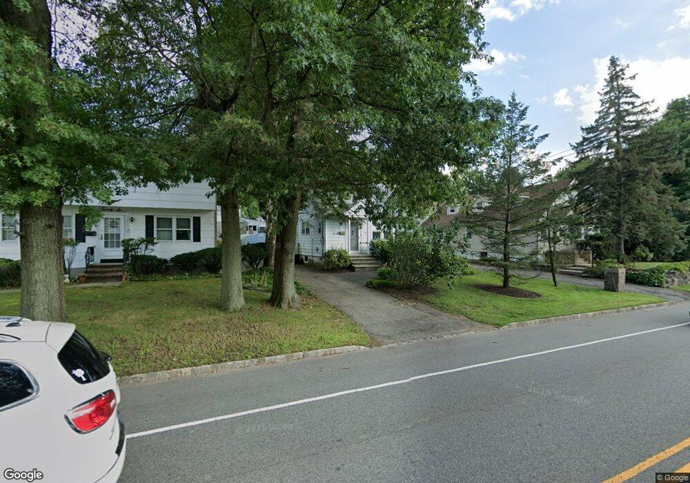
24 Passaic Ave Roseland, NJ 07068
Estimated Value: $470,217 - $551,000
--
Bed
--
Bath
924
Sq Ft
$560/Sq Ft
Est. Value
About This Home
This home is located at 24 Passaic Ave, Roseland, NJ 07068 and is currently estimated at $517,054, approximately $559 per square foot. 24 Passaic Ave is a home located in Essex County with nearby schools including Lester C. Noecker Elementary School, West Essex Middle School, and West Essex High School.
Ownership History
Date
Name
Owned For
Owner Type
Purchase Details
Closed on
Oct 30, 2000
Sold by
Burrier W Kevin
Bought by
Sharon Kathleen
Current Estimated Value
Home Financials for this Owner
Home Financials are based on the most recent Mortgage that was taken out on this home.
Original Mortgage
$122,000
Outstanding Balance
$44,730
Interest Rate
7.81%
Estimated Equity
$472,324
Purchase Details
Closed on
Mar 12, 1996
Sold by
Gray Michael
Bought by
Burrier Kevin and Burrier Janine
Home Financials for this Owner
Home Financials are based on the most recent Mortgage that was taken out on this home.
Original Mortgage
$100,000
Interest Rate
6.99%
Create a Home Valuation Report for This Property
The Home Valuation Report is an in-depth analysis detailing your home's value as well as a comparison with similar homes in the area
Home Values in the Area
Average Home Value in this Area
Purchase History
| Date | Buyer | Sale Price | Title Company |
|---|---|---|---|
| Sharon Kathleen | $152,500 | -- | |
| Burrier Kevin | $105,000 | -- |
Source: Public Records
Mortgage History
| Date | Status | Borrower | Loan Amount |
|---|---|---|---|
| Open | Sharon Kathleen | $122,000 | |
| Previous Owner | Burrier Kevin | $100,000 |
Source: Public Records
Tax History Compared to Growth
Tax History
| Year | Tax Paid | Tax Assessment Tax Assessment Total Assessment is a certain percentage of the fair market value that is determined by local assessors to be the total taxable value of land and additions on the property. | Land | Improvement |
|---|---|---|---|---|
| 2025 | $5,635 | $309,200 | $225,300 | $83,900 |
| 2024 | $5,635 | $309,200 | $225,300 | $83,900 |
| 2022 | $5,683 | $243,400 | $157,500 | $85,900 |
| 2021 | $5,606 | $243,400 | $157,500 | $85,900 |
| 2020 | $5,586 | $243,400 | $157,500 | $85,900 |
| 2019 | $5,535 | $243,400 | $157,500 | $85,900 |
| 2018 | $5,486 | $243,400 | $157,500 | $85,900 |
| 2017 | $5,484 | $243,400 | $157,500 | $85,900 |
| 2016 | $5,399 | $243,400 | $157,500 | $85,900 |
| 2015 | $5,411 | $243,400 | $157,500 | $85,900 |
| 2014 | $5,260 | $243,400 | $157,500 | $85,900 |
Source: Public Records
Map
Nearby Homes
- 26 Passaic Ave
- 38 Passaic Ave
- 20 Lenape Dr
- 518 Eagle Rock Ave
- 6 Mulford Ct Unit Address 6
- 6 Mulford Ct Unit C0013
- 88 Kent Dr Unit C0176
- 144 Passaic Ave
- 178 Passaic Ave
- 192 Eagle Rock Ave
- 30 Schweinberg Dr
- 187 Passaic Ave
- 39 Schweinberg Dr Unit 2039
- 39 Schweinberg Dr
- 281 N Livingston Ave
- 41 W Mcclellan Ave
- 11 Homestead Terrace
- 8 Riker Hill Rd
- 9 Cliffside Dr