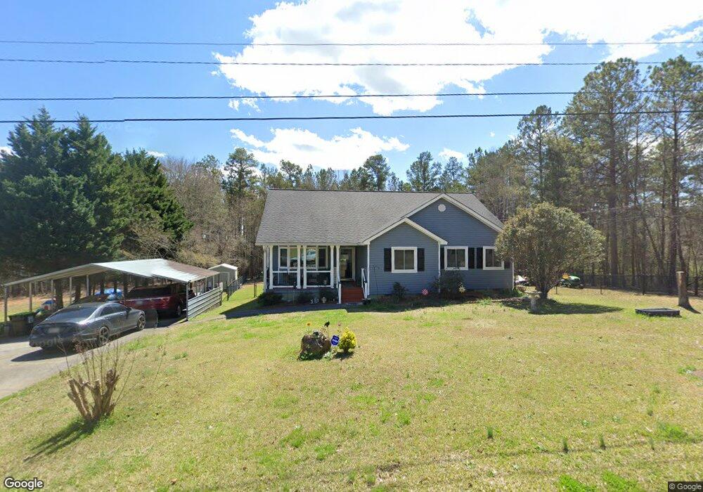
24 Paula Ct Cedartown, GA 30125
Estimated Value: $262,175 - $294,000
3
Beds
2
Baths
1,723
Sq Ft
$160/Sq Ft
Est. Value
About This Home
This home is located at 24 Paula Ct, Cedartown, GA 30125 and is currently estimated at $275,294, approximately $159 per square foot. 24 Paula Ct is a home located in Polk County.
Ownership History
Date
Name
Owned For
Owner Type
Purchase Details
Closed on
Dec 22, 2023
Sold by
Peal David E
Bought by
Peal David W
Current Estimated Value
Home Financials for this Owner
Home Financials are based on the most recent Mortgage that was taken out on this home.
Original Mortgage
$132,981
Outstanding Balance
$130,683
Interest Rate
7.29%
Mortgage Type
New Conventional
Estimated Equity
$144,611
Purchase Details
Closed on
Mar 22, 1995
Sold by
Igel Stanley Igel and Jacob Liverant
Bought by
Pearl David E and Pearl Teresa D
Purchase Details
Closed on
Oct 30, 1973
Sold by
Adams Charles W
Bought by
Igel Stanley
Create a Home Valuation Report for This Property
The Home Valuation Report is an in-depth analysis detailing your home's value as well as a comparison with similar homes in the area
Home Values in the Area
Average Home Value in this Area
Purchase History
| Date | Buyer | Sale Price | Title Company |
|---|---|---|---|
| Peal David W | $100,000 | -- | |
| Pearl David E | $1,000 | -- | |
| Igel Stanley | -- | -- |
Source: Public Records
Mortgage History
| Date | Status | Borrower | Loan Amount |
|---|---|---|---|
| Open | Peal David W | $132,981 |
Source: Public Records
Tax History Compared to Growth
Tax History
| Year | Tax Paid | Tax Assessment Tax Assessment Total Assessment is a certain percentage of the fair market value that is determined by local assessors to be the total taxable value of land and additions on the property. | Land | Improvement |
|---|---|---|---|---|
| 2024 | $2,021 | $98,707 | $16,000 | $82,707 |
| 2023 | $1,324 | $69,166 | $16,000 | $53,166 |
| 2022 | $828 | $48,292 | $3,000 | $45,292 |
| 2021 | $839 | $48,292 | $3,000 | $45,292 |
| 2020 | $841 | $48,292 | $3,000 | $45,292 |
| 2019 | $935 | $48,162 | $4,000 | $44,162 |
| 2018 | $926 | $46,930 | $4,000 | $42,930 |
| 2017 | $910 | $46,930 | $4,000 | $42,930 |
| 2016 | $862 | $45,157 | $4,000 | $41,157 |
| 2015 | $854 | $44,848 | $4,000 | $40,848 |
| 2014 | $1,167 | $44,440 | $4,120 | $40,320 |
Source: Public Records
Map
Nearby Homes
- 424 Michael Blvd
- 100 Lee Ave
- 0 Cave Spring Rd Unit 10631588
- 0 Cave Spring Rd Unit 7671027
- 600 Miller Rd
- 1200 N Cave Spring St
- 727 Cherokee Rd
- 39 Summerwind Dr
- 217 Cherokee Cir
- 208 Silverthorn Way
- LOT 21 Cherokee Cir
- 828 N College Dr
- 88 Sequoyah Ct
- 621 N College Dr
- 113 Cherokee Estates Dr
- 00 Oak Crest Dr
- 521 W John Hand Rd
- 232 Stephens Rd
- 112 College Cir
- 0 Collins Rd Unit 10627302
- 40 Paula Ct
- 591 Michael Blvd
- 21 Paula Ct
- 41 Paula Ct
- 23 Paula Ct
- 623 Michael Blvd
- 519 Michael Blvd
- 612 Michael Blvd
- 480 Michael Blvd
- 620 Michael Blvd
- 491 Michael Blvd
- 403 Michael Blvd
- 401 Michael Blvd
- 522 Michael Blvd
- 421 Michael Blvd
- 223 Valley Grove Rd
- 476 Michael Blvd
- 391 Michael Blvd
- 36 Jenni Ln
- 0 Michael Blvd