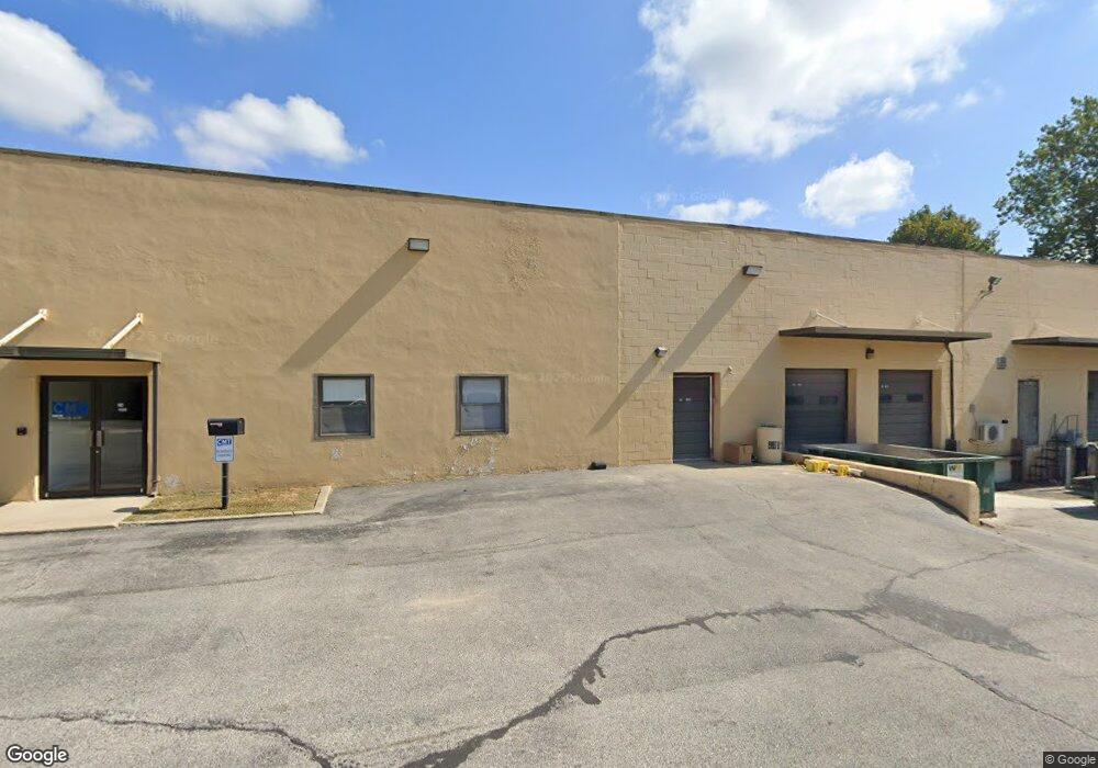
24 Portland Rd Conshohocken, PA 19428
Estimated Value: $5,582,737
--
Bed
--
Bath
58,480
Sq Ft
$95/Sq Ft
Est. Value
About This Home
This home is located at 24 Portland Rd, Conshohocken, PA 19428 and is currently estimated at $5,582,737, approximately $95 per square foot. 24 Portland Rd is a home located in Montgomery County with nearby schools including Bridgeport Elementary School, Upper Merion Middle School, and Upper Merion High School.
Ownership History
Date
Name
Owned For
Owner Type
Purchase Details
Closed on
Dec 26, 2013
Sold by
National Industrial Builders Inc
Bought by
Pen Del Portland Road Associates Llc
Current Estimated Value
Home Financials for this Owner
Home Financials are based on the most recent Mortgage that was taken out on this home.
Original Mortgage
$2,418,400
Outstanding Balance
$1,826,461
Interest Rate
4.4%
Mortgage Type
Future Advance Clause Open End Mortgage
Estimated Equity
$3,756,276
Create a Home Valuation Report for This Property
The Home Valuation Report is an in-depth analysis detailing your home's value as well as a comparison with similar homes in the area
Home Values in the Area
Average Home Value in this Area
Purchase History
| Date | Buyer | Sale Price | Title Company |
|---|---|---|---|
| Pen Del Portland Road Associates Llc | $3,023,000 | None Available |
Source: Public Records
Mortgage History
| Date | Status | Borrower | Loan Amount |
|---|---|---|---|
| Open | Pen Del Portland Road Associates Llc | $2,418,400 |
Source: Public Records
Tax History Compared to Growth
Tax History
| Year | Tax Paid | Tax Assessment Tax Assessment Total Assessment is a certain percentage of the fair market value that is determined by local assessors to be the total taxable value of land and additions on the property. | Land | Improvement |
|---|---|---|---|---|
| 2025 | $43,955 | $1,550,000 | $120,289 | $1,429,711 |
| 2024 | $43,955 | $1,550,000 | $120,289 | $1,429,711 |
| 2023 | $42,264 | $1,550,000 | $120,289 | $1,429,711 |
| 2022 | $40,692 | $1,550,000 | $120,289 | $1,429,711 |
| 2021 | $40,241 | $1,550,000 | $120,289 | $1,429,711 |
| 2020 | $39,322 | $1,550,000 | $120,289 | $1,429,711 |
| 2019 | $38,624 | $1,550,000 | $120,289 | $1,429,711 |
| 2018 | $38,450 | $1,550,000 | $120,289 | $1,429,711 |
| 2017 | $37,721 | $1,550,000 | $120,289 | $1,429,711 |
| 2016 | $37,116 | $1,550,000 | $120,289 | $1,429,711 |
| 2015 | $35,711 | $1,550,000 | $120,289 | $1,429,711 |
| 2014 | $35,711 | $1,550,000 | $120,289 | $1,429,711 |
Source: Public Records
Map
Nearby Homes
- 628 Ford St
- 627 Ford St
- 211 Josephine Ave
- 607 Apple St
- 258 Tennessee Ave
- 537 Apple St Unit 302
- 139 Moir Ave
- 218 Bullock St
- 1196 Rebel Hill Rd
- 116 Cedar Ave
- 107 Cedar Ave
- 223 Rebel Hill Rd
- 272 Militia Dr Unit 11A
- 17 Merion Ave
- 463 New Elm St
- 453 Old Elm St
- 235 Valley Forge Lookout Place
- 300 W Elm St Unit 2412
- 1408 Rene Rd
- 117 Colwell Ln
- 10 Balligomingo Rd
- 1091 Jones Rd
- 415 Balligomingo Rd
- 370 Balligomingo Rd
- 11 Union Hill Rd
- 15 Union Hill Rd
- 8 Union Hill Rd
- 7 Union Hill Rd
- 3 Union Hill Rd
- 350 Balligomingo Rd
- 300 Overlook Ln
- 18 Balligomingo Rd
- 302 Overlook Ln
- 22 Balligomingo Rd
- 304 Overlook Ln
- 1000 New Dehaven St
- 306 Overlook Ln
- 26 Balligomingo Rd
- 317 Church St
- 301 Overlook Ln
