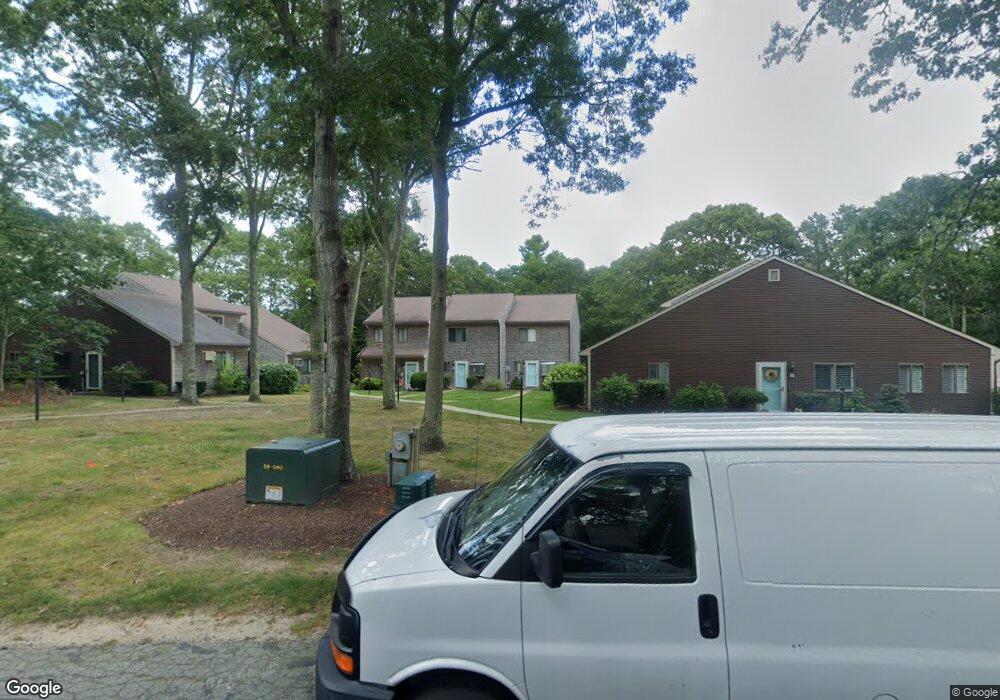
24 Roundhouse Rd Bourne, MA 02532
Estimated Value: $380,024 - $416,000
2
Beds
2
Baths
1,134
Sq Ft
$353/Sq Ft
Est. Value
About This Home
This home is located at 24 Roundhouse Rd, Bourne, MA 02532 and is currently estimated at $400,506, approximately $353 per square foot. 24 Roundhouse Rd is a home located in Barnstable County with nearby schools including Bourne High School, Cadence Academy Preschool - Bourne, and St Margaret Regional School.
Ownership History
Date
Name
Owned For
Owner Type
Purchase Details
Closed on
Mar 21, 2016
Sold by
Egan Paul A and Egan Sandra L
Bought by
Egan Paul A
Current Estimated Value
Purchase Details
Closed on
Jul 18, 1997
Sold by
Bourne Richard W and Bourne Virginia S
Bought by
Egan Paul A and Egan Sandra L
Home Financials for this Owner
Home Financials are based on the most recent Mortgage that was taken out on this home.
Original Mortgage
$67,027
Interest Rate
7.79%
Mortgage Type
Purchase Money Mortgage
Create a Home Valuation Report for This Property
The Home Valuation Report is an in-depth analysis detailing your home's value as well as a comparison with similar homes in the area
Home Values in the Area
Average Home Value in this Area
Purchase History
| Date | Buyer | Sale Price | Title Company |
|---|---|---|---|
| Egan Paul A | -- | -- | |
| Egan Paul A | $85,750 | -- |
Source: Public Records
Mortgage History
| Date | Status | Borrower | Loan Amount |
|---|---|---|---|
| Previous Owner | Egan Paul A | $112,000 | |
| Previous Owner | Egan Paul A | $99,600 | |
| Previous Owner | Egan Paul A | $67,027 |
Source: Public Records
Tax History Compared to Growth
Tax History
| Year | Tax Paid | Tax Assessment Tax Assessment Total Assessment is a certain percentage of the fair market value that is determined by local assessors to be the total taxable value of land and additions on the property. | Land | Improvement |
|---|---|---|---|---|
| 2025 | $2,494 | $319,300 | $0 | $319,300 |
| 2024 | $2,372 | $295,700 | $0 | $295,700 |
| 2023 | $2,330 | $264,500 | $0 | $264,500 |
| 2022 | $2,281 | $226,100 | $0 | $226,100 |
| 2021 | $2,254 | $209,300 | $0 | $209,300 |
| 2020 | $2,217 | $206,400 | $0 | $206,400 |
| 2019 | $1,995 | $189,800 | $0 | $189,800 |
| 2018 | $1,793 | $170,100 | $0 | $170,100 |
| 2017 | $1,721 | $167,100 | $0 | $167,100 |
| 2016 | $1,476 | $145,300 | $0 | $145,300 |
| 2015 | $1,463 | $145,300 | $0 | $145,300 |
Source: Public Records
Map
Nearby Homes
- 45 Round House Rd
- 45 Roundhouse Rd
- 84 Roundhouse Rd
- 16 Amberwood Ct
- 112 Clay Pond Rd
- 159 Clay Pond Rd
- 159 Clay Pond Rd
- 34 Turnberry Rd
- 232 County Rd
- 12 Laura Ln
- 22 Pinehurst Dr
- 12 Turnberry Rd Unit 12
- 203 County Rd
- 48 Tara Terrace
- 4 Hollyhock Knoll Ct Unit 4
- 4 Hollyhock Knoll Ct Unit 4
- 26 Carnoustie Rd
- 1 Hollyhock Knoll Ct Unit 1
- 9 Sea Knoll Ct
- 5 Sea Knoll Ct
- 26 Round House Rd
- 25 Round House Rd
- 24 Round House Rd
- 25 Roundhouse Rd
- 26 Roundhouse Rd
- 25 Roundhouse Rd Unit 25
- 23 Round House Rd
- 22 Round House Rd
- 21 Round House Rd
- 22 Roundhouse Rd
- 21 Roundhouse Rd
- 23 Roundhouse Rd
- 29 Round House Rd
- 28 Round House Rd
- 27 Round House Rd
- 27 Roundhouse Rd Unit 27
- 27 Roundhouse Rd Unit 1-B
- 27 Roundhouse Rd
- 28 Roundhouse Rd
- 7 Lancaster Ln