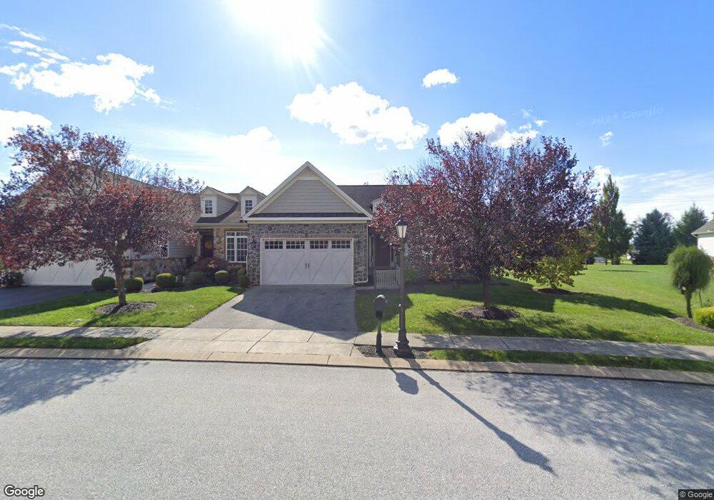
24 St Michaels Way Unit 32 Hanover, PA 17331
Estimated Value: $363,200 - $398,000
2
Beds
2
Baths
1,822
Sq Ft
$206/Sq Ft
Est. Value
About This Home
This home is located at 24 St Michaels Way Unit 32, Hanover, PA 17331 and is currently estimated at $375,550, approximately $206 per square foot. 24 St Michaels Way Unit 32 is a home located in Adams County with nearby schools including New Oxford Senior High School, St. Teresa of Calcutta Catholic School - McSherrystown Campus, and St. Teresa of Calcutta Catholic School - Conewago Campus.
Ownership History
Date
Name
Owned For
Owner Type
Purchase Details
Closed on
Apr 20, 2010
Sold by
Harvest Investment Group Llc
Bought by
Maitland Gary R and Maitland Joyce R
Current Estimated Value
Home Financials for this Owner
Home Financials are based on the most recent Mortgage that was taken out on this home.
Original Mortgage
$150,000
Outstanding Balance
$101,037
Interest Rate
5.23%
Mortgage Type
New Conventional
Estimated Equity
$274,513
Create a Home Valuation Report for This Property
The Home Valuation Report is an in-depth analysis detailing your home's value as well as a comparison with similar homes in the area
Home Values in the Area
Average Home Value in this Area
Purchase History
| Date | Buyer | Sale Price | Title Company |
|---|---|---|---|
| Maitland Gary R | $234,753 | -- |
Source: Public Records
Mortgage History
| Date | Status | Borrower | Loan Amount |
|---|---|---|---|
| Open | Maitland Gary R | $150,000 |
Source: Public Records
Tax History Compared to Growth
Tax History
| Year | Tax Paid | Tax Assessment Tax Assessment Total Assessment is a certain percentage of the fair market value that is determined by local assessors to be the total taxable value of land and additions on the property. | Land | Improvement |
|---|---|---|---|---|
| 2025 | $6,255 | $261,200 | $56,200 | $205,000 |
| 2024 | $5,778 | $261,200 | $56,200 | $205,000 |
| 2023 | $5,564 | $261,200 | $56,200 | $205,000 |
| 2022 | $5,394 | $261,200 | $56,200 | $205,000 |
| 2021 | $5,256 | $261,200 | $56,200 | $205,000 |
| 2020 | $5,263 | $261,200 | $56,200 | $205,000 |
| 2019 | $5,027 | $261,200 | $56,200 | $205,000 |
| 2018 | $4,921 | $261,200 | $56,200 | $205,000 |
| 2017 | $4,719 | $261,200 | $56,200 | $205,000 |
| 2016 | -- | $261,200 | $56,200 | $205,000 |
| 2015 | -- | $261,200 | $56,200 | $205,000 |
| 2014 | -- | $261,200 | $56,200 | $205,000 |
Source: Public Records
Map
Nearby Homes
- 152 St Michaels Way Unit 18
- 51 Michael St Unit 6
- 124 Flint Dr Unit 61
- 105 Flint Dr
- 108 Flint Dr
- 5955 Hanover Rd
- 73 Flint Dr
- 11 Flint Dr
- 24 Red Stone Ln Unit 47
- 62 Flint Dr
- 11 Shawl Dr
- 54 Flint Dr
- 84 Red Stone Ln Unit 41
- 92 Red Stone Ln Unit 40
- 46 Flint Dr
- 3211 Centennial Rd
- 9 Westview Dr Unit 2A
- 49 North St
- 1 Sease Dr Unit 1
- 128 North St
- 30 St Michaels Way Unit 33
- 30 St Michaels Way
- 18 St Michaels Way Unit 31
- 18 Saint Michaels Way
- 36 St Michaels Way Unit 34
- 36 St Michaels Way
- 36 Saint Michaels Way
- 12 Saint Michaels Way
- 12 St Michaels Way Unit 30
- 12 St Michaels Way
- 2 Saint Michaels Way
- Lot 5 St Michaels Way
- 6 St Michaels Way Unit 29
- 6 Saint Michaels Way
- 5623 Hanover Rd
- 5617 Hanover Rd
- 5629 Hanover Rd
- 50 St Michaels Way Unit 1
- 50 St Michaels Way
- 5607 Hanover Rd