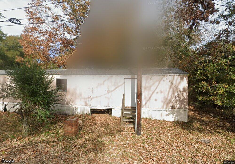
24 Station St Saraland, AL 36571
Estimated Value: $361,783
--
Bed
2
Baths
1,770
Sq Ft
$204/Sq Ft
Est. Value
About This Home
This home is located at 24 Station St, Saraland, AL 36571 and is currently estimated at $361,783, approximately $204 per square foot. 24 Station St is a home located in Mobile County with nearby schools including Saraland Elementary School, Nelson Leon Adams Middle School/Saraland Middle School, and Saraland High School.
Ownership History
Date
Name
Owned For
Owner Type
Purchase Details
Closed on
Aug 11, 2025
Sold by
Iras Development Company Inc
Bought by
Phillips James H
Current Estimated Value
Purchase Details
Closed on
Nov 22, 2016
Sold by
Reid Marie A
Bought by
Waymar Properties Llc
Purchase Details
Closed on
Sep 12, 2007
Sold by
South Trace Properties Llc
Bought by
Reid Wayne D and Reid Marie A
Home Financials for this Owner
Home Financials are based on the most recent Mortgage that was taken out on this home.
Original Mortgage
$200,000
Interest Rate
6.62%
Mortgage Type
Seller Take Back
Create a Home Valuation Report for This Property
The Home Valuation Report is an in-depth analysis detailing your home's value as well as a comparison with similar homes in the area
Home Values in the Area
Average Home Value in this Area
Purchase History
| Date | Buyer | Sale Price | Title Company |
|---|---|---|---|
| Phillips James H | $34,000 | None Listed On Document | |
| Waymar Properties Llc | -- | None Available | |
| Reid Wayne D | $225,000 | None Available |
Source: Public Records
Mortgage History
| Date | Status | Borrower | Loan Amount |
|---|---|---|---|
| Previous Owner | Reid Wayne D | $200,000 |
Source: Public Records
Tax History Compared to Growth
Tax History
| Year | Tax Paid | Tax Assessment Tax Assessment Total Assessment is a certain percentage of the fair market value that is determined by local assessors to be the total taxable value of land and additions on the property. | Land | Improvement |
|---|---|---|---|---|
| 2024 | $4,585 | $72,780 | $33,540 | $39,240 |
| 2023 | $4,330 | $40,620 | $12,000 | $28,620 |
| 2022 | $2,392 | $40,200 | $12,000 | $28,200 |
| 2021 | $2,254 | $41,820 | $12,000 | $29,820 |
| 2020 | $2,147 | $44,860 | $12,000 | $32,860 |
| 2019 | $2,147 | $36,080 | $0 | $0 |
| 2018 | $2,147 | $36,080 | $0 | $0 |
| 2017 | $2,147 | $36,080 | $0 | $0 |
| 2016 | $2,180 | $36,640 | $0 | $0 |
| 2013 | $1,822 | $34,720 | $0 | $0 |
Source: Public Records
Map
Nearby Homes
- 127 Lillian Ave
- 111 Bethel Forest Dr S
- 32 Everett Ave E
- 114 Bethel Forest Dr S
- 228 Lucille St
- 208 Strange Ave
- 306 Mignionette Ave
- 108 Craig Dr
- 127 Anderson Rd
- 13 Cypress Dr
- 0 Lind St
- 325 Bryant Ct
- 21 Frances St
- 118 2nd Ave
- 410 Allen Cir
- 321 Ferry Ave
- 234 Autumn Dr
- 629 Pine St
- 253 Autumn Dr
- 728 Shiloh St
- 18 Station St
- 14 Station St
- 25 Station St
- 318 Saraland Blvd S
- 19 Station St
- 360 Highway 43 S
- 370 Highway 43 S
- 328 Highway 43 S
- 412 Highway 43 S Unit 1
- 412 Highway 43 S Unit F
- 412 Highway 43 S Unit OUT PRCL
- 412 Highway 43 S Unit 1
- 412 Highway 43 S Unit BLDG. F
- 412 Highway 43 S Unit E
- 412 Highway 43 S
- 23 Station St
- 319 Highway 43
- 410 Highway 43 S
- 416 Highway 43 S
- 407 Highway 43 S