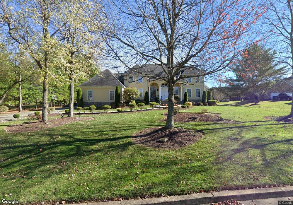
24 Timothy Dr Warminster, PA 18974
Estimated Value: $1,457,000 - $1,685,515
4
Beds
5
Baths
7,163
Sq Ft
$226/Sq Ft
Est. Value
About This Home
This home is located at 24 Timothy Dr, Warminster, PA 18974 and is currently estimated at $1,617,129, approximately $225 per square foot. 24 Timothy Dr is a home located in Bucks County with nearby schools including Maureen M. Welch Elementary School, Richboro Middle School, and Council Rock High School - South.
Ownership History
Date
Name
Owned For
Owner Type
Purchase Details
Closed on
Jun 10, 1999
Sold by
Adams Thomas J and Adams Tom
Bought by
Mirabelli Francesco A and Certo Mirabelli Donna
Current Estimated Value
Purchase Details
Closed on
Jul 15, 1994
Sold by
Rymar George L and Rymar Elizabeth A
Bought by
Gregory William and Clemente Kimberly
Purchase Details
Closed on
Aug 11, 1993
Bought by
Adams Thomas J and Adams Adelaide E
Create a Home Valuation Report for This Property
The Home Valuation Report is an in-depth analysis detailing your home's value as well as a comparison with similar homes in the area
Home Values in the Area
Average Home Value in this Area
Purchase History
| Date | Buyer | Sale Price | Title Company |
|---|---|---|---|
| Mirabelli Francesco A | $175,000 | -- | |
| Gregory William | $124,000 | -- | |
| Adams Thomas J | -- | -- |
Source: Public Records
Tax History Compared to Growth
Tax History
| Year | Tax Paid | Tax Assessment Tax Assessment Total Assessment is a certain percentage of the fair market value that is determined by local assessors to be the total taxable value of land and additions on the property. | Land | Improvement |
|---|---|---|---|---|
| 2025 | $18,223 | $94,610 | $11,330 | $83,280 |
| 2024 | $18,223 | $94,610 | $11,330 | $83,280 |
| 2023 | $17,174 | $94,610 | $11,330 | $83,280 |
| 2022 | $17,017 | $94,610 | $11,330 | $83,280 |
| 2021 | $16,479 | $94,610 | $11,330 | $83,280 |
| 2020 | $16,109 | $94,610 | $11,330 | $83,280 |
| 2019 | $15,418 | $94,610 | $11,330 | $83,280 |
| 2018 | $15,144 | $94,610 | $11,330 | $83,280 |
| 2017 | $14,560 | $94,610 | $11,330 | $83,280 |
| 2016 | $14,560 | $94,610 | $11,330 | $83,280 |
| 2015 | -- | $94,610 | $11,330 | $83,280 |
| 2014 | -- | $94,610 | $11,330 | $83,280 |
Source: Public Records
Map
Nearby Homes
- 290 Hatboro Rd
- 8 Shady Pines Dr
- 3 Shady Pines Dr
- 223 Cecelia Acres Dr
- 23 Oxford Dr
- 105 Edwards Dr
- 18 Lacey Ln
- 59 Parry Way
- 8 Lacey Ln
- 21 Spring Mill Dr Unit 12
- The Addis Plan at The Reserve at Spring Mill
- The Beckett Plan at The Reserve at Spring Mill
- 55 Parry Way
- 56 Joshua Dr
- 11 Spring Mill Dr
- 9 Spring Mill Dr
- 56 Parry Way
- 29 Devon Rd
- 636 Almshouse Rd
- 215 Surrey Rd