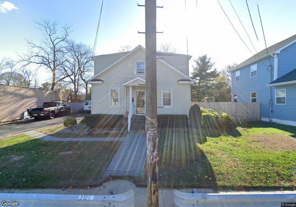
24 Wall St West Long Branch, NJ 07764
Estimated Value: $542,000 - $591,000
3
Beds
2
Baths
1,201
Sq Ft
$470/Sq Ft
Est. Value
About This Home
This home is located at 24 Wall St, West Long Branch, NJ 07764 and is currently estimated at $564,826, approximately $470 per square foot. 24 Wall St is a home located in Monmouth County with nearby schools including Betty McElmon Elementary School, Frank Antonides School, and Shore Regional High School.
Ownership History
Date
Name
Owned For
Owner Type
Purchase Details
Closed on
Jul 15, 2021
Sold by
Boynton Joseph C and Boynton Patricia A
Bought by
Babayoff Nathanel and Babayoff Effrati
Current Estimated Value
Purchase Details
Closed on
May 1, 2006
Sold by
Jesemine Jesemine Jones Aka
Bought by
Rosas Juan and Rosero Paulina
Home Financials for this Owner
Home Financials are based on the most recent Mortgage that was taken out on this home.
Original Mortgage
$276,660
Interest Rate
6.62%
Mortgage Type
Purchase Money Mortgage
Purchase Details
Closed on
Oct 29, 2001
Sold by
Palumbo Attilio
Bought by
Bricker Jesemine
Home Financials for this Owner
Home Financials are based on the most recent Mortgage that was taken out on this home.
Original Mortgage
$96,200
Interest Rate
6.72%
Mortgage Type
Purchase Money Mortgage
Purchase Details
Closed on
Aug 14, 1998
Sold by
Alvino Edward
Bought by
Brothers Geoffrey and Brothers Michelle
Create a Home Valuation Report for This Property
The Home Valuation Report is an in-depth analysis detailing your home's value as well as a comparison with similar homes in the area
Home Values in the Area
Average Home Value in this Area
Purchase History
| Date | Buyer | Sale Price | Title Company |
|---|---|---|---|
| Babayoff Nathanel | $385,000 | Land Title | |
| Rosas Juan | $307,400 | -- | |
| Bricker Jesemine | $148,000 | -- | |
| Brothers Geoffrey | $73,000 | -- |
Source: Public Records
Mortgage History
| Date | Status | Borrower | Loan Amount |
|---|---|---|---|
| Previous Owner | Rosas Juan | $276,660 | |
| Previous Owner | Bricker Jesemine | $96,200 |
Source: Public Records
Tax History Compared to Growth
Tax History
| Year | Tax Paid | Tax Assessment Tax Assessment Total Assessment is a certain percentage of the fair market value that is determined by local assessors to be the total taxable value of land and additions on the property. | Land | Improvement |
|---|---|---|---|---|
| 2025 | $6,073 | $507,300 | $343,800 | $163,500 |
| 2024 | $6,942 | $466,100 | $305,600 | $160,500 |
| 2023 | $6,942 | $496,900 | $340,200 | $156,700 |
| 2022 | $5,281 | $371,800 | $222,600 | $149,200 |
| 2021 | $5,281 | $273,200 | $155,100 | $118,100 |
| 2020 | $5,096 | $248,000 | $132,600 | $115,400 |
| 2019 | $4,820 | $235,800 | $121,100 | $114,700 |
| 2018 | $4,877 | $230,500 | $121,100 | $109,400 |
| 2017 | $4,891 | $220,700 | $114,600 | $106,100 |
| 2016 | $4,852 | $223,400 | $126,200 | $97,200 |
| 2015 | $4,565 | $209,900 | $115,200 | $94,700 |
| 2014 | $4,580 | $196,500 | $106,200 | $90,300 |
Source: Public Records
Map
Nearby Homes
- 264 Norwood Ave
- 2 Hilltop Rd
- 54 Wall St
- 21 Dennis St
- 440 W End Ave
- 317 Norwood Ave
- 153 Vanderbilt Ave
- 11 Fairway Ave
- 570 Monmouth Place
- 88 Norwood Ave
- 552 Westwood Ave
- 388 Brookdale Ave
- 434 Westwood Ave
- 57 Hollywood Ave
- 28 Norwood Ave
- 448 Monmouth Place
- 364 Westwood Ave Unit 39
- 364 Westwood Ave Unit 71
- 364 Westwood Ave Unit 21
- 377 Westwood Ave
- 26 Wall St
- 2 Mitchell Terrace
- 232 Norwood Ave Unit 102
- 232 Norwood Ave Unit 105
- 232 Norwood Ave Unit A
- 232 Norwood Ave Unit 101
- 4 Mitchell Terrace
- 217 Oakwood Ave
- 34 Wall St
- 27 Wall St
- 6 Mitchell Terrace
- 29 Wall St
- 211 Oakwood Ave
- 635 Wall St
- 31 Wall St
- 635 Wall St Unit 637
- 36 Wall St Unit 38
- 14 Wall St
- 207 Oakwood Ave Unit 2
- 207 Oakwood Ave Unit 2