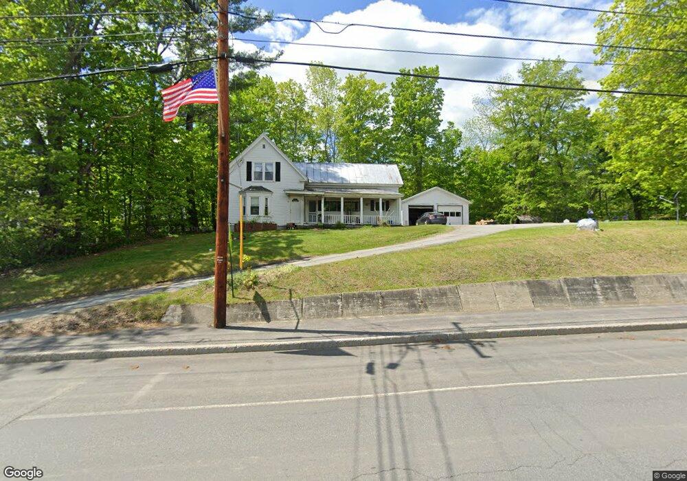
24 Weld Rd Wilton, ME 04294
Estimated Value: $82,000 - $205,000
4
Beds
1
Bath
976
Sq Ft
$157/Sq Ft
Est. Value
About This Home
This home is located at 24 Weld Rd, Wilton, ME 04294 and is currently estimated at $152,858, approximately $156 per square foot. 24 Weld Rd is a home located in Franklin County with nearby schools including Mt. Blue High School and Western Maine Christian Academy.
Ownership History
Date
Name
Owned For
Owner Type
Purchase Details
Closed on
May 27, 2023
Sold by
Conant Bertron M
Bought by
Taylor Alex S
Current Estimated Value
Purchase Details
Closed on
Feb 15, 2005
Sold by
Brown Linda D and Therriault Linda D
Bought by
Michaud Vickie L
Home Financials for this Owner
Home Financials are based on the most recent Mortgage that was taken out on this home.
Original Mortgage
$66,400
Interest Rate
5.83%
Mortgage Type
Purchase Money Mortgage
Create a Home Valuation Report for This Property
The Home Valuation Report is an in-depth analysis detailing your home's value as well as a comparison with similar homes in the area
Home Values in the Area
Average Home Value in this Area
Purchase History
We collect this data history from publicly available records. To have your information removed, we recommend requesting removal directly through your county’s website.
| Date | Buyer | Sale Price | Title Company |
|---|---|---|---|
| Taylor Alex S | $14,000 | None Available | |
| Michaud Vickie L | -- | -- |
Source: Public Records
Mortgage History
We collect this data history from publicly available records. To have your information removed, we recommend requesting removal directly through your county’s website.
| Date | Status | Borrower | Loan Amount |
|---|---|---|---|
| Previous Owner | Michaud Vickie L | $66,400 |
Source: Public Records
Tax History
| Year | Tax Paid | Tax Assessment Tax Assessment Total Assessment is a certain percentage of the fair market value that is determined by local assessors to be the total taxable value of land and additions on the property. | Land | Improvement |
|---|---|---|---|---|
| 2025 | $1,520 | $69,576 | $18,886 | $50,690 |
| 2024 | $1,482 | $69,576 | $18,886 | $50,690 |
| 2023 | $1,419 | $69,576 | $18,886 | $50,690 |
| 2022 | $1,350 | $69,576 | $18,886 | $50,690 |
| 2021 | $1,350 | $69,576 | $18,886 | $50,690 |
| 2020 | $387 | $69,576 | $18,886 | $50,690 |
| 2019 | $1,392 | $69,576 | $18,886 | $50,690 |
| 2018 | $3,460 | $69,576 | $18,886 | $50,690 |
| 2017 | $1,437 | $69,576 | $18,886 | $50,690 |
| 2016 | $1,437 | $69,576 | $18,886 | $50,690 |
| 2015 | $1,697 | $90,500 | $40,200 | $50,300 |
| 2014 | $1,570 | $90,500 | $40,200 | $50,300 |
| 2013 | $1,471 | $90,500 | $40,200 | $50,300 |
Source: Public Records
Map
Nearby Homes
- 530 Main St
- 38 High St
- 555 Depot St
- 28 Prospect St
- 38 Birch St
- Lot 019 Olivewood Cir
- Lot 2-7 Prospect St
- 42 Fernald St
- 684 Main St
- 21 Main St
- 76 U S 2 West Route
- 10 Pine St
- 3 Pullo Rd
- 28//36&37 Us Route 2 & 4
- 48 Farrington Rd
- 81 Applegate Ln
- 25 Lake School Rd
- 416 U S Highway 2
- 412 Weld Rd
- 96 Blue Spruce Rd
Your Personal Tour Guide
Ask me questions while you tour the home.