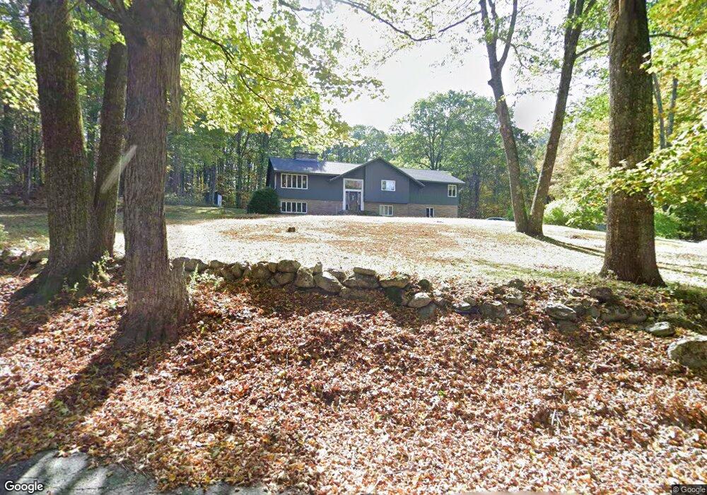
24 Wheeler Rd Princeton, MA 01541
Estimated Value: $547,237 - $633,000
5
Beds
3
Baths
1,770
Sq Ft
$337/Sq Ft
Est. Value
About This Home
This home is located at 24 Wheeler Rd, Princeton, MA 01541 and is currently estimated at $596,809, approximately $337 per square foot. 24 Wheeler Rd is a home located in Worcester County with nearby schools including Wachusett Regional High School.
Ownership History
Date
Name
Owned For
Owner Type
Purchase Details
Closed on
Mar 29, 1993
Sold by
Dime Sb Ny
Bought by
Ebbeling Julie
Current Estimated Value
Purchase Details
Closed on
Mar 13, 1992
Sold by
Mcsherry James
Bought by
Dime Sb New York
Purchase Details
Closed on
Sep 10, 1987
Sold by
Snell Charles A
Bought by
Mcsherry James C
Create a Home Valuation Report for This Property
The Home Valuation Report is an in-depth analysis detailing your home's value as well as a comparison with similar homes in the area
Home Values in the Area
Average Home Value in this Area
Purchase History
| Date | Buyer | Sale Price | Title Company |
|---|---|---|---|
| Ebbeling Julie | $107,000 | -- | |
| Dime Sb New York | $202,002 | -- | |
| Mcsherry James C | $188,000 | -- |
Source: Public Records
Mortgage History
| Date | Status | Borrower | Loan Amount |
|---|---|---|---|
| Open | Mcsherry James C | $90,000 | |
| Open | Mcsherry James C | $150,000 | |
| Closed | Mcsherry James C | $20,000 |
Source: Public Records
Tax History Compared to Growth
Tax History
| Year | Tax Paid | Tax Assessment Tax Assessment Total Assessment is a certain percentage of the fair market value that is determined by local assessors to be the total taxable value of land and additions on the property. | Land | Improvement |
|---|---|---|---|---|
| 2025 | $7,031 | $483,900 | $128,900 | $355,000 |
| 2024 | $6,953 | $495,600 | $128,900 | $366,700 |
| 2023 | $6,180 | $408,200 | $102,700 | $305,500 |
| 2022 | $5,524 | $381,600 | $102,700 | $278,900 |
| 2021 | $5,524 | $342,700 | $102,700 | $240,000 |
| 2020 | $5,370 | $338,800 | $102,700 | $236,100 |
| 2019 | $5,355 | $334,300 | $100,100 | $234,200 |
| 2018 | $5,281 | $305,600 | $91,400 | $214,200 |
| 2017 | $3,869 | $217,600 | $135,900 | $81,700 |
| 2016 | $3,873 | $217,600 | $135,900 | $81,700 |
| 2015 | $3,652 | $211,100 | $133,500 | $77,600 |
Source: Public Records
Map
Nearby Homes
- 45 Old Colony Rd
- 56 Hubbardston Rd
- 81 Glenwood Place
- 271 Glenwood Rd
- 166 Ball Hill Rd
- 175 Glenwood Rd
- 134 Mountain Rd
- 101 Brintnal Dr
- 73 Brintnal Dr
- 35 Brintnal Dr
- 20 Mountain Rd
- 2 Simon Davis Dr
- 147 E County Rd Unit 149
- 139 E County Rd Unit 139
- 58 Merriam Rd
- 75 Barre Rd
- 28 Merriam Rd
- 1 Barre Road Cut Off
- 11 Mirick Rd
- 15 Stagecoach Rd