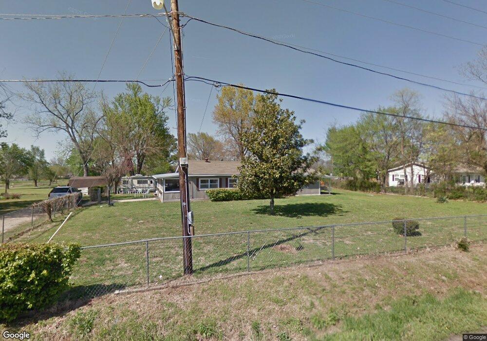
24 Wolfdale Rd Farmington, AR 72730
Estimated Value: $268,000 - $312,000
--
Bed
1
Bath
1,676
Sq Ft
$169/Sq Ft
Est. Value
About This Home
This home is located at 24 Wolfdale Rd, Farmington, AR 72730 and is currently estimated at $283,932, approximately $169 per square foot. 24 Wolfdale Rd is a home located in Washington County with nearby schools including Randall G. Lynch Middle School, Bob Folsom Elementary School, and Farmington Jr. High.
Ownership History
Date
Name
Owned For
Owner Type
Purchase Details
Closed on
Jul 9, 2009
Sold by
Hornback Willis L and Hornback Willie Faye
Bought by
Hornback Willis Leon
Current Estimated Value
Purchase Details
Closed on
Oct 13, 1994
Bought by
Hornback Willis L and Hornback Willie
Purchase Details
Closed on
Feb 28, 1994
Bought by
Atkinson Janie L
Purchase Details
Closed on
Jun 26, 1991
Bought by
Atkinson, Iron Ray & Janie L.
Purchase Details
Closed on
Aug 22, 1986
Bought by
Burnett Donald L
Purchase Details
Closed on
Jan 1, 1985
Bought by
Burnett Donald L
Create a Home Valuation Report for This Property
The Home Valuation Report is an in-depth analysis detailing your home's value as well as a comparison with similar homes in the area
Home Values in the Area
Average Home Value in this Area
Purchase History
| Date | Buyer | Sale Price | Title Company |
|---|---|---|---|
| Hornback Willis Leon | -- | None Available | |
| Hornback Willis L | $63,000 | -- | |
| Atkinson Janie L | -- | -- | |
| Atkinson, Iron Ray & Janie L. | $125,000 | -- | |
| Burnett Donald L | -- | -- | |
| Burnett Donald L | -- | -- |
Source: Public Records
Tax History Compared to Growth
Tax History
| Year | Tax Paid | Tax Assessment Tax Assessment Total Assessment is a certain percentage of the fair market value that is determined by local assessors to be the total taxable value of land and additions on the property. | Land | Improvement |
|---|---|---|---|---|
| 2025 | $277 | $42,130 | $11,200 | $30,930 |
| 2024 | $386 | $42,130 | $11,200 | $30,930 |
| 2023 | $499 | $42,130 | $11,200 | $30,930 |
| 2022 | $549 | $20,230 | $8,000 | $12,230 |
| 2021 | $554 | $20,230 | $8,000 | $12,230 |
| 2020 | $554 | $20,230 | $8,000 | $12,230 |
| 2019 | $557 | $18,280 | $6,050 | $12,230 |
| 2018 | $639 | $18,280 | $6,050 | $12,230 |
| 2017 | $630 | $18,280 | $6,050 | $12,230 |
| 2016 | $630 | $18,280 | $6,050 | $12,230 |
| 2015 | $630 | $18,280 | $6,050 | $12,230 |
| 2014 | $561 | $17,000 | $6,050 | $10,950 |
Source: Public Records
Map
Nearby Homes
- 48 Cedar St
- 216 Idaho Ave
- 142 N Sheep Dog Ave
- 485 W Branta St
- 93 Old Depot Rd
- 271 Greenfield Ave
- TBD White St
- 237 Briarhill Dr
- 201 Countryside Dr
- 311 S Sundown Dr
- 285 Briarhill Dr
- 10948 Blue Sky Rd
- 9 Bois d Arc St
- 10800 Blue Sky Rd
- 87 James St
- 179 Birchfield Ln
- 275 S Nightfall Ave
- 114 W Main St
- 215 N Broyles St
- Rye 1903 Plan at The Grove at Engles Mill
- 40 Wolfdale Rd
- 403 S Hunter St
- 324 S Hunter St
- 52 Wolfdale Rd
- 419 S Hunter St Unit 3
- 419 S Hunter St
- 395 S Hunter St
- 391 S Hunter St
- 415 S Hunter St Unit 1
- 415 S Hunter St Unit 1 & 3
- 415 S Hunter St Unit 4
- 415 S Hunter St Unit 3
- 415 S Hunter St
- Lot 4 W Rainsong St
- Lot 4 Rainsong
- 0 S Ar 170 Hwy Unit 599747
- 2.2 Acres W Rainsong St
- 2 W Rainsong St
- 2 W Rainsong St
- 2 W Rainsong St