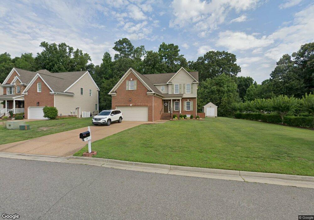
24 Wornom Farm Rd Poquoson, VA 23662
Poquoson Shores NeighborhoodEstimated Value: $519,000 - $592,000
4
Beds
3
Baths
2,533
Sq Ft
$221/Sq Ft
Est. Value
About This Home
This home is located at 24 Wornom Farm Rd, Poquoson, VA 23662 and is currently estimated at $559,416, approximately $220 per square foot. 24 Wornom Farm Rd is a home located in Poquoson City with nearby schools including Summit Christian Academy - Upper School.
Ownership History
Date
Name
Owned For
Owner Type
Purchase Details
Closed on
Nov 6, 2007
Sold by
Marque Homes
Bought by
Swartz William
Current Estimated Value
Home Financials for this Owner
Home Financials are based on the most recent Mortgage that was taken out on this home.
Original Mortgage
$260,000
Outstanding Balance
$164,844
Interest Rate
6.42%
Mortgage Type
New Conventional
Estimated Equity
$394,572
Create a Home Valuation Report for This Property
The Home Valuation Report is an in-depth analysis detailing your home's value as well as a comparison with similar homes in the area
Home Values in the Area
Average Home Value in this Area
Purchase History
| Date | Buyer | Sale Price | Title Company |
|---|---|---|---|
| Swartz William | $360,000 | -- |
Source: Public Records
Mortgage History
| Date | Status | Borrower | Loan Amount |
|---|---|---|---|
| Open | Swartz William | $260,000 |
Source: Public Records
Tax History Compared to Growth
Tax History
| Year | Tax Paid | Tax Assessment Tax Assessment Total Assessment is a certain percentage of the fair market value that is determined by local assessors to be the total taxable value of land and additions on the property. | Land | Improvement |
|---|---|---|---|---|
| 2024 | $5,303 | $465,200 | $118,500 | $346,700 |
| 2023 | $5,164 | $465,200 | $118,500 | $346,700 |
| 2022 | $4,520 | $400,000 | $118,500 | $281,500 |
| 2021 | $4,520 | $394,400 | $112,900 | $281,500 |
| 2020 | $0 | $355,200 | $112,900 | $242,300 |
| 2019 | -- | $355,200 | $112,900 | $242,300 |
| 2018 | -- | $366,300 | $110,700 | $255,600 |
| 2017 | -- | $366,300 | $110,700 | $255,600 |
| 2016 | -- | $366,300 | $110,700 | $255,600 |
| 2015 | -- | $361,300 | $105,400 | $255,900 |
| 2013 | -- | $361,300 | $105,400 | $255,900 |
Source: Public Records
Map
Nearby Homes
- 11 Dorothy Dr
- 8 Wornom Farm Rd
- 11 Valmoore Dr
- 11 Bull Run
- 28 Pasture Rd
- 40 Valmoore Dr
- 240 Hunts Neck Rd
- 29 River Rd
- 41 W Sandy Point Rd
- 35 River Rd
- 15 Pickins Dr
- 20 Pickins Dr
- 15+AC Browns Neck Rd
- 103 Darden Dr
- 8 Harbour View Dr
- 9 Cherokee Dr
- 1 Phillips Rd
- 706 Yorktown Rd
- 106 Ocean Breeze Dr
- 38 Valasia Rd
- 44 Wornom Farm Rd
- 26 Wornom Farm Rd
- 20 Wornom Farm Rd
- 28 Wornom Farm Rd
- 25 Wornom Farm Rd
- 23 Wornom Farm Rd
- 27 Wornom Farm Rd
- 18 Wornom Farm Rd
- 21 Wornom Farm Rd
- 19 Lee Ave
- 1 Dorothy Dr
- 3 Dorothy Dr
- 19 Wornom Farm Rd
- 29 Wornom Farm Rd
- 21 Lee Ave
- 16 Wornom Farm Rd
- 32 Wornom Farm Rd
- 5 Dorothy Dr
- 17 Wornom Farm Rd
- 31 Wornom Farm Rd