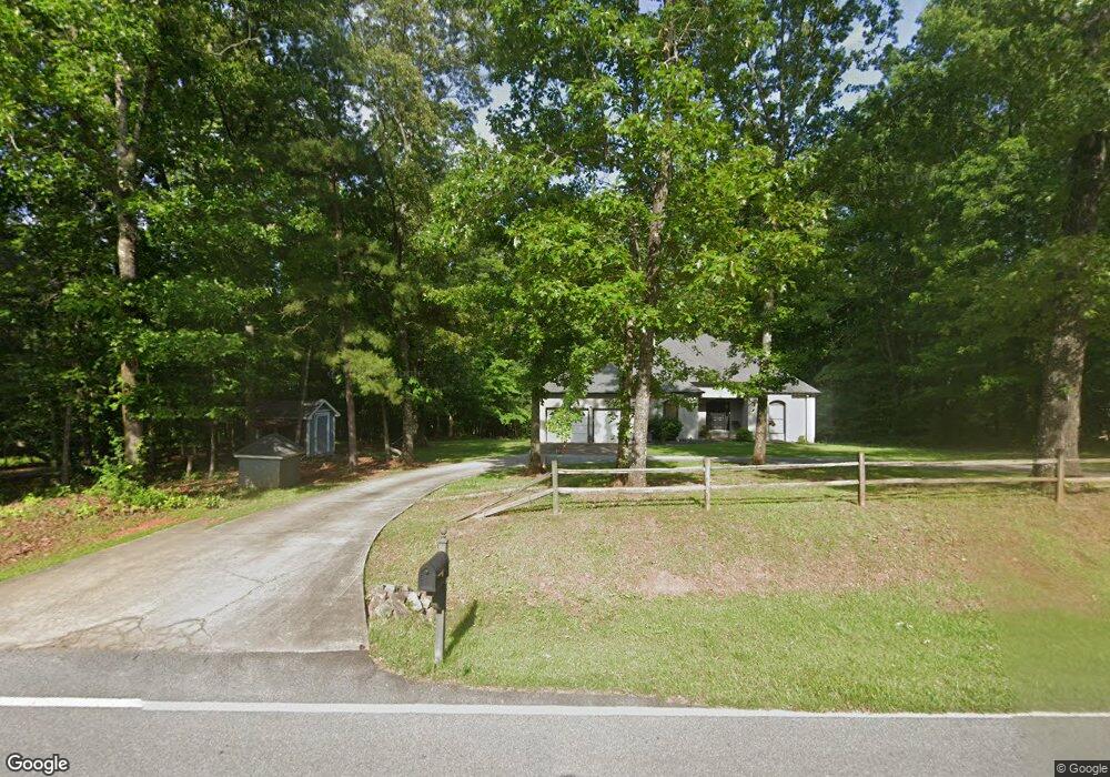
240 Bill Hart Rd Newnan, GA 30265
Estimated Value: $451,000 - $624,523
3
Beds
3
Baths
3,116
Sq Ft
$167/Sq Ft
Est. Value
About This Home
This home is located at 240 Bill Hart Rd, Newnan, GA 30265 and is currently estimated at $520,841, approximately $167 per square foot. 240 Bill Hart Rd is a home with nearby schools including Poplar Road Elementary School, East Coweta Middle School, and East Coweta High School.
Ownership History
Date
Name
Owned For
Owner Type
Purchase Details
Closed on
Jun 2, 2005
Sold by
Ivester Susan Nicole
Bought by
Ivester Jon Mark
Current Estimated Value
Purchase Details
Closed on
Aug 12, 1996
Sold by
Nationsbank Na
Bought by
Ivester Jon
Purchase Details
Closed on
Aug 3, 1995
Bought by
Nationsbank Of Georg
Purchase Details
Closed on
Sep 30, 1988
Bought by
Flannery John
Create a Home Valuation Report for This Property
The Home Valuation Report is an in-depth analysis detailing your home's value as well as a comparison with similar homes in the area
Home Values in the Area
Average Home Value in this Area
Purchase History
| Date | Buyer | Sale Price | Title Company |
|---|---|---|---|
| Ivester Jon Mark | -- | -- | |
| Ivester Jon | $36,300 | -- | |
| Nationsbank Of Georg | -- | -- | |
| Flannery John | -- | -- |
Source: Public Records
Mortgage History
| Date | Status | Borrower | Loan Amount |
|---|---|---|---|
| Closed | Ivester Jon | $0 |
Source: Public Records
Tax History Compared to Growth
Tax History
| Year | Tax Paid | Tax Assessment Tax Assessment Total Assessment is a certain percentage of the fair market value that is determined by local assessors to be the total taxable value of land and additions on the property. | Land | Improvement |
|---|---|---|---|---|
| 2025 | $3,624 | $193,016 | $45,420 | $147,597 |
| 2024 | $3,687 | $198,287 | $45,420 | $152,868 |
| 2023 | $3,687 | $210,441 | $48,336 | $162,105 |
| 2022 | $2,856 | $150,916 | $39,685 | $111,231 |
| 2021 | $2,459 | $135,295 | $39,685 | $95,610 |
| 2020 | $1,927 | $137,384 | $41,774 | $95,610 |
| 2019 | $2,044 | $104,163 | $31,852 | $72,312 |
| 2018 | $2,047 | $104,163 | $31,852 | $72,312 |
| 2017 | $2,044 | $104,163 | $31,851 | $72,312 |
| 2016 | $2,020 | $104,163 | $31,852 | $72,312 |
| 2015 | $1,987 | $104,163 | $31,852 | $72,312 |
| 2014 | $1,970 | $104,163 | $31,852 | $72,312 |
Source: Public Records
Map
Nearby Homes
- 0 Poplar Rd Unit 10580891
- 2752 Poplar Rd
- 105 Turnberry Trace
- 108 Turnberry Trace
- 25 Pacific Ave
- 9 Marvin Gardens
- 162 Ashton Place
- 2812 Highway 16 E
- 24 Marvin Gardens
- 316 Winchester Dr
- 1948 Highway 16 E
- 18 Berkeley Park
- 161 Briandwood Dr
- 37 Fox Ridge Dr
- 53 Fox Ridge Dr
- 28 Fox Ridge Dr
- 0 Mary Freeman Rd Unit 20069973
- Camden Plan at Candleberry Place
- Savannah Plan at Candleberry Place
- Briarwood Plan at Candleberry Place
- 220 Bill Hart Rd
- 255 Bill Hart Rd
- 190 Bill Hart Rd
- 300 Bill Hart Rd
- 210 Bill Hart Rd
- 170 Bill Hart Rd
- 330 Bill Hart Rd
- 179 Bill Hart Rd
- 140 Bill Hart Rd
- 131 Bill Hart Rd
- 205 Bill Hart Rd
- 104 Bill Hart Rd
- 111 Bill Hart Rd
- 203 Bill Hart Rd
- 94 Bill Hart Rd
- 101 Bill Hart Rd
- 2526 Poplar Rd
- 10 Shelby Bluff
- 50 Bill Hart Rd
- 2520 Poplar Rd