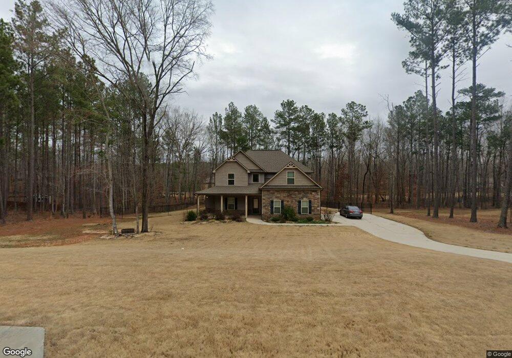
240 Cecil Way Unit 67 McDonough, GA 30252
Estimated Value: $374,000 - $427,000
4
Beds
4
Baths
2,694
Sq Ft
$149/Sq Ft
Est. Value
About This Home
This home is located at 240 Cecil Way Unit 67, McDonough, GA 30252 and is currently estimated at $402,336, approximately $149 per square foot. 240 Cecil Way Unit 67 is a home located in Henry County with nearby schools including Rock Spring Elementary School, Ola Middle School, and Ola High School.
Ownership History
Date
Name
Owned For
Owner Type
Purchase Details
Closed on
Dec 8, 2021
Sold by
Longview Carveout Llc
Bought by
Tolstoy Ga Llc
Current Estimated Value
Purchase Details
Closed on
Sep 3, 2021
Sold by
Pate Garrett P
Bought by
Longview Carveout Llc
Purchase Details
Closed on
Feb 2, 2018
Sold by
K & M Homes Inc
Bought by
Pate Garrett P and Pate Traci Y
Home Financials for this Owner
Home Financials are based on the most recent Mortgage that was taken out on this home.
Original Mortgage
$252,981
Interest Rate
3.95%
Mortgage Type
VA
Create a Home Valuation Report for This Property
The Home Valuation Report is an in-depth analysis detailing your home's value as well as a comparison with similar homes in the area
Home Values in the Area
Average Home Value in this Area
Purchase History
| Date | Buyer | Sale Price | Title Company |
|---|---|---|---|
| Tolstoy Ga Llc | $4,123,997 | -- | |
| Longview Carveout Llc | $350,500 | -- | |
| Pate Garrett P | $244,900 | -- |
Source: Public Records
Mortgage History
| Date | Status | Borrower | Loan Amount |
|---|---|---|---|
| Previous Owner | Pate Garrett P | $252,981 |
Source: Public Records
Tax History Compared to Growth
Tax History
| Year | Tax Paid | Tax Assessment Tax Assessment Total Assessment is a certain percentage of the fair market value that is determined by local assessors to be the total taxable value of land and additions on the property. | Land | Improvement |
|---|---|---|---|---|
| 2024 | $6,273 | $155,760 | $24,000 | $131,760 |
| 2023 | $5,976 | $153,600 | $18,000 | $135,600 |
| 2022 | $5,542 | $142,280 | $18,000 | $124,280 |
| 2021 | $3,904 | $112,040 | $18,000 | $94,040 |
| 2020 | $3,731 | $104,720 | $14,800 | $89,920 |
| 2019 | $3,571 | $97,960 | $13,714 | $84,246 |
| 2018 | $2,265 | $56,840 | $12,000 | $44,840 |
Source: Public Records
Map
Nearby Homes
- 106 Loam Dr
- 209 Amber Ct
- 1120 Stroud Rd
- 1100 Stroud Rd
- 1908 Munford Place
- 4904 Highway 81 E
- 0 Highway 81 St E Unit 10597150
- 41 Giles Dr
- 124 Wynn Rd
- 518 Gallantry Trail
- 4075 O Henry Ct
- 180 Mackey Rd
- 170 Mackey Rd
- 5168 Highway 81 E
- 501 Barhams Ridge Dr
- 3000 Keeneland Blvd
- 227 Aves Ct
- 320 Ponderosa Trail
- 128 Lavender Way Unit LOT 75
- 58 Maddox Dr
- 240 Cecil Way
- 244 Cecil Way
- 236 Cecil Way Unit 68
- 237 Cecil Way Unit 56
- 237 Cecil Way
- 241 Cecil Way Unit 57
- 241 Cecil Way
- 233 Cecil Way Unit 55
- 233 Cecil Way
- 246 Cecil Way Unit 65
- 246 Cecil Way
- 0 Cecil Way Unit 7373576
- 0 Cecil Way Unit 8959361
- 0 Cecil Way Unit 8993588
- 0 Cecil Way Unit 8993677
- 0 Cecil Way Unit 9035394
- 0 Cecil Way Unit 9051922
- 0 Cecil Way Unit 9048385
- 0 Cecil Way Unit 8775095
- 0 Cecil Way Unit 8790101