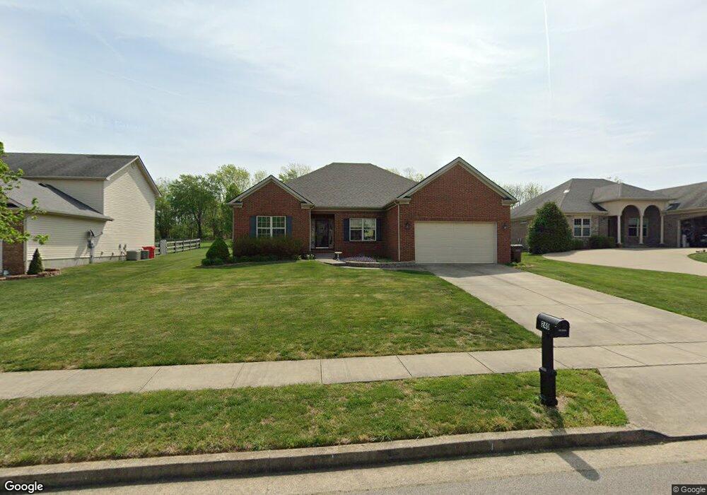
240 Curtis Ford Trace Nicholasville, KY 40356
South Nicholasville NeighborhoodEstimated Value: $359,662 - $381,000
3
Beds
2
Baths
2,300
Sq Ft
$160/Sq Ft
Est. Value
About This Home
This home is located at 240 Curtis Ford Trace, Nicholasville, KY 40356 and is currently estimated at $367,916, approximately $159 per square foot. 240 Curtis Ford Trace is a home located in Jessamine County with nearby schools including Warner Elementary School, East Jessamine Middle School, and East Jessamine High School.
Ownership History
Date
Name
Owned For
Owner Type
Purchase Details
Closed on
Apr 21, 2017
Sold by
Tackett Donald and Tackett Jane
Bought by
Gabrielson Carrie R and Gabrielson Christopher J
Current Estimated Value
Home Financials for this Owner
Home Financials are based on the most recent Mortgage that was taken out on this home.
Original Mortgage
$223,155
Outstanding Balance
$186,154
Interest Rate
4.3%
Mortgage Type
New Conventional
Estimated Equity
$181,762
Purchase Details
Closed on
Jul 9, 2007
Sold by
Rick Moore Homes Inc
Bought by
Tackett Donald and Tackett Jane
Create a Home Valuation Report for This Property
The Home Valuation Report is an in-depth analysis detailing your home's value as well as a comparison with similar homes in the area
Home Values in the Area
Average Home Value in this Area
Purchase History
| Date | Buyer | Sale Price | Title Company |
|---|---|---|---|
| Gabrielson Carrie R | $234,900 | Bluegrass Land Title Llc | |
| Tackett Donald | $215,000 | -- |
Source: Public Records
Mortgage History
| Date | Status | Borrower | Loan Amount |
|---|---|---|---|
| Open | Gabrielson Carrie R | $223,155 |
Source: Public Records
Tax History Compared to Growth
Tax History
| Year | Tax Paid | Tax Assessment Tax Assessment Total Assessment is a certain percentage of the fair market value that is determined by local assessors to be the total taxable value of land and additions on the property. | Land | Improvement |
|---|---|---|---|---|
| 2024 | $2,792 | $265,400 | $27,100 | $238,300 |
| 2023 | $2,819 | $265,400 | $27,100 | $238,300 |
| 2022 | $437 | $234,900 | $24,000 | $210,900 |
| 2021 | $437 | $234,900 | $24,000 | $210,900 |
| 2020 | $437 | $234,900 | $24,000 | $210,900 |
| 2019 | $437 | $234,900 | $24,000 | $210,900 |
| 2018 | $437 | $234,900 | $24,000 | $210,900 |
| 2017 | $391 | $210,000 | $24,000 | $186,000 |
| 2016 | $1,745 | $210,000 | $24,000 | $186,000 |
| 2015 | $1,745 | $210,000 | $24,000 | $186,000 |
| 2014 | $1,625 | $200,000 | $24,000 | $176,000 |
Source: Public Records
Map
Nearby Homes
- 441 Friendly Ave
- 445 Friendly Ave
- 453 Friendly Ave
- 506 Friendly Ave
- 505 Friendly Ave
- 109 Clearwater Dr
- 105 Clearwater Dr
- 308 Friendly Ave
- 880 Sulphur Well Pike
- 212 Friendly Ave
- lot 4 Crawford Creek Dr
- 404 Elam Ave
- 400 Elam Ave
- 312 Elam Ave
- 308 Elam Ave
- 304 Elam Ave
- 300 Elam Ave
- 208 Elam Ave
- 408 Elam Ave
- Grace Plan at Eastgate
- 240 Curtis-Ford Trace
- 236 Curtis Ford Trace
- 244 Curtis-Ford Trace
- 232 Curtis-Ford Trace
- 248 Curtis Ford Trace
- 232 Curtis Ford Trace
- 228 Curtis Ford Trace
- 252 Curtis Ford Trace
- 221 Curtis-Ford Trace
- 225 Curtis-Ford Trace
- 229 Curtis-Ford Trace
- 217 Curtis-Ford Trace
- 233 Curtis-Ford Trace
- 224 Curtis Ford Trace
- 224 Curtis-Ford Trace
- 256 Curtis Ford Trace
- 237 Curtis Ford Trace
- 213 Curtis-Ford Trace
- 220 Curtis-Ford Trace
- 120 Dawson Pass