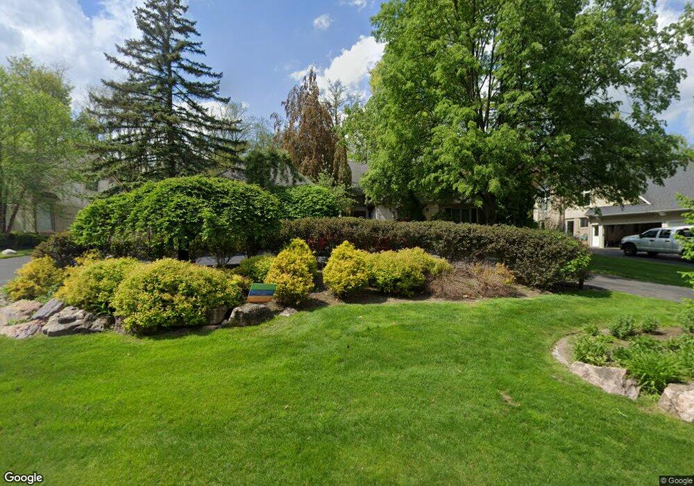
240 Devon Rd Bloomfield Hills, MI 48302
Estimated Value: $671,000 - $893,000
3
Beds
4
Baths
3,066
Sq Ft
$267/Sq Ft
Est. Value
About This Home
This home is located at 240 Devon Rd, Bloomfield Hills, MI 48302 and is currently estimated at $819,128, approximately $267 per square foot. 240 Devon Rd is a home located in Oakland County with nearby schools including Way Elementary School, South Hills Middle School, and Bloomfield Hills High School.
Ownership History
Date
Name
Owned For
Owner Type
Purchase Details
Closed on
Jun 15, 2001
Sold by
Magno Theresa M
Bought by
Weiss Robert M
Current Estimated Value
Home Financials for this Owner
Home Financials are based on the most recent Mortgage that was taken out on this home.
Original Mortgage
$512,000
Outstanding Balance
$196,170
Interest Rate
7.22%
Estimated Equity
$622,958
Purchase Details
Closed on
Feb 15, 1996
Sold by
Glenn M Charest Tr
Bought by
Magno Manolo B
Home Financials for this Owner
Home Financials are based on the most recent Mortgage that was taken out on this home.
Original Mortgage
$420,000
Interest Rate
7.06%
Create a Home Valuation Report for This Property
The Home Valuation Report is an in-depth analysis detailing your home's value as well as a comparison with similar homes in the area
Home Values in the Area
Average Home Value in this Area
Purchase History
| Date | Buyer | Sale Price | Title Company |
|---|---|---|---|
| Weiss Robert M | $640,000 | -- | |
| Magno Manolo B | $525,000 | -- |
Source: Public Records
Mortgage History
| Date | Status | Borrower | Loan Amount |
|---|---|---|---|
| Open | Weiss Robert M | $512,000 | |
| Previous Owner | Magno Manolo B | $420,000 |
Source: Public Records
Tax History Compared to Growth
Tax History
| Year | Tax Paid | Tax Assessment Tax Assessment Total Assessment is a certain percentage of the fair market value that is determined by local assessors to be the total taxable value of land and additions on the property. | Land | Improvement |
|---|---|---|---|---|
| 2024 | $5,501 | $342,060 | $0 | $0 |
| 2023 | $5,323 | $319,960 | $0 | $0 |
| 2022 | $10,003 | $297,130 | $0 | $0 |
| 2021 | $9,931 | $312,940 | $0 | $0 |
| 2020 | $4,868 | $321,280 | $0 | $0 |
| 2019 | $9,345 | $323,270 | $0 | $0 |
| 2018 | $9,388 | $309,060 | $0 | $0 |
| 2017 | $9,320 | $310,010 | $0 | $0 |
| 2016 | $9,338 | $316,050 | $0 | $0 |
| 2015 | -- | $271,770 | $0 | $0 |
| 2014 | -- | $238,370 | $0 | $0 |
| 2011 | -- | $254,020 | $0 | $0 |
Source: Public Records
Map
Nearby Homes
- 2665 Lahser Rd
- 240 Applewood Ln
- 363 Sycamore Ct
- 2863 Meadowood Ln
- 136 Belroi Place
- 00 S Berkshire
- 284 Woodwind Dr
- 75 Hillsdale Rd
- 95 Hillsdale Rd
- 3060 Chickering Ln
- 42160 Woodward Ave Unit 8
- 42160 Woodward Ave
- 556 Barrington Ct
- 2383 Mulberry Square Unit 72
- 2449 Mulberry Square Unit 28
- 559 Barrington Park
- 3403 Chickering Ln
- 3531 Brookside Dr
- 41350 Woodward Ave Unit 8
- 3435 Devon Brook Dr
- 250 Devon Rd
- 230 Devon Rd
- 2611 Norwood Rd
- 2620 Wendover Rd
- 2625 Norwood Rd
- 210 Devon Rd
- 2637 Norwood Rd
- 2601 Norwood Rd
- 196 Timber Trace Ln Unit 11
- 196 Timber Trace Ln
- 194 Timber Trace Ln Unit 12
- 2565 Norwood Rd Unit Bldg-Unit
- 2565 Norwood Rd
- 198 Timber Trace Ln
- 2578 Wendover Rd
- 192 Timber Trace Ln Unit 13
- 2634 Norwood Rd
- 120 Devon Rd Unit Bldg-Unit
- 120 Devon Rd
- 2631 Wendover Rd