Estimated Value: $3,455,929
--
Bed
--
Bath
3,400
Sq Ft
$1,016/Sq Ft
Est. Value
About This Home
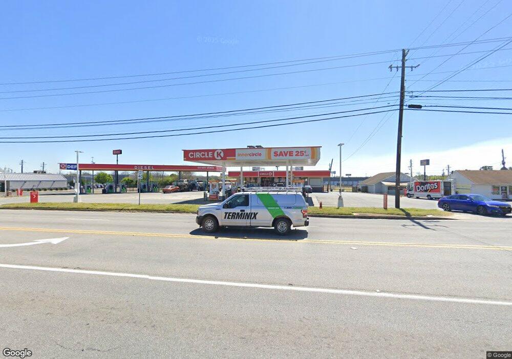
This home is located at 240 Ga Highway 49 N, Byron, GA 31008 and is currently priced at $3,455,929, approximately $1,016 per square foot. 240 Ga Highway 49 N is a home located in Peach County with nearby schools including Byron Elementary School, Byron Middle School, and Peach County High School.
Ownership History
Date
Name
Owned For
Owner Type
Purchase Details
Closed on
Aug 27, 2015
Sold by
Big Sky Land Co Llc
Bought by
Bhd Properties Llc
Current Estimated Value
Purchase Details
Closed on
Dec 19, 2013
Sold by
Eat 1305 Llc
Bought by
Big Sky Land Co Llc
Purchase Details
Closed on
Jul 8, 2013
Sold by
Runway Enterprises Llc
Bought by
Eat 1305 Llc
Purchase Details
Closed on
Aug 17, 2012
Sold by
Ricker Carl H
Bought by
Runway Enterprises Llc
Purchase Details
Closed on
Apr 21, 1987
Bought by
Ricker Carl H and Ricker Jr
Purchase Details
Closed on
Jun 30, 1986
Bought by
Ricker Carl H
Create a Home Valuation Report for This Property
The Home Valuation Report is an in-depth analysis detailing your home's value as well as a comparison with similar homes in the area
Home Values in the Area
Average Home Value in this Area
Purchase History
| Date | Buyer | Sale Price | Title Company |
|---|---|---|---|
| Bhd Properties Llc | $1,915,000 | -- | |
| Big Sky Land Co Llc | $575,000 | -- | |
| Eat 1305 Llc | $575,000 | -- | |
| Runway Enterprises Llc | $450,000 | -- | |
| Ricker Carl H | -- | -- | |
| Ricker Carl H | $520,000 | -- |
Source: Public Records
Tax History Compared to Growth
Tax History
| Year | Tax Paid | Tax Assessment Tax Assessment Total Assessment is a certain percentage of the fair market value that is determined by local assessors to be the total taxable value of land and additions on the property. | Land | Improvement |
|---|---|---|---|---|
| 2024 | $18,166 | $509,040 | $155,240 | $353,800 |
| 2023 | $17,549 | $488,560 | $124,200 | $364,360 |
| 2022 | $19,361 | $479,520 | $124,200 | $355,320 |
| 2021 | $11,821 | $378,600 | $124,200 | $254,400 |
| 2020 | $11,784 | $377,440 | $124,200 | $253,240 |
| 2019 | $11,409 | $363,640 | $110,400 | $253,240 |
| 2018 | $11,467 | $363,640 | $110,400 | $253,240 |
| 2017 | $11,523 | $363,640 | $110,400 | $253,240 |
Source: Public Records
Map
Nearby Homes
- 0 W White Rd Unit 329733
- 104 Robinson St
- 105 2nd St
- 00 Dunbar Rd
- 00 Georgia 49
- 252 Shantz Way
- 252 Shantz Way Unit (LOT A43)
- 113 Early Dr
- 106 Early Dr
- 256 Shantz Way
- 121 Early Dr
- 256 Shantz Way Unit (LOT A45)
- 262 Shantz Way
- 262 Shantz Way Unit (LOT A48)
- 212 Eric Ct
- 208 Eric Ct
- 206 Eric Ct
- 202 Eric Ct
- 200 Eric Ct
- 239 Georgia 49
- 239 Ga Highway 49 N
- 303 Old MacOn Rd
- 0 Chapman Rd Unit 20 7452627
- 0 Chapman Rd Unit 20 8023044
- 0 Chapman Rd Unit 8023042
- 0 Chapman Rd Unit 8044207
- 0 Chapman Rd Unit 7450305
- 0 Chapman Rd Unit M150105
- 0 Chapman Rd Unit 7460684
- 0 Chapman Rd Unit 192462
- 0 Chapman Rd Unit 8568038
- 0 Woodland and Old MacOn Unit 8264015
- 0 Woodland and Old MacOn Unit 3245130
- 224 Georgia 49
- 222 Georgia 49
- 110 Woodland Dr
- 218 Ga Highway 49 N
- 218 Ga Highway 49 N
- 112 Woodland Dr