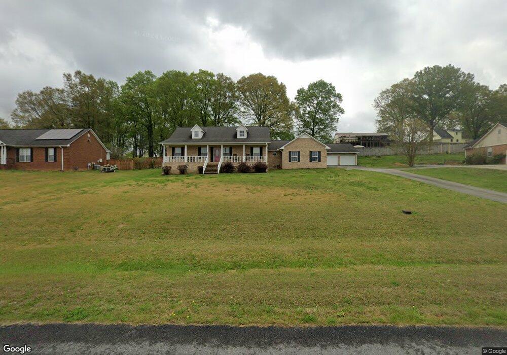
240 Kimwood Dr Cedartown, GA 30125
Estimated Value: $298,947 - $349,000
3
Beds
3
Baths
1,676
Sq Ft
$193/Sq Ft
Est. Value
About This Home
This home is located at 240 Kimwood Dr, Cedartown, GA 30125 and is currently estimated at $322,737, approximately $192 per square foot. 240 Kimwood Dr is a home located in Polk County with nearby schools including Vineyard Harvester Christian Academy.
Ownership History
Date
Name
Owned For
Owner Type
Purchase Details
Closed on
Aug 31, 2005
Sold by
Hogg Michael
Bought by
Hogg Michael and Hogg Kathy C
Current Estimated Value
Purchase Details
Closed on
Jun 10, 1997
Sold by
West Duane G
Bought by
Hogg Michael
Purchase Details
Closed on
Mar 16, 1997
Sold by
Northwest Prop Credit
Bought by
West Duane G
Create a Home Valuation Report for This Property
The Home Valuation Report is an in-depth analysis detailing your home's value as well as a comparison with similar homes in the area
Home Values in the Area
Average Home Value in this Area
Purchase History
| Date | Buyer | Sale Price | Title Company |
|---|---|---|---|
| Hogg Michael | -- | -- | |
| Hogg Michael | $7,500 | -- | |
| West Duane G | -- | -- |
Source: Public Records
Tax History Compared to Growth
Tax History
| Year | Tax Paid | Tax Assessment Tax Assessment Total Assessment is a certain percentage of the fair market value that is determined by local assessors to be the total taxable value of land and additions on the property. | Land | Improvement |
|---|---|---|---|---|
| 2024 | $2,173 | $118,684 | $8,000 | $110,684 |
| 2023 | $1,632 | $82,172 | $8,000 | $74,172 |
| 2022 | $1,597 | $69,292 | $4,240 | $65,052 |
| 2021 | $1,618 | $69,292 | $4,240 | $65,052 |
| 2020 | $1,621 | $69,292 | $4,240 | $65,052 |
| 2019 | $1,675 | $64,386 | $6,000 | $58,386 |
| 2018 | $1,632 | $61,218 | $6,000 | $55,218 |
| 2017 | $1,611 | $61,218 | $6,000 | $55,218 |
| 2016 | $1,611 | $61,218 | $6,000 | $55,218 |
| 2015 | $1,632 | $61,781 | $6,000 | $55,781 |
| 2014 | $1,644 | $61,781 | $6,000 | $55,781 |
Source: Public Records
Map
Nearby Homes
- 270 Oakwood Dr
- 77 Ben Dr W
- 462 Oakwood Dr
- 660 Valley Rd
- 645 Valley Rd
- 254 E Girard Ave
- 64 Virginia Cir
- 618 Valley Rd
- 0 Woodlawn Dr Unit 7638056
- 0 Woodlawn Dr Unit 10590789
- 133 Virginia Cir
- 416 Lakeview Dr
- 119 Thornton Ave
- 226 Adams Ave
- 0 Blanche Rd Unit 7652978
- 0 Blanche Rd Unit 10609468
- 403 Lakeside Dr
- 112 College Cir
- 413 N College Dr
- 240 Kimwood Dr Unit 9
- 248 Kimwood Dr
- 328 Kimwood Dr Unit 8
- 328 Kimwood Dr
- 363 Oakwood Dr
- 339 Kimwood Dr
- 325 Kimwood Dr
- 316 Kimwood Dr
- 353 Oakwood Dr Unit 39
- 353 Oakwood Dr
- 360 Kimwood Dr
- 343 Oakwood Dr
- 373 Oakwood Dr
- 331 Oakwood Dr
- 362 Oakwood Dr
- 348 Oakwood Dr
- 311 Kimwood Dr
- 389 Kimwood Dr
- 306 Kimwood Dr
- 342 Oakwood Dr