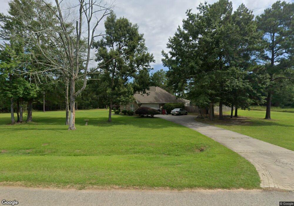
240 Natchez Trace Macon, GA 31216
Estimated Value: $246,000 - $268,868
3
Beds
2
Baths
1,850
Sq Ft
$141/Sq Ft
Est. Value
About This Home
This home is located at 240 Natchez Trace, Macon, GA 31216 and is currently estimated at $261,217, approximately $141 per square foot. 240 Natchez Trace is a home located in Bibb County with nearby schools including Heard Elementary School, Rutland Middle School, and Rutland High School.
Ownership History
Date
Name
Owned For
Owner Type
Purchase Details
Closed on
May 2, 2008
Sold by
Pergerson Carl C and Pergerson Brittany G
Bought by
Fallings Travis Dewayne and Fallings Fredda Lolita
Current Estimated Value
Home Financials for this Owner
Home Financials are based on the most recent Mortgage that was taken out on this home.
Original Mortgage
$174,978
Outstanding Balance
$109,476
Interest Rate
5.82%
Mortgage Type
FHA
Estimated Equity
$151,741
Create a Home Valuation Report for This Property
The Home Valuation Report is an in-depth analysis detailing your home's value as well as a comparison with similar homes in the area
Purchase History
| Date | Buyer | Sale Price | Title Company |
|---|---|---|---|
| Fallings Travis Dewayne | $177,725 | None Available |
Source: Public Records
Mortgage History
| Date | Status | Borrower | Loan Amount |
|---|---|---|---|
| Open | Fallings Travis Dewayne | $174,978 |
Source: Public Records
Tax History
| Year | Tax Paid | Tax Assessment Tax Assessment Total Assessment is a certain percentage of the fair market value that is determined by local assessors to be the total taxable value of land and additions on the property. | Land | Improvement |
|---|---|---|---|---|
| 2025 | $2,008 | $88,695 | $9,200 | $79,495 |
| 2024 | $2,072 | $88,593 | $9,200 | $79,393 |
| 2023 | $1,498 | $83,981 | $6,900 | $77,081 |
| 2022 | $2,279 | $72,832 | $8,000 | $64,832 |
| 2021 | $2,049 | $60,924 | $8,000 | $52,924 |
| 2020 | $2,094 | $60,924 | $8,000 | $52,924 |
| 2019 | $2,111 | $60,924 | $8,000 | $52,924 |
| 2018 | $3,214 | $57,617 | $8,000 | $49,617 |
| 2017 | $1,866 | $56,797 | $8,000 | $48,797 |
| 2016 | $1,723 | $56,797 | $8,000 | $48,797 |
| 2015 | $2,439 | $56,797 | $8,000 | $48,797 |
| 2014 | $3,279 | $73,836 | $15,280 | $58,556 |
Source: Public Records
Map
Nearby Homes
- 319 Hawk Ct
- 317 Hawk Ct
- 312 Hawk Ct
- 412 Gray Wolf Dr
- 1419 Griffin Rd
- 1850 Barnes Ferry Rd
- 120 Abberley Ln
- 137 Abberley Ln
- 341 Stockton Cir
- 337 Stockton Cir
- 301 Stockton Cir
- 7070 Sofkee Place
- 2165 Griffin Rd
- 2154 Allen Rd
- 8410 Hawkinsville Rd Unit LOT 42
- 4057 Liberty Estates Dr
- 297 Amanda Dr
- 268 Amanda Dr
- 261 Amanda Dr
- 344 Browning Pointe Rd
- 115 Deer Forest Trail
- 238 Natchez Trace
- 401 Dakota Trail
- 111 Deer Forest Trail
- 114 Deer Forest Trail
- 244 Natchez Trace
- 110 Deer Forest Trail
- 234 Natchez Trace
- 246 Natchez Trace
- 109 Deer Forest Trail
- 405 Dakota Trail
- 402 Dakota Trail
- 108 Deer Forest Trail
- 404 Dakota Trail
- 248 Natchez Trace
- 104 Deer Forest Trail
- 425 Gray Wolf Dr
- 429 Gray Wolf Dr
- 421 Gray Wolf Dr
- 250 Natchez Trace
Your Personal Tour Guide
Ask me questions while you tour the home.