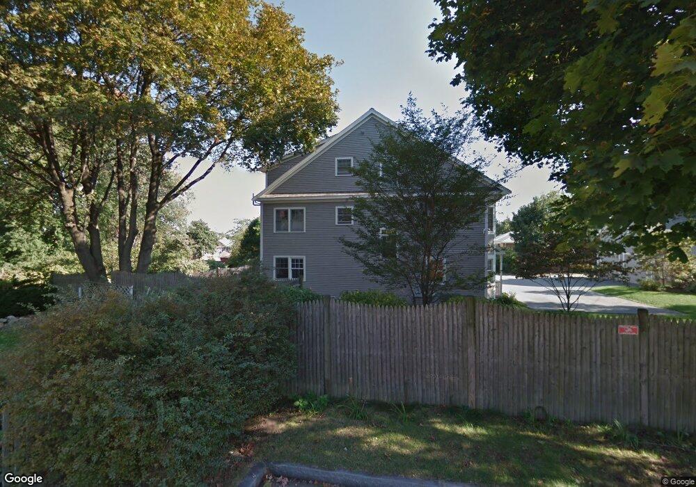
240 Nevada St Unit B Newtonville, MA 02460
Nonantum NeighborhoodEstimated Value: $1,446,690 - $1,729,000
4
Beds
4
Baths
2,595
Sq Ft
$604/Sq Ft
Est. Value
About This Home
This home is located at 240 Nevada St Unit B, Newtonville, MA 02460 and is currently estimated at $1,568,423, approximately $604 per square foot. 240 Nevada St Unit B is a home located in Middlesex County with nearby schools including Horace Mann Elementary School, Lincoln-Eliot Elementary School, and F.A. Day Middle School.
Ownership History
Date
Name
Owned For
Owner Type
Purchase Details
Closed on
Jan 7, 2013
Sold by
Mackin Rt
Bought by
Tang Ling and Gao Ping
Current Estimated Value
Home Financials for this Owner
Home Financials are based on the most recent Mortgage that was taken out on this home.
Original Mortgage
$417,000
Outstanding Balance
$289,670
Interest Rate
3.35%
Mortgage Type
New Conventional
Estimated Equity
$1,278,753
Purchase Details
Closed on
Dec 6, 2006
Sold by
Mackin Richard W
Bought by
Mackin Rt and Mackin
Create a Home Valuation Report for This Property
The Home Valuation Report is an in-depth analysis detailing your home's value as well as a comparison with similar homes in the area
Home Values in the Area
Average Home Value in this Area
Purchase History
| Date | Buyer | Sale Price | Title Company |
|---|---|---|---|
| Tang Ling | $780,000 | -- | |
| Tang Ling | $780,000 | -- | |
| Mackin Rt | -- | -- | |
| Mackin Rt | -- | -- |
Source: Public Records
Mortgage History
| Date | Status | Borrower | Loan Amount |
|---|---|---|---|
| Open | Tang Ling | $417,000 | |
| Closed | Tang Ling | $417,000 |
Source: Public Records
Tax History Compared to Growth
Tax History
| Year | Tax Paid | Tax Assessment Tax Assessment Total Assessment is a certain percentage of the fair market value that is determined by local assessors to be the total taxable value of land and additions on the property. | Land | Improvement |
|---|---|---|---|---|
| 2025 | $12,139 | $1,238,700 | $0 | $1,238,700 |
| 2024 | $11,737 | $1,202,600 | $0 | $1,202,600 |
| 2023 | $11,455 | $1,125,200 | $0 | $1,125,200 |
| 2022 | $11,273 | $1,071,600 | $0 | $1,071,600 |
| 2021 | $10,877 | $1,010,900 | $0 | $1,010,900 |
| 2020 | $10,554 | $1,010,900 | $0 | $1,010,900 |
| 2019 | $10,257 | $981,500 | $0 | $981,500 |
| 2018 | $10,264 | $948,600 | $0 | $948,600 |
| 2017 | $9,951 | $894,900 | $0 | $894,900 |
| 2016 | $9,518 | $836,400 | $0 | $836,400 |
| 2015 | $9,249 | $796,600 | $0 | $796,600 |
Source: Public Records
Map
Nearby Homes
- 191 Linwood Ave
- 282 Nevada St Unit 282
- 286 Nevada St Unit 286
- 177 Nevada St
- 57 Walnut St
- 42-44 Judkins St
- 158 Adams St
- 354 Linwood Ave Unit 1
- 49 Hawthorn St
- 611 Watertown St Unit 14
- 34 West St Unit A
- 188-190 Adams St
- 3 Ashmont Ave
- 53 West St
- 11 Murphy Ct
- 32-34 Rossmere St
- 290 Watertown St Unit 3
- 290 Watertown St Unit 4
- 168 Walnut St
- 22-24 Emerald St
- 240 Nevada St Unit A
- 240 Nevada St
- 240 Nevada St Unit B
- 240 Nevada St Unit 240A
- 238 Nevada St Unit B
- 238 Nevada St Unit A
- 238B Nevada St Unit 238B
- 238B Nevada St Unit B
- 238A Nevada St
- 189 Linwood Ave Unit A
- 189 Linwood Ave Unit 1
- 24 Lawn Ave
- 29 Melville Ave
- 25 Lawn Ave
- 31 Melville Ave
- 199 Linwood Ave Unit 1
- 199 Linwood Ave Unit 199
- 197 Linwood Ave
- 187 Linwood Ave
- 187 Linwood Ave Unit 187