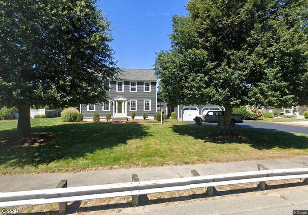
240 Ralph Talbot St South Weymouth, MA 02190
South Weymouth NeighborhoodEstimated Value: $740,000 - $863,000
3
Beds
2
Baths
1,666
Sq Ft
$475/Sq Ft
Est. Value
About This Home
This home is located at 240 Ralph Talbot St, South Weymouth, MA 02190 and is currently estimated at $791,848, approximately $475 per square foot. 240 Ralph Talbot St is a home located in Norfolk County with nearby schools including Ralph Talbot Primary School, Abigail Adams Middle School, and Weymouth Middle School Chapman.
Ownership History
Date
Name
Owned For
Owner Type
Purchase Details
Closed on
Mar 3, 2021
Sold by
Seadog Rt
Bought by
Jarhead Rt
Current Estimated Value
Purchase Details
Closed on
Nov 30, 2007
Sold by
Scales Richard M
Bought by
Seadog Rt
Purchase Details
Closed on
Mar 10, 1993
Sold by
South Shore Hldngs Ltd
Bought by
Sullivan Anne M
Create a Home Valuation Report for This Property
The Home Valuation Report is an in-depth analysis detailing your home's value as well as a comparison with similar homes in the area
Home Values in the Area
Average Home Value in this Area
Purchase History
| Date | Buyer | Sale Price | Title Company |
|---|---|---|---|
| Jarhead Rt | -- | None Available | |
| Seadog Rt | -- | -- | |
| Sullivan Anne M | $65,000 | -- |
Source: Public Records
Mortgage History
| Date | Status | Borrower | Loan Amount |
|---|---|---|---|
| Previous Owner | Sullivan Anne M | $170,000 | |
| Previous Owner | Sullivan Anne M | $186,000 | |
| Previous Owner | Sullivan Anne M | $191,000 | |
| Previous Owner | Sullivan Anne M | $192,000 |
Source: Public Records
Tax History Compared to Growth
Tax History
| Year | Tax Paid | Tax Assessment Tax Assessment Total Assessment is a certain percentage of the fair market value that is determined by local assessors to be the total taxable value of land and additions on the property. | Land | Improvement |
|---|---|---|---|---|
| 2025 | $7,910 | $783,200 | $222,300 | $560,900 |
| 2024 | $7,720 | $751,700 | $211,800 | $539,900 |
| 2023 | $7,591 | $726,400 | $196,100 | $530,300 |
| 2022 | $7,342 | $640,700 | $181,600 | $459,100 |
| 2021 | $6,438 | $548,400 | $181,600 | $366,800 |
| 2020 | $6,128 | $514,100 | $181,600 | $332,500 |
| 2019 | $5,845 | $482,300 | $174,600 | $307,700 |
| 2018 | $5,699 | $455,900 | $166,300 | $289,600 |
| 2017 | $5,570 | $434,800 | $158,400 | $276,400 |
| 2016 | $5,394 | $421,400 | $152,300 | $269,100 |
| 2015 | $4,982 | $386,200 | $137,100 | $249,100 |
| 2014 | $4,862 | $365,600 | $141,700 | $223,900 |
Source: Public Records
Map
Nearby Homes
- 5 Oak St
- 206 Pine St
- 41 Oak St
- 261 Pleasant St Unit 5
- 446 Ralph Talbot St
- 17 Sears Rd
- 11 White St
- 120 Burkhall St Unit K
- 159 Tall Oaks Dr Unit D
- 45 Union St
- 121 Tall Oaks Dr Unit Q
- 200 Burkhall St Unit 803
- 26 Leahaven Rd
- 299 Union St
- 27 Park Ave
- 17 Buchanan Ln
- 54 Old Quarry Dr
- 18 Ben Hogan Landing Unit 18
- 79 Tilden Rd
- 197 White St
- 230 Ralph Talbot St
- 248 Ralph Talbot St
- 245 Ralph Talbot St
- 241 Ralph Talbot St
- 231 Ralph Talbot St
- 8 Ralston Rd
- 20 Ralston Rd
- 34 Ralston Rd
- 218 Ralph Talbot St
- 258 Ralph Talbot St
- 249 Ralph Talbot St Unit Rear Lot
- 249 Ralph Talbot St
- 223 Ralph Talbot St
- 2 Ralston Rd
- 42 Ralston Rd
- 15 Ralston Rd
- 210 Ralph Talbot St
- 35 Ralston Rd
- 5 Ralston Rd
- 265 Ralph Talbot St