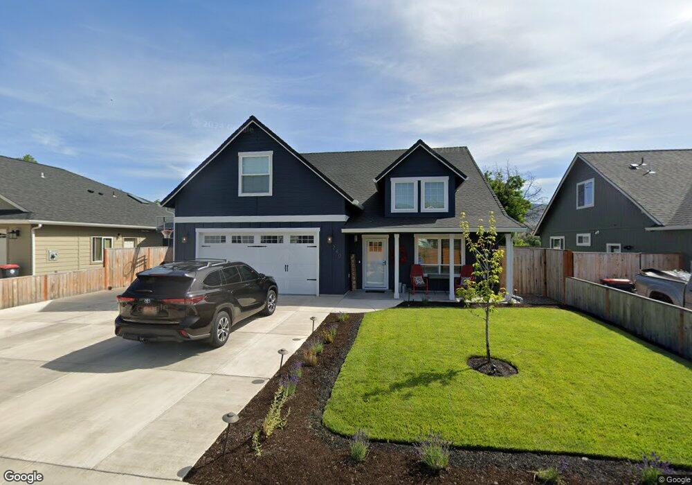
240 Samuel Lane Loop Rd Phoenix, OR 97535
Estimated Value: $560,000 - $662,000
4
Beds
3
Baths
2,801
Sq Ft
$217/Sq Ft
Est. Value
About This Home
This home is located at 240 Samuel Lane Loop Rd, Phoenix, OR 97535 and is currently estimated at $608,156, approximately $217 per square foot. 240 Samuel Lane Loop Rd is a home located in Jackson County with nearby schools including Phoenix Elementary School, Talent Middle School, and Phoenix High School.
Ownership History
Date
Name
Owned For
Owner Type
Purchase Details
Closed on
Jul 26, 2004
Sold by
Reagan William L and Reagan Iris
Bought by
Reagan William L and Reagan Iris
Current Estimated Value
Purchase Details
Closed on
Nov 25, 2003
Sold by
Wyncoop Jason L and Wyncoop Sonja M
Bought by
Reagan William L and Reagan Iris F
Purchase Details
Closed on
Jul 29, 1999
Sold by
Cwi Construction Inc
Bought by
Wyncoop Jason L and Wyncoop Sonja M
Home Financials for this Owner
Home Financials are based on the most recent Mortgage that was taken out on this home.
Original Mortgage
$107,959
Interest Rate
7.64%
Mortgage Type
FHA
Purchase Details
Closed on
Jul 28, 1999
Sold by
Parducci Larry
Bought by
Cwi Construction Inc
Home Financials for this Owner
Home Financials are based on the most recent Mortgage that was taken out on this home.
Original Mortgage
$107,959
Interest Rate
7.64%
Mortgage Type
FHA
Create a Home Valuation Report for This Property
The Home Valuation Report is an in-depth analysis detailing your home's value as well as a comparison with similar homes in the area
Home Values in the Area
Average Home Value in this Area
Purchase History
| Date | Buyer | Sale Price | Title Company |
|---|---|---|---|
| Reagan William L | -- | -- | |
| Reagan William L | $168,900 | Lawyers Title Insurance Corp | |
| Wyncoop Jason L | $108,850 | Jackson County Title | |
| Cwi Construction Inc | -- | Jackson County Title |
Source: Public Records
Mortgage History
| Date | Status | Borrower | Loan Amount |
|---|---|---|---|
| Previous Owner | Wyncoop Jason L | $107,959 |
Source: Public Records
Tax History Compared to Growth
Tax History
| Year | Tax Paid | Tax Assessment Tax Assessment Total Assessment is a certain percentage of the fair market value that is determined by local assessors to be the total taxable value of land and additions on the property. | Land | Improvement |
|---|---|---|---|---|
| 2025 | $6,003 | $374,350 | $83,350 | $291,000 |
| 2024 | $6,003 | $363,450 | $80,920 | $282,530 |
| 2023 | $5,815 | $352,870 | $78,570 | $274,300 |
| 2022 | $5,660 | $352,870 | $78,570 | $274,300 |
| 2021 | $1,230 | $76,290 | $76,290 | $0 |
| 2020 | $3,310 | $205,750 | $75,210 | $130,540 |
| 2019 | $3,222 | $193,950 | $70,910 | $123,040 |
| 2018 | $3,128 | $188,310 | $68,840 | $119,470 |
| 2017 | $2,955 | $188,310 | $68,840 | $119,470 |
| 2016 | $2,875 | $177,510 | $64,890 | $112,620 |
| 2015 | $2,763 | $177,510 | $64,890 | $112,620 |
| 2014 | $2,659 | $167,330 | $61,160 | $106,170 |
Source: Public Records
Map
Nearby Homes
- 504 Elm St
- 817 Amerman Dr
- 4624 S Pacific Hwy Unit 26
- 4624 S Pacific Hwy Unit 61
- 454 Elm St
- 158 Sharon Dr
- 404 Oak St
- 201 S Rose St
- 4601 S Pacific Hwy Unit 3
- 4601 S Pacific Hwy Unit 29
- 4601 S Pacific Hwy Unit 18
- 4729 S Pacific Hwy Unit 14
- 4729 S Pacific Hwy Unit 39
- 4729 S Pacific Hwy Unit 16
- 1620 Pacific Ln
- 105 W 1st St
- 309 W 1st St
- 133 S Main St
- 3459 S Pacific Hwy
- 4119 S Pacific Hwy
- 240 Samuel Rd
- 236 Samuel Rd
- 236 Samuel Lane Loop Rd
- 244 Samuel Lane Loop Rd
- 232 Samuel Rd
- 232 Samuel Lane Loop Rd
- 248 Samuel Rd
- 241 Samuel Lane Loop Rd
- 248 Samuel Lane Loop Rd
- 248 Samuel Loop Ln
- 221 Samuel Lane Loop Rd
- 221 Samuel Rd
- 241 Samuel Rd
- 228 Samuel Rd
- 217 Samuel Lane Loop Rd
- 217 Samuel Rd
- 228 Samuel Lane Loop Rd
- 258 Samuel Lane Loop Rd
- 251 Samuel Rd
- 251 Samuel Lane Loop Rd