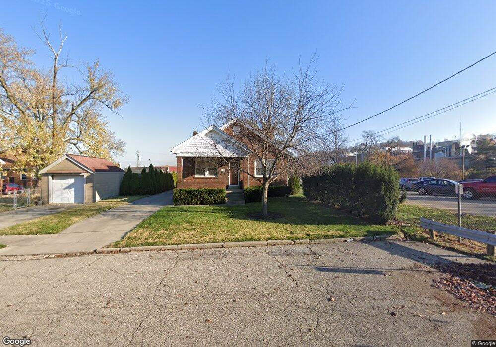
240 Sherman Ave Cincinnati, OH 45215
Roselawn NeighborhoodEstimated Value: $185,000 - $229,000
2
Beds
1
Bath
1,160
Sq Ft
$175/Sq Ft
Est. Value
About This Home
This home is located at 240 Sherman Ave, Cincinnati, OH 45215 and is currently estimated at $203,191, approximately $175 per square foot. 240 Sherman Ave is a home located in Hamilton County with nearby schools including Reading Community High School and Saints Peter and Paul Academy.
Ownership History
Date
Name
Owned For
Owner Type
Purchase Details
Closed on
Feb 21, 2008
Sold by
Sand Joseph B and Sand Tammara L
Bought by
Bentley Anthony W
Current Estimated Value
Purchase Details
Closed on
Dec 8, 2000
Sold by
Sand Sheilah M
Bought by
Sand Patrick S
Home Financials for this Owner
Home Financials are based on the most recent Mortgage that was taken out on this home.
Original Mortgage
$94,451
Interest Rate
7.83%
Purchase Details
Closed on
Dec 1, 2000
Sold by
Sand Patrick S and Sand Rebecca
Bought by
Sand Joseph B
Home Financials for this Owner
Home Financials are based on the most recent Mortgage that was taken out on this home.
Original Mortgage
$94,451
Interest Rate
7.83%
Purchase Details
Closed on
Apr 16, 1998
Sold by
Campbell Beverly A
Bought by
Sand Patrick S
Home Financials for this Owner
Home Financials are based on the most recent Mortgage that was taken out on this home.
Original Mortgage
$60,000
Interest Rate
7.26%
Create a Home Valuation Report for This Property
The Home Valuation Report is an in-depth analysis detailing your home's value as well as a comparison with similar homes in the area
Home Values in the Area
Average Home Value in this Area
Purchase History
| Date | Buyer | Sale Price | Title Company |
|---|---|---|---|
| Bentley Anthony W | $125,000 | Ltoc | |
| Sand Patrick S | -- | -- | |
| Sand Joseph B | $91,700 | -- | |
| Sand Patrick S | $75,000 | -- |
Source: Public Records
Mortgage History
| Date | Status | Borrower | Loan Amount |
|---|---|---|---|
| Previous Owner | Sand Joseph B | $94,451 | |
| Previous Owner | Sand Patrick S | $60,000 |
Source: Public Records
Tax History
| Year | Tax Paid | Tax Assessment Tax Assessment Total Assessment is a certain percentage of the fair market value that is determined by local assessors to be the total taxable value of land and additions on the property. | Land | Improvement |
|---|---|---|---|---|
| 2025 | $2,359 | $44,349 | $10,101 | $34,248 |
| 2023 | $2,341 | $44,349 | $10,101 | $34,248 |
| 2022 | $2,456 | $36,051 | $8,124 | $27,927 |
| 2021 | $2,058 | $36,051 | $8,124 | $27,927 |
| 2020 | $2,072 | $36,051 | $8,124 | $27,927 |
| 2019 | $2,011 | $31,903 | $7,189 | $24,714 |
| 2018 | $2,013 | $31,903 | $7,189 | $24,714 |
| 2017 | $1,902 | $31,903 | $7,189 | $24,714 |
| 2016 | $2,047 | $34,405 | $7,616 | $26,789 |
| 2015 | $2,060 | $34,405 | $7,616 | $26,789 |
| 2014 | $1,804 | $34,405 | $7,616 | $26,789 |
| 2013 | $1,828 | $35,105 | $7,770 | $27,335 |
Source: Public Records
Map
Nearby Homes
- 20 Clark Rd
- 2281 E Galbraith Rd
- 321 Southern Ave
- 415 Arlington Ave
- 654 3rd St
- 653 Harmes Ave
- 0 Hill St Unit 1616370
- 334 Williams St
- 1808 Crest Hill Ave
- 7829 Sunfield Dr
- 129 Pike St
- 7871 Glenorchard Dr
- 7831 Glen Orchard Dr
- 636 Maple Dr
- 310 E Vine St
- 8338 Anthony Wayne Ave
- 7510 Fernwood Dr
- 134 Walnut St
- 8421 Wiswell St
- 217 W Wyoming Ave
- 8430 Reading Rd
- 8428 Reading Rd
- 8432 Reading Rd
- 8420 Reading Rd
- 8439 Reading Rd
- 8431 Reading Rd
- 8418 Reading Rd
- 8429 Reading Rd
- 8427 Reading Rd
- 8423 Reading Rd
- 11 Clark Rd
- 8421 Reading Rd
- 8507 Reading Rd
- 8419 Reading Rd
- 8509 Reading Rd
- 8412 Reading Rd
- 12 Clark Rd
- 266 Burkhart Ave
- 8417 Reading Rd
- 262 Burkhart Ave