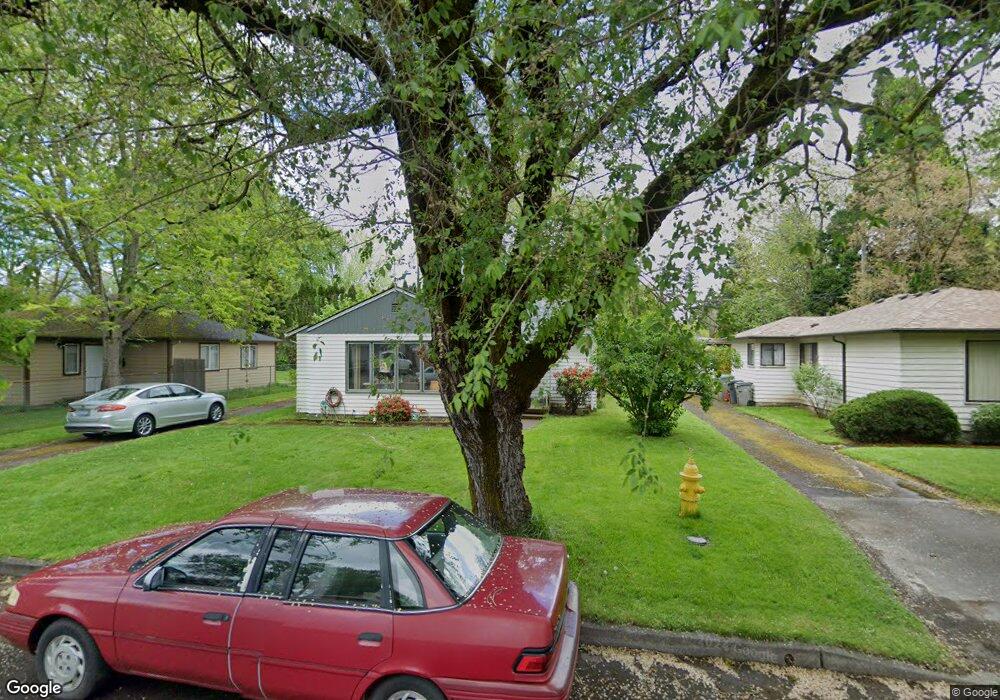
240 SW 132nd Ave Beaverton, OR 97005
Estimated Value: $415,000 - $474,000
3
Beds
1
Bath
1,132
Sq Ft
$394/Sq Ft
Est. Value
About This Home
This home is located at 240 SW 132nd Ave, Beaverton, OR 97005 and is currently estimated at $446,534, approximately $394 per square foot. 240 SW 132nd Ave is a home located in Washington County with nearby schools including Barnes Elementary School, Meadow Park Middle School, and Sunset High School.
Ownership History
Date
Name
Owned For
Owner Type
Purchase Details
Closed on
Oct 13, 2015
Sold by
Ross Mark C and Ross Tanya L
Bought by
Mark C Ross Properties Llc
Current Estimated Value
Purchase Details
Closed on
Aug 22, 2013
Sold by
Mark C Ross Properties Llc
Bought by
Ross Mark C
Purchase Details
Closed on
Dec 9, 2011
Sold by
Mark C Ross Properties Llc
Bought by
Mark C Ross Properties Llc
Purchase Details
Closed on
Oct 22, 2010
Sold by
Ross Mark C
Bought by
Mark C Ross Properties Llc
Purchase Details
Closed on
Oct 5, 1995
Sold by
Mulkey Ann C
Bought by
Ross Mark C
Create a Home Valuation Report for This Property
The Home Valuation Report is an in-depth analysis detailing your home's value as well as a comparison with similar homes in the area
Home Values in the Area
Average Home Value in this Area
Purchase History
| Date | Buyer | Sale Price | Title Company |
|---|---|---|---|
| Mark C Ross Properties Llc | -- | None Available | |
| Ross Mark C | -- | None Available | |
| Mark C Ross Properties Llc | -- | None Available | |
| Mark C Ross Properties Llc | -- | None Available | |
| Ross Mark C | $101,000 | First American Title Ins Co |
Source: Public Records
Tax History Compared to Growth
Tax History
| Year | Tax Paid | Tax Assessment Tax Assessment Total Assessment is a certain percentage of the fair market value that is determined by local assessors to be the total taxable value of land and additions on the property. | Land | Improvement |
|---|---|---|---|---|
| 2025 | $3,691 | $201,900 | -- | -- |
| 2024 | $3,466 | $196,020 | -- | -- |
| 2023 | $3,466 | $190,320 | $0 | $0 |
| 2022 | $3,344 | $190,320 | $0 | $0 |
| 2021 | $3,224 | $179,400 | $0 | $0 |
| 2020 | $3,126 | $174,180 | $0 | $0 |
| 2019 | $3,027 | $169,110 | $0 | $0 |
| 2018 | $2,929 | $164,190 | $0 | $0 |
| 2017 | $2,824 | $159,410 | $0 | $0 |
| 2016 | $2,723 | $154,770 | $0 | $0 |
| 2015 | $2,627 | $150,270 | $0 | $0 |
| 2014 | $2,566 | $145,900 | $0 | $0 |
Source: Public Records
Map
Nearby Homes
- 245 SW 133rd Ave
- 13120 SW Rita Dr
- 12825 SW Evergreen St
- 12614 NW Barnes Rd Unit 12
- 13115 NW Glenridge Dr
- 12618 NW Barnes Rd Unit 11
- 414 SW Frenwood Way
- 12622 NW Barnes Rd Unit 2
- 12622 NW Barnes Rd Unit 6
- 12620 NW Barnes Rd Unit 5
- 12604 NW Barnes Rd Unit 3
- 938 SW Adrian Terrace
- 12634 NW Barnes Rd Unit 8
- 13860 SW Butner Rd
- 13720 SW Butner Rd
- 11990 SW Corby Dr Unit 6
- 11990 SW Corby (#6) Dr
- 425 NW 139th Ave
- 595 NW Lost Springs Terrace Unit 303
- 14386 NW Tripton Ct
- 220 SW 132nd Ave
- 260 SW 132nd Ave
- 235 SW 131st Ave
- 180 SW 132nd Ave
- 280 SW 132nd Ave
- 215 SW 131st Ave
- 255 SW 131st Ave
- 175 SW 131st Ave
- 235 SW 132nd Ave
- 275 SW 131st Ave
- 255 SW 132nd Ave
- 320 SW 132nd Ave
- 205 SW 132nd Ave
- 160 SW 132nd Ave
- 275 SW 132nd Ave
- 155 SW 131st Ave
- 315 SW 131st Ave
- 340 SW 132nd Ave
- 315 SW 132nd Ave
- 145 SW 132nd Ave