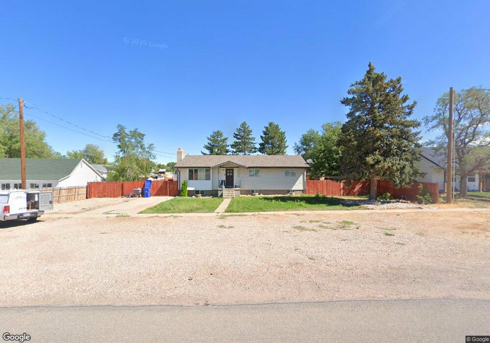
240 W 200 S Fillmore, UT 84631
Estimated Value: $274,000 - $431,000
3
Beds
2
Baths
2,304
Sq Ft
$142/Sq Ft
Est. Value
About This Home
This home is located at 240 W 200 S, Fillmore, UT 84631 and is currently estimated at $326,465, approximately $141 per square foot. 240 W 200 S is a home located in Millard County.
Ownership History
Date
Name
Owned For
Owner Type
Purchase Details
Closed on
Jan 19, 2023
Sold by
Bullock Dakota
Bought by
Hare Michael and Hare Kimber
Current Estimated Value
Purchase Details
Closed on
Sep 27, 2017
Sold by
Briggs Stacy and Rowley Linda S
Bought by
Bullock Dakota and Bullock Shelby
Purchase Details
Closed on
Apr 1, 2008
Sold by
Rowley Preston John
Bought by
Rowley Linda S
Purchase Details
Closed on
Mar 27, 2008
Sold by
Briggs Stacy R
Bought by
Rowley Linda S
Purchase Details
Closed on
Mar 18, 2008
Sold by
Rowley Tyler Scott
Bought by
Rowley Linda S
Create a Home Valuation Report for This Property
The Home Valuation Report is an in-depth analysis detailing your home's value as well as a comparison with similar homes in the area
Home Values in the Area
Average Home Value in this Area
Purchase History
| Date | Buyer | Sale Price | Title Company |
|---|---|---|---|
| Hare Michael | -- | First American Title | |
| Bullock Dakota | -- | -- | |
| Rowley Linda S | -- | -- | |
| Rowley Linda S | -- | -- | |
| Rowley Linda S | -- | -- |
Source: Public Records
Tax History Compared to Growth
Tax History
| Year | Tax Paid | Tax Assessment Tax Assessment Total Assessment is a certain percentage of the fair market value that is determined by local assessors to be the total taxable value of land and additions on the property. | Land | Improvement |
|---|---|---|---|---|
| 2025 | $1,120 | $140,624 | $26,267 | $114,357 |
| 2024 | $1,120 | $125,273 | $20,754 | $104,519 |
| 2023 | $1,377 | $125,273 | $20,754 | $104,519 |
| 2022 | $1,150 | $103,255 | $18,867 | $84,388 |
| 2021 | $1,004 | $86,593 | $12,251 | $74,342 |
| 2020 | $930 | $80,657 | $11,138 | $69,519 |
| 2019 | $794 | $69,029 | $11,138 | $57,891 |
| 2018 | $757 | $67,396 | $11,138 | $56,258 |
| 2017 | $618 | $52,269 | $10,890 | $41,379 |
| 2016 | $591 | $52,269 | $10,890 | $41,379 |
| 2015 | $591 | $52,269 | $10,890 | $41,379 |
| 2014 | -- | $52,269 | $10,890 | $41,379 |
| 2013 | -- | $52,269 | $10,890 | $41,379 |
Source: Public Records
Map
Nearby Homes
- 115 W 200 S
- 58 E 300 South St
- 8610 S Highway 91
- 135 E 200 N
- 5098 W Hatton Rd
- Parcel # 8816
- 145 N 200 E
- 60 W Center St
- 50 N 100 Rd E
- 0 Tbd Black Rock Rd Unit LotWP001
- 1565 W Sunflower Ln Unit 3
- 1615 W Sunflower Ln
- 1615 W Sunflower Ln Unit 4
- 1565 W Sunflower Ln
- 2000 N West Frontage I-15
- 1100 S 725 Rd W
- 310 S 500 West Rd
- 190 W 400 St S
- 760 E 700 St S
- 155 E 500 St S
- 255 S S 200 West St St
- 265 S 200 W
- 180 S 200 W
- 175 W 200 S
- 175 W 200 S Unit 1
- 175 W 200 S Unit 2
- 175 W 200 S Unit 4
- 175 W 200 S Unit 7
- 175 W 200 S Unit 6
- 175 W 200 S
- 175 W 200 S
- 180 W W 200 South St St
- 285 S S 200 West St Rd
- 295 S 200 W Unit 2
- 160 W 300 S
- 190 W 200 St S
- 165 S 200 W
- 160 W 200 S
- 145 W 200 S
- 140 W 300 S