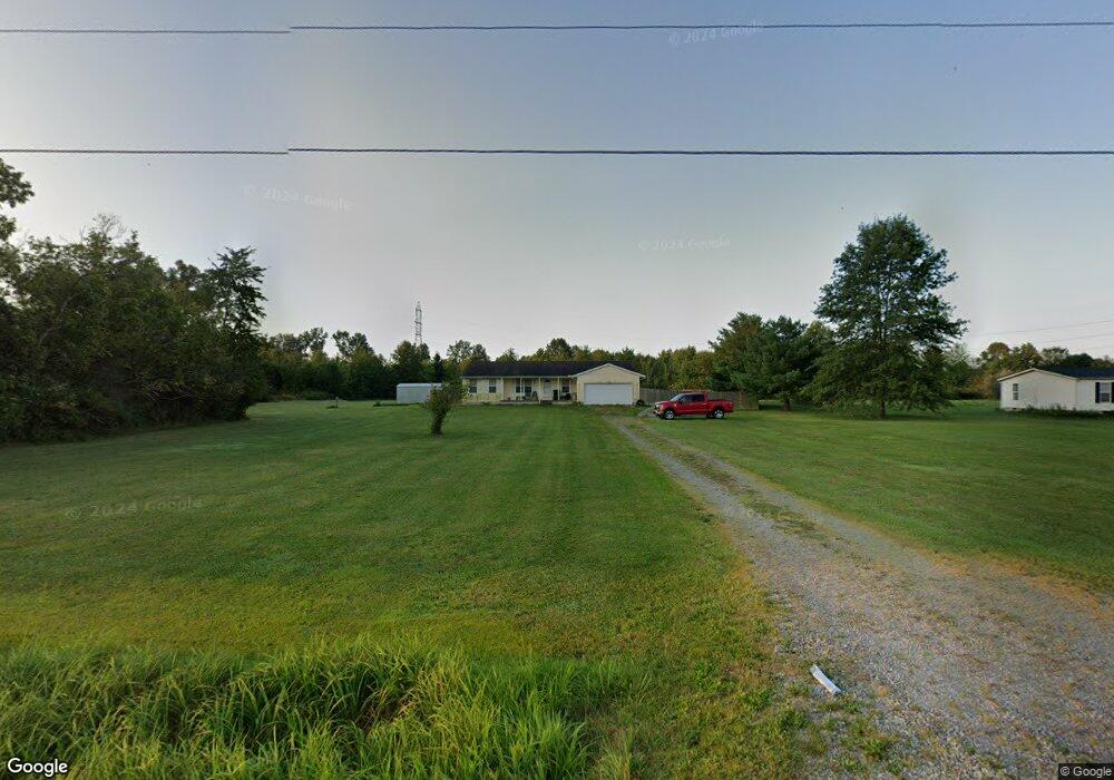
2400 New Harmony Shiloh Rd Mount Orab, OH 45154
Estimated Value: $243,000 - $306,000
3
Beds
2
Baths
1,526
Sq Ft
$176/Sq Ft
Est. Value
About This Home
This home is located at 2400 New Harmony Shiloh Rd, Mount Orab, OH 45154 and is currently estimated at $268,676, approximately $176 per square foot. 2400 New Harmony Shiloh Rd is a home with nearby schools including Western Brown High School.
Ownership History
Date
Name
Owned For
Owner Type
Purchase Details
Closed on
Oct 31, 2002
Sold by
Wasserman Farms
Bought by
Zenni John and Zenni Tina
Current Estimated Value
Home Financials for this Owner
Home Financials are based on the most recent Mortgage that was taken out on this home.
Original Mortgage
$142,493
Outstanding Balance
$60,386
Interest Rate
6.18%
Mortgage Type
New Conventional
Estimated Equity
$208,290
Purchase Details
Closed on
Jun 1, 2002
Sold by
Wasserman Farms
Bought by
Zenni John H and Zenni Tina M
Purchase Details
Closed on
Aug 13, 1997
Sold by
Wasserman Farms
Bought by
Robert and Powell Betty J
Create a Home Valuation Report for This Property
The Home Valuation Report is an in-depth analysis detailing your home's value as well as a comparison with similar homes in the area
Home Values in the Area
Average Home Value in this Area
Purchase History
| Date | Buyer | Sale Price | Title Company |
|---|---|---|---|
| Zenni John | $19,000 | -- | |
| Zenni John H | $19,000 | -- | |
| Robert | $10,950 | -- |
Source: Public Records
Mortgage History
| Date | Status | Borrower | Loan Amount |
|---|---|---|---|
| Open | Zenni John | $142,493 |
Source: Public Records
Tax History Compared to Growth
Tax History
| Year | Tax Paid | Tax Assessment Tax Assessment Total Assessment is a certain percentage of the fair market value that is determined by local assessors to be the total taxable value of land and additions on the property. | Land | Improvement |
|---|---|---|---|---|
| 2024 | $1,877 | $76,180 | $13,450 | $62,730 |
| 2023 | $1,877 | $58,730 | $9,700 | $49,030 |
| 2022 | $1,455 | $58,730 | $9,700 | $49,030 |
| 2021 | $1,732 | $58,730 | $9,700 | $49,030 |
| 2020 | $1,495 | $48,950 | $8,090 | $40,860 |
| 2019 | $1,608 | $48,950 | $8,090 | $40,860 |
| 2018 | $1,596 | $48,950 | $8,090 | $40,860 |
| 2017 | $1,398 | $42,430 | $8,090 | $34,340 |
| 2016 | $1,398 | $42,430 | $8,090 | $34,340 |
| 2015 | $1,417 | $42,430 | $8,090 | $34,340 |
| 2014 | $1,384 | $41,690 | $7,350 | $34,340 |
| 2013 | $1,380 | $41,690 | $7,350 | $34,340 |
Source: Public Records
Map
Nearby Homes
- 2017 Maple Grove Rd
- 13045 Lower Cumberland Rd
- 2437 Tri County Hwy
- 2079 Old State Rd
- 125 Sweet Bay Trail
- 1921 Amiott Ln
- 1993 Old State Rd
- 105 Maple Ridge Ave
- 3305 Pleasant Hill Rd
- 13523 Lake Grant Rd
- 14084 Holiday Dr
- 12570 Liming van Thompson Rd
- 15070 Bodman Rd
- 0 Starling Rd Unit 1863553
- 114 Tammera Ln
- 216 Red Bud Ln
- 781 S High St
- 2756 Bardwell West Rd
- 3722 Coon Ave
- 15270 Karampas Ln
- 2382 New Harmony Shiloh Rd
- 2420 New Harmony Shiloh Rd
- 2346 New Harmony Shiloh Rd
- 13688 Gargonia Rd
- 2458 New Harmony Shiloh Rd
- 13660 Gargonia Rd
- 2480 New Harmony Shiloh Rd
- 2496 New Harmony Shiloh Rd
- 13576 Gargonia Rd
- 2229 New Harmony Shiloh Rd
- 2180 New Harmony Shiloh Rd
- 2180 New Harmony Shiloh Rd
- 12990 Upper Cumberland Rd
- 13738 Upper Cumberland Rd
- 13492 Gargonia Rd
- 13728 Upper Cumberland Rd
- 13718 Upper Cumberland Rd
- 2633 New Harmony Shiloh Rd
- 13893 Upper Cumberland Rd
- 13889 Upper Cumberland Rd