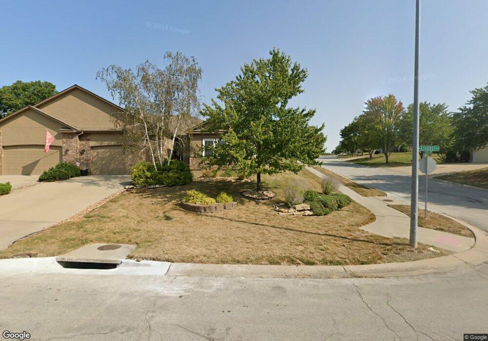
2400 NW Ashurst Dr Lees Summit, MO 64081
Estimated Value: $344,000 - $367,000
2
Beds
2
Baths
1,394
Sq Ft
$255/Sq Ft
Est. Value
About This Home
This home is located at 2400 NW Ashurst Dr, Lees Summit, MO 64081 and is currently estimated at $355,723, approximately $255 per square foot. 2400 NW Ashurst Dr is a home located in Jackson County with nearby schools including Cedar Creek Elementary School, Pleasant Lea Middle School, and Lee's Summit Senior High School.
Ownership History
Date
Name
Owned For
Owner Type
Purchase Details
Closed on
Oct 21, 2021
Sold by
Jane E Merritt Revocable Trust
Bought by
Trujakmur Properties Llc
Current Estimated Value
Purchase Details
Closed on
Jun 27, 2012
Sold by
Merritt Robert F and Merritt Jane E
Bought by
Merritt Jane E and Merritt Robert F
Purchase Details
Closed on
Jul 15, 2009
Sold by
Bannister Realty Company Inc
Bought by
Merritt Robert F and Merritt Jane E
Home Financials for this Owner
Home Financials are based on the most recent Mortgage that was taken out on this home.
Original Mortgage
$140,000
Interest Rate
5.39%
Mortgage Type
Purchase Money Mortgage
Create a Home Valuation Report for This Property
The Home Valuation Report is an in-depth analysis detailing your home's value as well as a comparison with similar homes in the area
Home Values in the Area
Average Home Value in this Area
Purchase History
We collect this data history from publicly available records. To have your information removed, we recommend requesting removal directly through your county’s website.
| Date | Buyer | Sale Price | Title Company |
|---|---|---|---|
| Trujakmur Properties Llc | -- | None Listed On Document | |
| Merritt Jane E | -- | None Available | |
| Merritt Robert F | -- | Assured Quality Title Co |
Source: Public Records
Mortgage History
We collect this data history from publicly available records. To have your information removed, we recommend requesting removal directly through your county’s website.
| Date | Status | Borrower | Loan Amount |
|---|---|---|---|
| Previous Owner | Merritt Robert F | $140,000 |
Source: Public Records
Tax History
| Year | Tax Paid | Tax Assessment Tax Assessment Total Assessment is a certain percentage of the fair market value that is determined by local assessors to be the total taxable value of land and additions on the property. | Land | Improvement |
|---|---|---|---|---|
| 2025 | $3,997 | $54,777 | $14,134 | $40,643 |
| 2024 | $3,968 | $55,357 | $6,730 | $48,627 |
| 2023 | $3,968 | $55,356 | $7,499 | $47,857 |
| 2022 | $3,344 | $41,420 | $4,646 | $36,774 |
| 2021 | $3,413 | $41,420 | $4,646 | $36,774 |
| 2020 | $3,019 | $36,278 | $4,646 | $31,632 |
| 2019 | $2,936 | $36,278 | $4,646 | $31,632 |
| 2018 | $1,820,054 | $33,130 | $3,230 | $29,900 |
| 2017 | $2,846 | $33,130 | $3,230 | $29,900 |
| 2016 | $2,846 | $32,300 | $3,287 | $29,013 |
| 2014 | $2,963 | $32,965 | $2,850 | $30,115 |
Source: Public Records
Map
Nearby Homes
- 319 NW Rockwood Ct
- 202 NW Ambersham Dr
- 2635 NW Ashurst Ln
- 416 NW Highcliffe Dr
- 2648 NW Ashurst Ln
- 2110 NW Ashurst Dr
- 2074 NW O'Brien Rd
- 920 NW High Point Dr
- 2070 NW O'Brien Rd
- 917 NW Winterset St
- 2448 NW Valley View Dr
- 330 NW Ambersham Dr
- 341 NW Thoreau Cir
- 336 NW Thoreau Cir
- 2508 NW Bent Tree Cir
- 2127 NW Killarney Ln
- 2123 NW Killarney Ln
- 2702 NW Cedar Brook
- 129 NW Morton Dr
- 3121 SW Merriam Dr
- 2402 NW Ashurst Dr
- 2406 NW Ashurst Dr
- 510 NW Ashley Ave
- 508 NW Ashley Ave
- 2408 NW Ashurst Dr
- 2407 NW Ashurst Dr
- 2401 NW Ashurst Dr
- 514 NW Ashley Ave
- 503 NW Alexa Ln
- 505 NW Alexa Ln
- 516 NW Ashley Ave
- 2410 NW Ashurst Dr
- 509 NW Alexa Ln
- 417 NW Ashurst Cir
- 2411 NW Ashurst Dr
- 511 NW Alexa Ln
- 514 NW Alexa Ln
- 2412 NW Ashurst Dr
- 422 NW Timberbrooke Dr
- 2413 NW Ashurst Dr
Your Personal Tour Guide
Ask me questions while you tour the home.